As you enjoyed your weekend, conditions changed in the tropics.
The National Hurricane Center designated a system of low pressure in the eastern Atlantic as Invest 97L. The system is moving quickly across the Atlantic and has a high chance of development.
It could become a tropical depression or tropical storm by the middle or later part of this week, according to the National Hurricane Center.
➤ Weather alerts via text: Sign up to get updates about current storms and weather events by location
Invest 97L "has already drawn attention as a contender for the next named storm of the season (Erin)," said Ryan Truchelut, WeatherTiger meteorologist who provides regular hurricane season forecasts for the USA TODAY Network.
Invest 96L, another area of low pressure, is heading north in the central Atlantic. Chances for development have been dropping.
The next named storms of the Atlantic hurricane season will be Erin and Fernand. The fifth-named storm of the season historically develops Aug. 22, followed by the sixth-named storm on Aug. 29, according to AccuWeather.
Here's the latest advisory from the National Hurricane Center as of 2 a.m. Aug. 11:
Where are Invest 96L and Invest 97L, and where are they going?
Invest 96L is moving north in the central Atlantic.
Invest 97L is an area of low pressure in the eastern Atlantic. It's moving west to west-northwest.
Invest 97L 2025 Spaghetti models
Spaghetti models for Invest 96L
Special note about spaghetti models: Illustrations include an array of forecast tools and models, and not all are created equal. The hurricane center uses only the top four or five highest performing models to help make its forecasts.
➤ How often has Florida been impacted, threatened by August hurricanes? We took a look back
What tropical waves, disturbances are in Atlantic basin now? How likely are they to strengthen?
Invest 97L: Showers and thunderstorms continue to show signs of organization in association with a well-defined low pressure area located near the northwestern Cabo Verde Islands. The system will likely becomea tropical depression within the next day or so while it moves generally westward. Locally heavy rainfall and gusty winds are expected to continue today across portions of the Cabo Verde Islands, and interests there should monitor the progress of this system.Even if a tropical depression does not form over the next day or so, environmental conditions appear conducive for later development, and a tropical depression or tropical storm is expected to form by the middle to latter portion of this week while moving westward to west-northwestward at 15 to 20 mph across the eastern and central tropical Atlantic.
Formation chance through 48 hours: high, 70 percent.
Formation chance through seven days: high, 90 percent.
Invest 96L: Disorganized showers and thunderstorms continue in association with a trough of low pressure located over the central tropical Atlantic. Some gradual development is possible during the middle part of this week while the system moves generally northward over the central Atlantic.
Formation chance through 48 hours: low, 10 percent.
Formation chance through seven days: low, 20 percent.
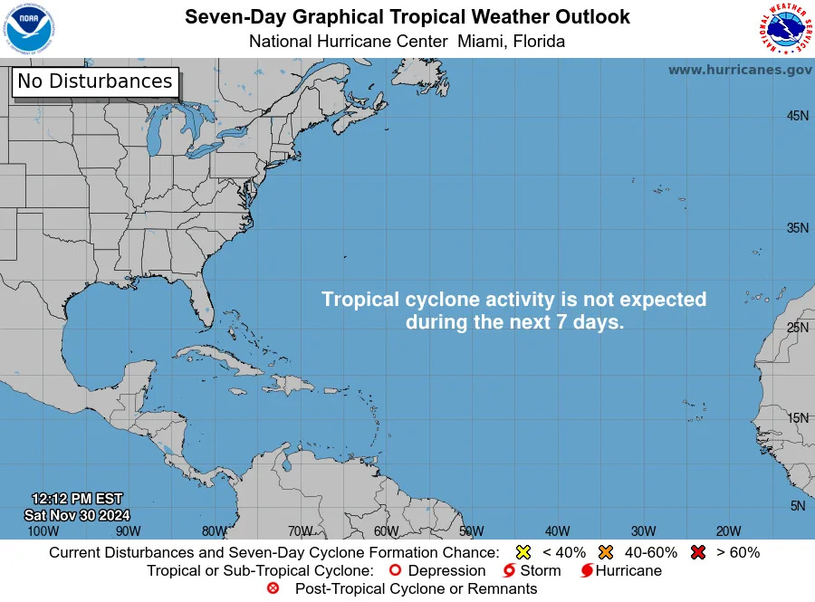
What do the colored, hatched areas on the NOAA map mean?
The hatched areas on the National Hurricane Center's tropical outlook map indicate "areas where a tropical cyclone — which could be a tropical depression, tropical storm or hurricane — could develop," said National Hurricane Center Deputy Director Jamie Rhome.
The colors make it visibly clear how likely a system could develop, with yellow being low, orange medium, and red high.
The National Hurricane Center generally doesn't issue tropical advisories until there is a named storm, but there is an exception.
"If a system is near land and there is potential for development, the National Hurricane Center won't wait before it issues advisories, even if the system hasn't become an actual storm. This gives residents time to prepare," Rhome said.
Is there a storm or hurricane coming to Florida?
No, but remember conditions can change rapidly and we are quickly approaching the busiest weeks of hurricane season, mid-August through mid-October.
Invest 97L is moving quickly west across the Atlantic and AccuWeather forecasters predict it will become a hurricane later this week. If it does, it would become the first hurricane of the 2025 season. The average date for the first hurricane is Aug. 11.
AccuWeather is predicting Invest 97L will become a hurricane by Aug. 14, strengthening into a Category 3 story by Aug. 16.
It's expected to turn to the north, staying north of the Caribbean by the weekend.
“The upper air pattern late week favors it turning north and likely staying east of the U.S. East Coast," said AccuWeather Senior Meteorologist Chad Merrill.
"However, there can be an increase in rough surf and rip currents along the East Coast beaches next weekend into early the following week."
The Florida Division of Emergency Management said Invest 97L poses no threat to Florida at this time but should continue to be monitored.
What should you do now to prepare for hurricane season?
Officials regularly encourage Florida residents to prepare for storms before a hurricane is approaching while shelves are full stocked and you aren't battling crowds all rushing to the store at the same time.
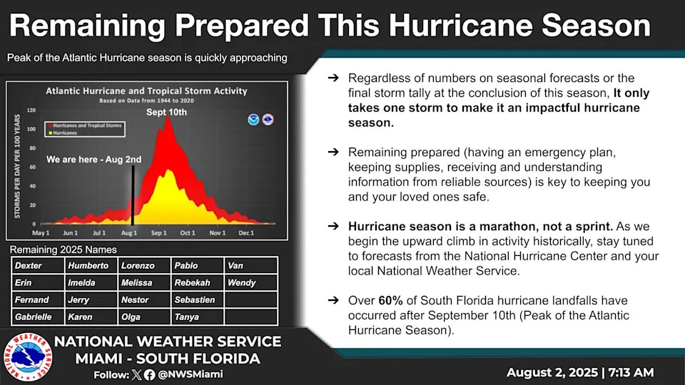
"It only takes one storm to make it an impactful year for your community," the National Hurricane Center Miami posted on X. "Hurricane season is a marathon, not a sprint."
On Aug. 1, specific hurricane supplies became permanently tax free in Florida, ranging from batteries to generators.
➤ See list of emergency supplies you can now buy tax free
Florida weather radar for Aug. 11, 2025
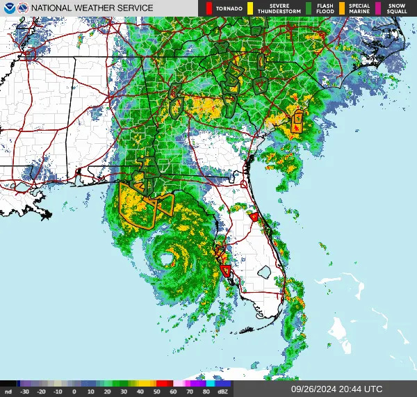
Weather watches and warnings issued in Florida
When is the Atlantic hurricane season?
The Atlantic hurricane season runs from June 1 through Nov. 30.
Ninety-seven percent of tropical cyclone activity occurs during this time period, NOAA said.
The Atlantic basin includes the northern Atlantic Ocean, Caribbean Sea and Gulf of America, as the Gulf of Mexico is now known in the U.S. per an order from President Trump. NOAA and the National Hurricane Center are now using Gulf of America on its maps and in its advisories.
When is the peak of hurricane season?
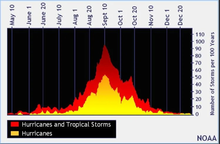
The peak of the season is Sept. 10, with the most activity happening between mid-August and mid-October, according to the Hurricane Center.
Hurricane names for 2025 season
Here are the names for the 2025 Atlantic hurricane season, along with how to pronounce them:
Andrea(June 20)Barry(June 29)Chantal(July 5)Dexter(Aug. 3)Erin: AIR-rin
Fernand: fair-NAHN
Gabrielle: ga-bree-ELL
Humberto: oom-BAIR-toh
Imelda: ee-MEHL-dah
Jerry: JEHR-ee
Karen: KAIR-ren
Lorenzo: loh-REN-zoh
Melissa: meh-LIH-suh
Nestor: NES-tor
Olga: OAL-guh
Pablo: PAHB-lo
Rebekah: reh-BEH-kuh
Sebastien: se-BAS-tee-en
Tanya: TAHN-yuh
Van: van
Wendy: WEN-dee
Interactive map: Hurricanes, tropical storms that have passed near your city
Stay informed. Get weather alerts via text
What's next?
We will update our tropical weather coverage daily.
Download your local site's app to ensure you're always connected to the news. And look for our special subscription offers here.
This article originally appeared on Naples Daily News: NOAA tracks Invest 97L. Will it become Tropical Storm Erin, hurricane


Comments