Aug. 18 (UPI) -- The Outer Banks in North Carolina are under evacuation warning as Hurricane Erin whips up high waves and flooding along the east coast.
Forecasters expect waves of up to 20 feet Wednesday and Thursday. Dare and Hyde counties ordered tourists and residents to leave Hatteras and Ocracoke islands, which are prone to flooding, the Raleigh News & Observer reported.
For those who choose to ride the storm out, Hyde County on Sunday said, "It is extremely likely that Hyde County EMS services will not be available in Ocracoke due to Highway 12 being inaccessible. Please take this warning seriously, especially if you have medical issues or are likely to need special care."
Now is the peak tourist season in the area.
"This is not the week to swim in the ocean," Dare County Emergency Management said in its evacuation order. "The risk from surf and flooding will be life-threatening."
Erin isn't expected to fully land on the East Coast, but its proximity to the coast means dangerous waves and riptides are likely along much of Atlantic coast and in Bermuda, the National Hurricane Center said Sunday. Strong winds and heavy rainfall in those locations are expected.
The National Weather Service has issued a flood watch for much of the North Carolina coast.
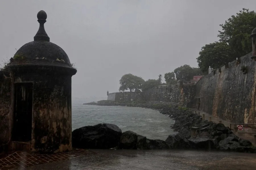
The hurricane already battered the Caribbean, bringing high waves, strong winds and rain to the Virgin Islands and Puerto Rico. More than 50,000 customers were without power.
"As of 7:30 p.m., 95.1% of customers have electrical service. The majority of affected customers are concentrated in the regions of Caguas, Mayagüez, and San Juan, as the rain bands have been moving out of Puerto Rico," Luma Energy, which operates Puerto Rico's power grid, said Sunday night on X.
An extra 2 inches of rainfall is expected in Puerto Rico through Monday night. Up to 6 inches of rain is forecast over the Turks and Caicos and the eastern Bahamas through Tuesday. Flash flooding, landslides and mudslides are possible, it added.
Over the weekend, Erin logged one of the fastest intensification bursts on record in the Atlantic. In just over a day, the storm rose from tropical-storm strength to Category 5, peaking near 165 mph winds on Saturday. Then it eased to Category 3 while replacing its eyewall. Now, the storm is at Category 4, with a broader field.
Puerto Rico Gov. Jennifer González-Colón said there were no residents in shelters and no reports of flooding so far but that flash flooding remains a concern.
It's also unusual to see a Category 5 storm form so early in the season, especially outside of the Gulf of Mexico, CNN reported.
Forecasters have said this year's Atlantic hurricane season will be busier than average. The National Oceanic and Atmospheric Administration issued its updated forecast earlier this month, calling for 13 to 18 named storms (winds of 39 mph or greater), with five to 9 becoming hurricanes and two to five becoming major hurricanes with winds of 111 mph or greater.
A typical hurricane season brings 14 named storms, including seven hurricanes, three of them major. Climate experts have said global warming is contributing to more frequent and more intense storms. Hurricane season runs from June 1 to Nov. 30, with the busiest part of the season from mid-August to mid-October.


Comments