Time is running out for some residents of North Carolina to prepare for Hurricane Erin as the threat of dangerous surf, coastal flooding and beach erosion is escalating.
The Outer Banks for North Carolina are expected to be the area of the United States hit the hardest by Erin, with local officials declaring a State of Emergency for Dare County and mandatory evacuations for Hatteras Island. Residents have been told to evacuate by 8 a.m. EDT Tuesday.
"Now is the time to make final preparations, secure property, evacuate with all personal belongings and follow instructions from your property management company," Dare County officials said in a statement.

People who stay behind to ride out the storm may be cut off from the mainland for several days as Highway 12, the main road in the area, is likely to be impassable. Waves are predicted to be between 10 and 15 feet along the Outer Banks with the pounding waves to persist most of the week.
"Roads will likely be impassable under several feet of water, and vehicles will likely be submerged," officials said. "Large dangerous waves will likely inundate and destroy protective dune structures. Severe flooding will likely extend inland where there is vulnerable or no protective dune structure flooding homes and businesses with some structural damage possible."
Elsewhere along the Atlantic coast, beaches are announcing closures due to the risk of rip currents from Hurricane Erin. Wildwood, New Jersey, is one of the beaches that is closed to swimmers, saying on Facebook, "To ensure the safety of everyone, including those who may be called to perform a rescue, please stay on the sand until the storm passes later this week."
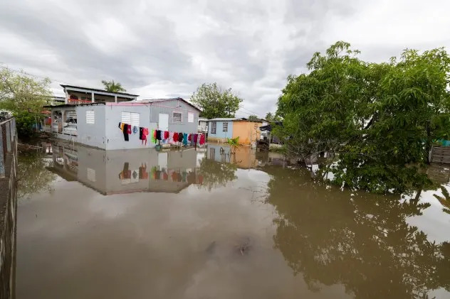
Puerto Rico flooded as Erin tracks nearby
Parts of Puerto Rico were underwater in the wake of Erin, which unleashed heavy rain across the island over the weekend. The eye of the major hurricane stayed north of Puerto Rico, but it tracked close enough for tropical downpours to flood regions of the island.
Nearly 150,000 electric customers were without power due to impacts of the hurricane, according to The Associated Press, but that number has gradually declined as weather conditions improve.
San Juan measured 2.9 inches of rain since late last week, but some remote areas picked up as much as 8 inches.

Cleanup is underway, but residents are advised that the far-reaching influence of Erin will continue to produce life-threatening rip currents in the coming days.


Comments