ALTOONA, PA. (WTAJ) — A comfortable and cooler start for some this Monday morning, but widespread relief from the Summertime mugginess has not arrived just yet.
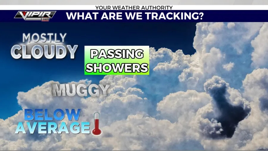
Some of the key weather variables and atmospheric phenomena we are keeping an eye on include:

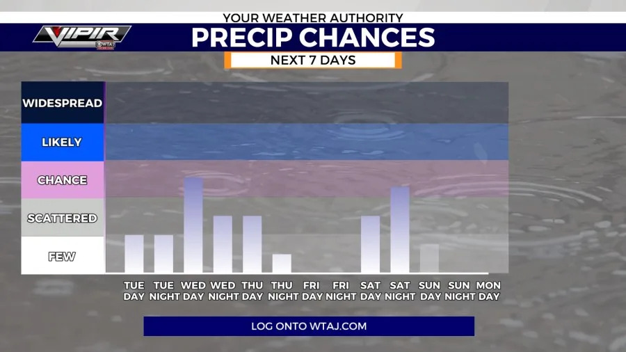
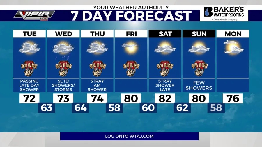
Clouds linger over Central PA for most of the work-week, with some breaks in coverage. Widespread rainfall is not in the forecast, but passing showers late Tuesday through early Thursday morning is possible. Temperatures will generally trend below average for the week as well.
Temperatures were cooler today due to cloud cover, but that means we will be warmer Tuesday morning, compared to Monday morning.
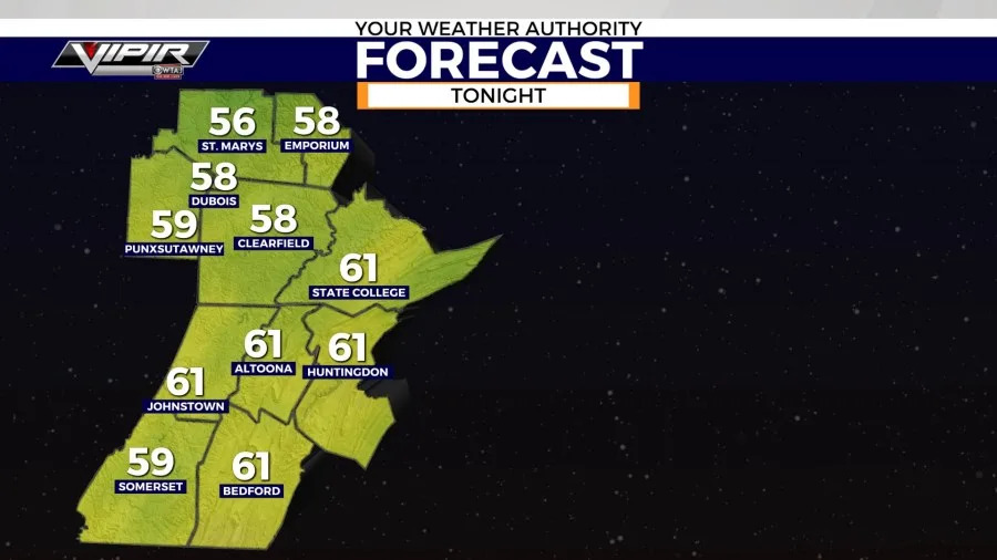
Moving forward, we will range in temps north to south over the next handful of days.
Areas along and north of I-80 will trend slightly warmer for daytime highs, compared to along I-99.
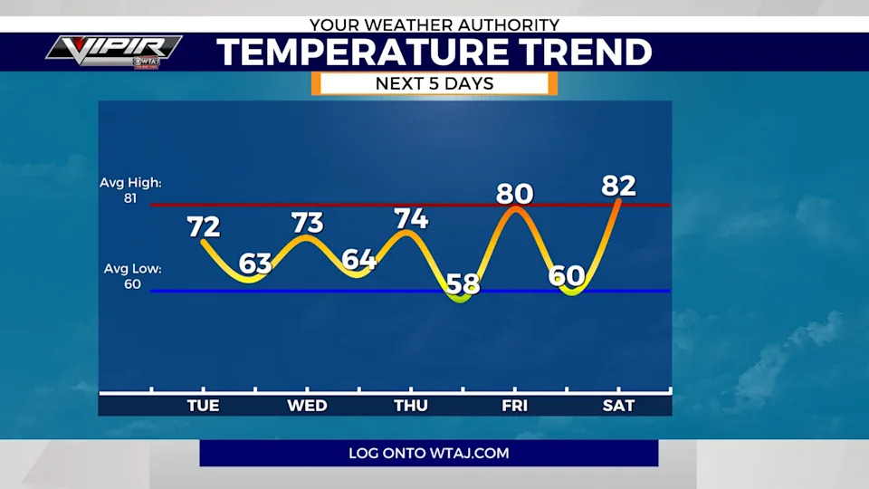
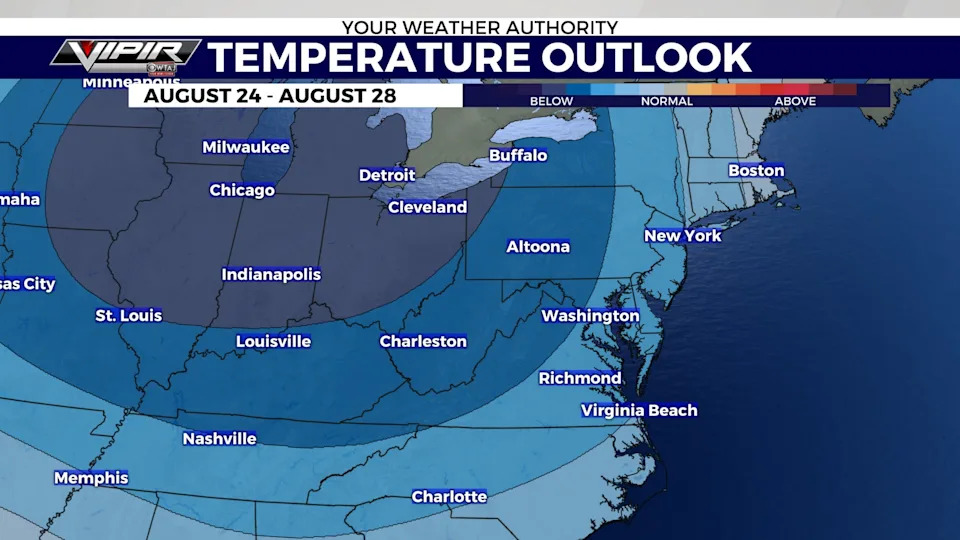
The extended temperature outlook favors below average temperatures for the end of the month. Likely staying with highs in the 70s to begin September, but that can of course still change.
We haven’t talked about the possibility for rain, so the question is…. will it?
The chances return for our Tuesday-Thursday time period, but only passing showers. Best chances for organized rain is Wednesday. However, recent model runs have trended down our threat.
7-Day Forecast
Meteorologist Zach Petey
Copyright 2025 Nexstar Media, Inc. All rights reserved. This material may not be published, broadcast, rewritten, or redistributed.
For the latest news, weather, sports, and streaming video, head to WTAJ - www.wtaj.com.


Comments