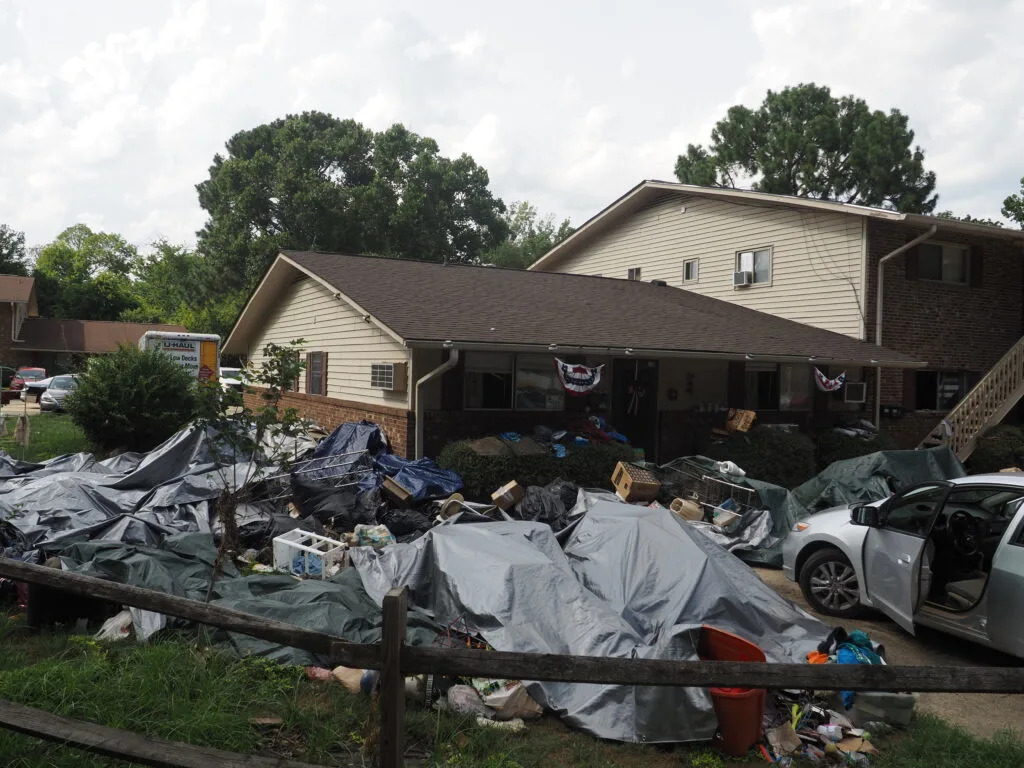
A Chapel Hill home ravaged by flooding by Tropical Storm Chantal in Camelot Village. (Photo by Brandon Kingdollar/NC Newsline)
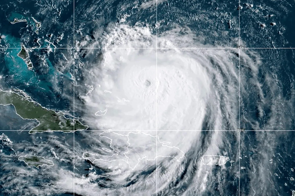
Hurricane Erin pounded the Outer Banks Wednesday evening, leaving behind floodwaters and closing portions of Highway 12.
But the storm spared most of North Carolina. For the Research Triangle area, it’s been a lull in what feels like a constant stream of raining and flooding this summer.
There have been 134 flash flood warnings in North Carolina so far this year as of Wednesday, according to the National Weather Service. That’s the third most by Aug. 20 on record.
Only two years have had more: 2024 and 2003.
Flash flooding is occurring or imminent, according to the National Weather Service. A warning indicates the potential for a threat to life or property that could result in the need for immediate action to avoid or mitigate the threat.
The past few weeks have been unusually rainy in the Research Triangle, Jonathan Blaes, meteorologist-in-charge for the National Weather Service’s Raleigh office, told NC Newsline.
Official observations for the Raleigh-Durham area are at the airport. It rained nine out of the first 13 days of August for a total of 7.8 inches, more than triple the normal rainfall at that point of the month.
“We’ve already had three times as much rain as we normally do, and even if it doesn’t rain the rest of the month, we’ll have almost double the normal rainfall for the whole month,” Blaes said. “We’re not even at the peak of hurricane season in the Atlantic Ocean.”
That’s usually closer to the start of September, meaning storms start becoming more active around this time of the year.
The National Weather Service calculates climate based on a 30-year normal.
Typically in August, the Raleigh-Durham area receives an average of 4.71 inches of rain total. The average rainfall for the first 13 days of August in the Raleigh-Durham area is 2.06 inches, placing 2025 well above normal.
Tropical Storm Chantal brought heavy storms and flooding to the central part of the state in July, including businesses in Chapel Hill.
“Part of that problem is that as the area becomes more urbanized, there’s more impervious surfaces or places where the water can’t soak into the ground. Think parking lots, rooftops of buildings, shopping areas, buildings,” Blaes said.
Rain landing in those areas doesn’t get soaked into the ground. Instead, it’s redirected to drains, pipes, and gutters, which then gets dumped into creeks and other bodies of water.
The influx of water in those creeks and streams then leads to flooding.
“That is a pretty significant problem, for sure, and there’s not an easy solution to that,” Blaes said.
But some municipalities in North Carolina are implementing measures to reduce and prevent flooding.
For example, Raleigh is developing a comprehensive plan to address flood resilience in the face of climate change. The city’s Flood Early Warning System helps the public by identifying and predicting flood locations as soon as possible. It’s also working toward creating more green spaces to prevent flooding and runoff.
“The city cannot prevent flooding. We can only mitigate the impacts of flooding events to protect property and keep our community safe,” Wayne Miles, engineering services assistant director for the city of Raleigh, said in a statement.
Looking at the past four decades, 2024 had the most flash flood warnings on record, with 272 total.
At the start of the year, a strong cold front moved across the Carolinas, bringing about a line of severe thunderstorms. There were 22 flash flood warnings issued in the Tar Heel State on Jan. 9, 2024.
Later on, Hurricane Helene wreaked devastation towards the end of September, particularly in the western portion of the state.
The National Weather Service issued 71 flash flood warnings in the week between Sept. 24 and Oct. 1. There were 46 on Sept. 27, the most intense day.
There have been 11 years on record with more total flash flood warnings than what there’s been so far in 2025.
“Some of the years with the highest number of flash flood warnings were years with hurricanes that produced big flood events,” Nicholas Petro, warning coordination meteorologist at the National Weather Service’s Raleigh office, wrote in an email.
Petro pointed to Hurricanes Helene in 2024, Florence in 2018, and Floyd in 1999 as examples of that.
Fewer flash flood warnings were issued in the 1980s and the early 1990s compared to later years. Petro said he wasn’t sure if the metrics for that process differed. Climatologists have attributed the rising precipitation and flooding in recent years to climate change.
The majority of climate models project a rise in annual total precipitation by the middle of the 21st century due to increases in greenhouse gas concentrations, according to the North Carolina Climate Science Report, revised in September 2020.
“Heavy rains from hurricanes and other weather systems will become more frequent and more intense,” the report read. “Annual precipitation is also expected to increase. These changes are driven primarily by increases in atmospheric water vapor as the climate warms.”


Comments