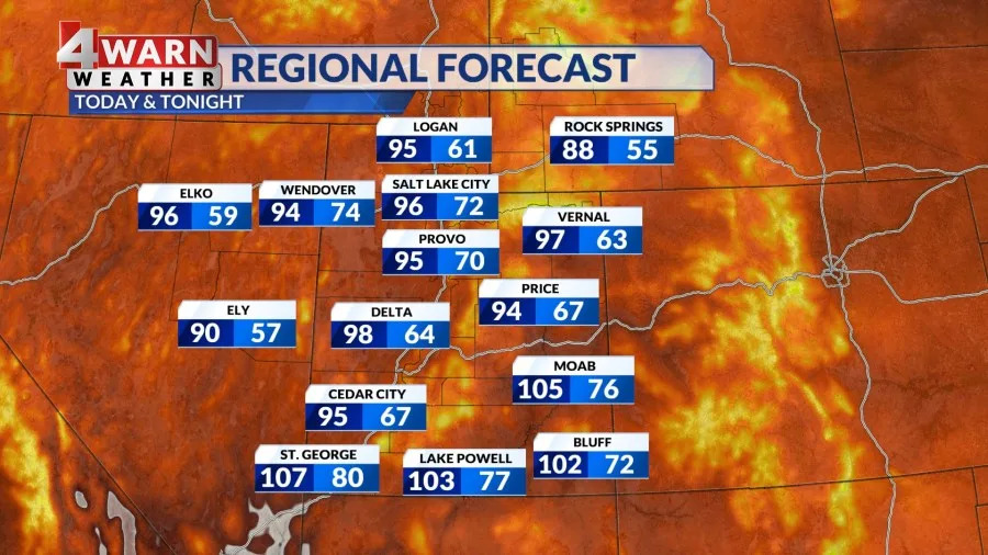
SALT LAKE CITY (ABC 4) – Happy Thursday, Utah! It’s been a sunny start for SW Utah as the heat continues to build. Highs will warm into the 106-108 range through Friday. An Extreme Heat Warning is in effect for Lower Washington County due to the prolonged period of stifling conditions through Friday evening.
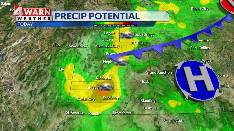
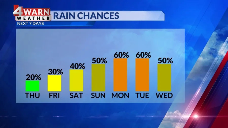
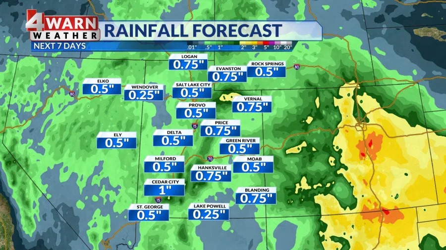
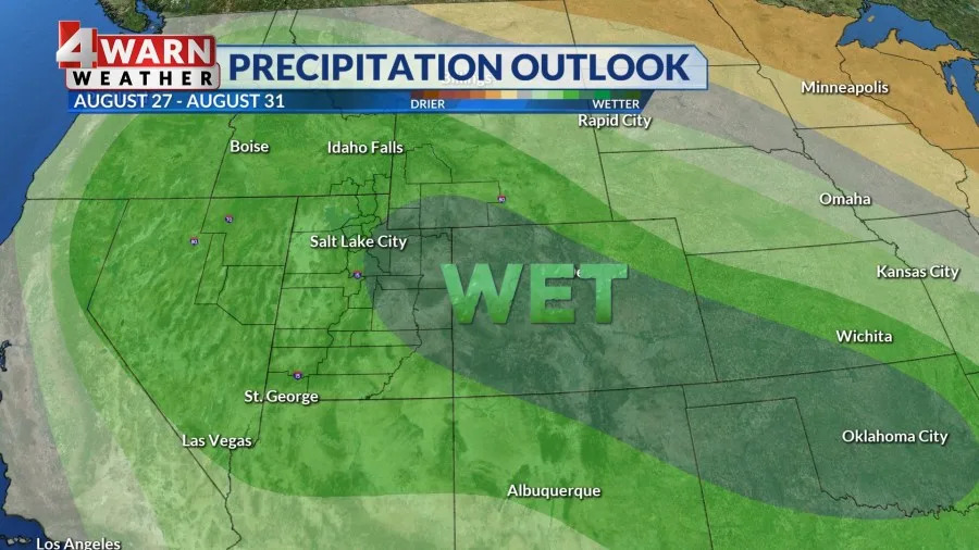
Across the Wasatch Front, a surge of monsoon moisture is moving across the region. This means increasing chances of rain starting Thursday afternoon across the mountains and ramping up Friday through the upcoming weekend across all of the Beehive state. Some of these scattered showers and storms could produce some decent downpours which could lead to some flash flooding issues across our state and national parks. A marginal risk for flooding develops across S. UT by Friday afternoon, spreading north across the state by the end of the weekend. The overall pattern screams wetter than average conditions for Utah through most of next week. High temperatures will cool back into the 90s for the Wasatch Front thru the weekend, with highs still 100+ for SW Utah. By next week, highs could only be in the 90s for SW Utah with highs only in the 80s for parts of the Wasatch Front.

Copyright 2025 Nexstar Media, Inc. All rights reserved. This material may not be published, broadcast, rewritten, or redistributed.
For the latest news, weather, sports, and streaming video, head to ABC4 Utah.


Comments