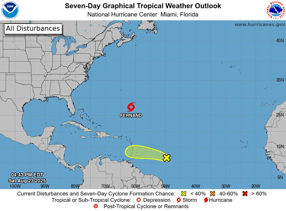
Tropical Storm Fernand formed in the open ocean, hundreds of miles from any land Saturday afternoon, hurricane forecasters say. Another system is also being tracked that has low chances of becoming a tropical storm next week.
Neither system poses any threat to Florida or the U.S. East Coast in the near future, according to National Hurricane Center forecasters and models.
As of the Center’s 5 p.m. advisory, Fernand was 405 miles south-southeast of Bermuda and moving north at 15 mph. It packed 40-mph maximum sustained winds, making it a weak tropical storm.
It’s expected to keep tracking north to northeast, well away from Bermuda and across open waters..
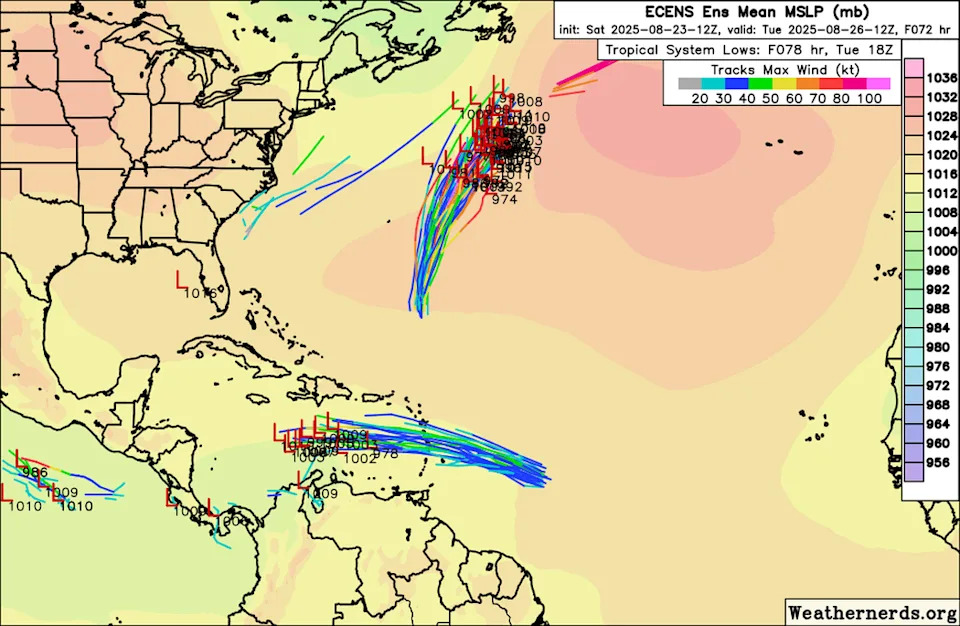
Long-range models show Fernand taking a similar trajectory to Hurricane Erin, steering clear of the U.S. and Caribbean. It’s too early to tell precisely where Fernand will go, and no tropical storm watches or warnings have been issued.
The second system is near the Caribbean’s southeast islands and continued to see its chances of any formation drop. As of 2 p.m., it had a 20% chance of forming into a tropical depression or storm in the next two to seven days.
“Some development of this system could occur during the next couple of days while the system moves quickly westward at about 20 to 25 mph,” forecasters said. “By Tuesday, conditions over the central Caribbean are expected to be unfavorable for further development.“
Many long-range models agree that the system will move further into the Caribbean, but won’t reach the necessary strength to be classified as a tropical storm. As with Fernand, time will tell exactly what path it takes.


Comments