Just one day after a massive wall of dust rolled across Phoenix, multiple flash flood watches and warnings have been issued across southern Utah on Tuesday.
The flash flood warning was issued first in Zion National Park and watches were issued across southern Utah as a disturbance carries heavy rain across the state.
Flash flood warnings issued in Utah
The National Weather Service issued a flash flood warning for Zion National Park, after park rangers reported that the Virgin River has risen around 1.5 feet, per KUTV.
The warning was first issued on Tuesday at 9:39 a.m. MDT for west central Kane County and east central Washington County. KUTV reported that flash flooding had already begun in the area.
This flash flood warning was scheduled to expire at 12:45 p.m. MDT.
There was also a flash flood watch issued across all of southern Utah, because of storms moving across the state.
“A surge of deep monsoonal moisture combined with a slow-moving upper trough will bring periods of heavy showers and thunderstorms across the region,” meteorologists said, according to KUTV.
A storm with heavy rain is expected to reach the Wasatch Front by late afternoon or evening on Tuesday, as it moves across the state from south to north.
The showers and thunderstorms could continue throughout the night as the storm moves into Idaho, per KUTV.
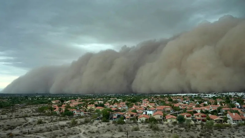
Storm causes wall of dust to hit Phoenix
In Phoenix on Monday, a powerful storm kicked up a massive wall of dust, known as a haboob, that rolled across the city.
“A haboob is a dust storm pushed by the wind produced by a weather front or thunderstorm and typically occurs in flat, arid areas,” per The Associated Press.
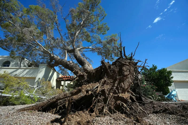
Monday’s haboob, which caused near-zero visibility in the city, was followed by heavy rain and wind which delayed flights at Phoenix Sky Harbor International Airport. A connector bridge at the airport was damaged by 70 mph wind gusts, per CNN.
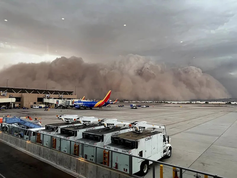
As the system moved into Maricopa County on Monday evening, the National Weather Service in Phoenix issued both dust storm and severe thunderstorm warnings.
After the storms swept through the area, over 60,000 people in Arizona were left without power, with a majority of these outages in Maricopa County, per CNN.
During this year’s monsoon season, Phoenix has been drier than usual but areas of southeast and north-central Arizona have had a fair amount of rain.
There were multiple people in the area who posted photos and videos of Phoenix’s haboob on social media.
A warmer than average fall is predicted across the U.S.
The National Oceanic and Atmospheric Administration released its latest fall season outlook, predicting hot and balmy conditions throughout autumn, per ABC News.
This season outlook forecasts whether parts of the country will be above, below or near average from September to November.
According to ABC News, September is expected to feature typical fall conditions, but October and November could likely end up above normal.
In Phoenix, the average high temperatures range from 104 degrees at the start of the season to 70 degrees at the end of fall. New York City’s range is predicted to be 76 degrees at the start of fall to 54 degrees at the end of the season.


Comments