Tornado and derecho threats? Severe weather could ramp up again in Minnesota originally appeared on Bring Me The News.
Is there going to be a rise in severe weather in Minnesota this week? After storms slammed the state during the last week of July, the message from esteemed meteorologist and self-described "extreme storm chaser" Reed Timmer is that Minnesota could be the focal point for tornado and derecho threats Tuesday through Sunday.
"This severe weather will target the northern Plains into the Upper Midwest starting as early as Tuesday in ND and SD, spreading east to Minnesota and Wisconsin on Wednesday, and impacting the same areas through the weekend with round-after-round of severe weather," Timmer said Saturday.
"Each event will usually begin as supercells capable of all hazards, before growing upscale into long-lived complexes of storms or wind bags."
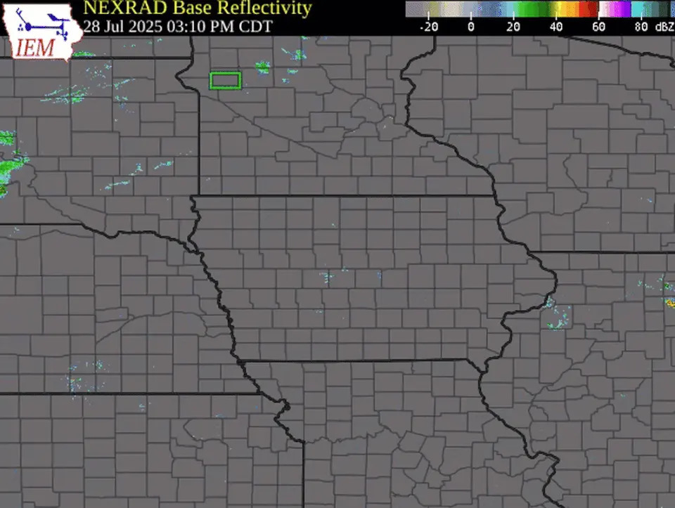
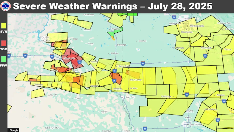
Derecho was a viral term last week as a much-hyped storm system threatened tornadoes and 100 mph winds in South Dakota, Minnesota and Iowa. Minnesota didn't get the 100 mph winds, but winds in excess of 70 mph were confirmed as a damaging line of storms left tens of thousands without power. And there was a confirmed derecho that produced winds up to 99 mph across South Dakota and northern Iowa.
Timmer is monitoring the Dakotas for severe storms on Tuesday, though he says a strong cap could be a limiting factor. Then on Wednesday, his target turns to Minnesota.
"It looks like on Wednesday that trough pushes off to the east, and that will push the low-level jet, northwest Iowa, into southern Minnesota, maybe up near Minneapolis could be very active on Wednesday," Timmer said in a forecast video he posted on social media.
Timmer says the setup will allow for an "explosion of moisture" to fuel severe storms on Wednesday.
"Eastern Dakotas, southern Minnesota, northwestern Iowa on Wednesday," he said. "Setting up for a wind bag. Initial supercells, then they'll congeal into a mesoscale convective system (MCS) — long-lived wind bag or even a derecho as we go from Wednesday into Thursday."
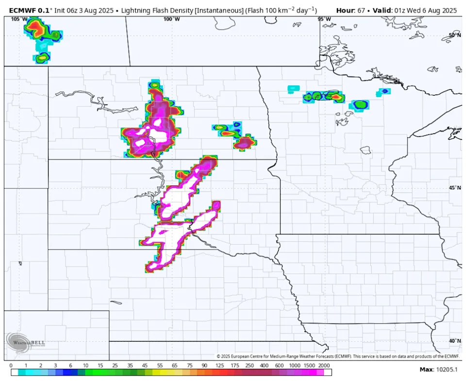
We can use the European model's lightning simulation forecast to get a decent idea of what might be cooking in the days ahead. Here's a view of the Euro's lightning simulation Tuesday evening, which puts the focus on South Dakota if storms can break the cap.
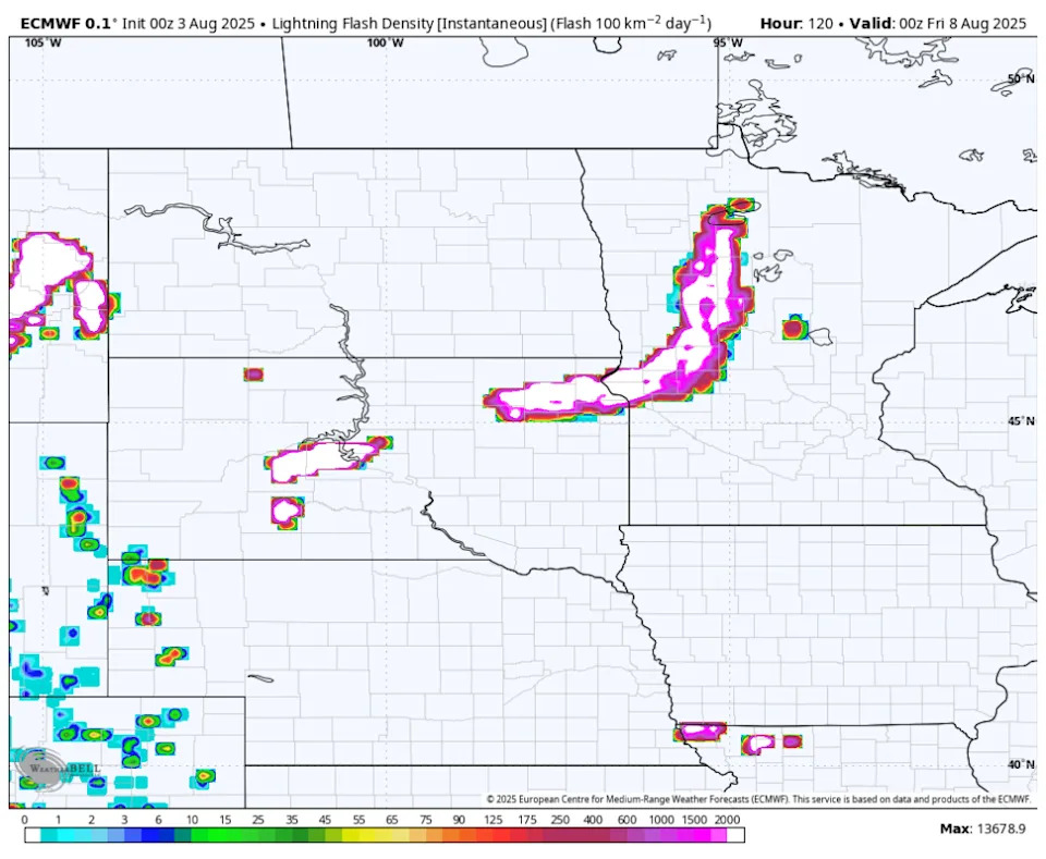
The Euro's lightning model doesn't show anything in Minnesota or Iowa on Wednesday, but it does reveal a bowing line of storms Thursday evening.
Attention Friday and Saturday, at this point anyway, points to potential for severe weather in northern Iowa, southern Minnesota, southern Wisconsin, and northern Illinois.
While Timmer isn't shy about forecasting possibilities, NOAA's Storm Prediction Center (SPC) isn't sounding the alarm for tornadoes or derechos. Instead, the SPC is only acknowledging that a "moist and unstable airmass" will be in place, supporting the "potential for isolated severe [gusts] and hail."
The SPC does however have a close eye on Saturday.
"Model forecasts develop a relatively large cluster of thunderstorms Saturday evening ahead of the trough from northwestern Minnesota into eastern South Dakota," the SPC says. "The models also have strong instability and moderate deep-layer shear in place ahead of the trough within the favored convective zone. This could support a potential for supercells with large hail and severe wind gusts."
The National Weather Service forecast office in Chanhassen is also focused on what might be a higher-end severe threat next weekend as a strong trough moves into the region from the Pacific Northwest.
"We will need to keep our eyes on the progression of this feature as it's likely to provide our next chance for an organized system next weekend," the NWS Twin Cities said in Sunday's forecast discussion.
This story was originally reported by Bring Me The News on Aug 3, 2025, where it first appeared.


Comments