Monitoring 2 rounds of severe storms that could slam Minnesota through Saturday originally appeared on Bring Me The News.
The next two days could bring significant severe weather to the Northern Plains and Upper Midwest, including the threat of damaging winds roaring across parts of Minnesota late Thursday night into Friday morning before another threat develops late in the day Friday.
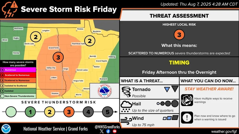
NOAA's Storm Prediction Center (SPC) has a level 3 of 5 "enhanced" risk of severe storms across North Dakota on Thursday. Nasty storms will bring a threat of very large hail, tornadoes and damaging winds before initial supercells morph into a line and blast to the east.
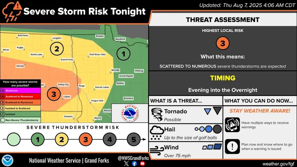
According to the SPC and the National Weather Service in the Twin Cities, the storms in North Dakota will rip to the east across northern Minnesota or begin to dive southeast, targeting areas further south in Minnesota.
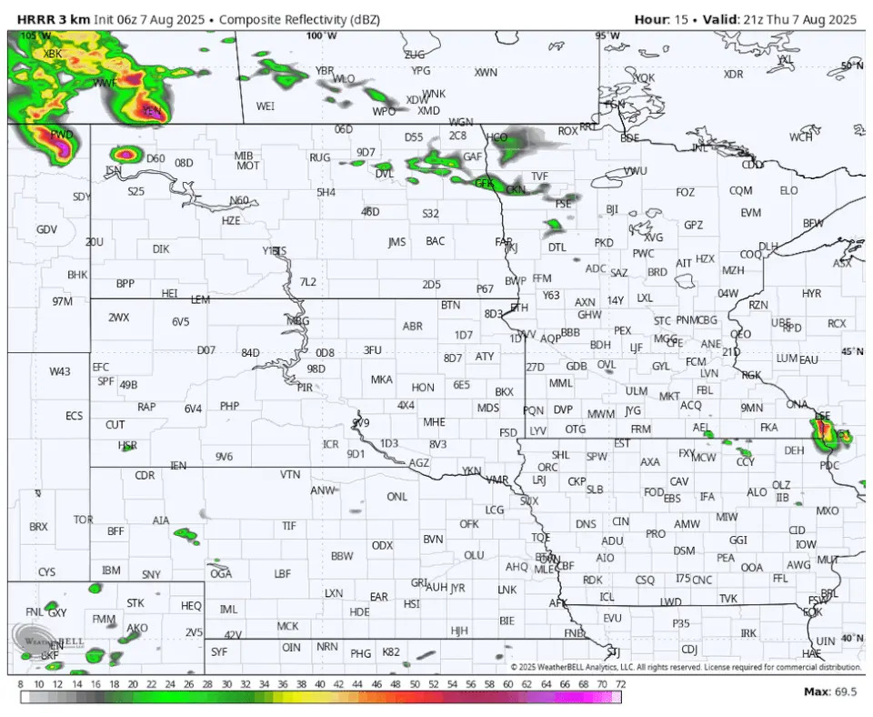
The HRRR model has the northerly outcome, with the NWS Twin Cities describing the situation as "gnarly convection" in North Dakota Thursday afternoon tracking due east as a bow echo.
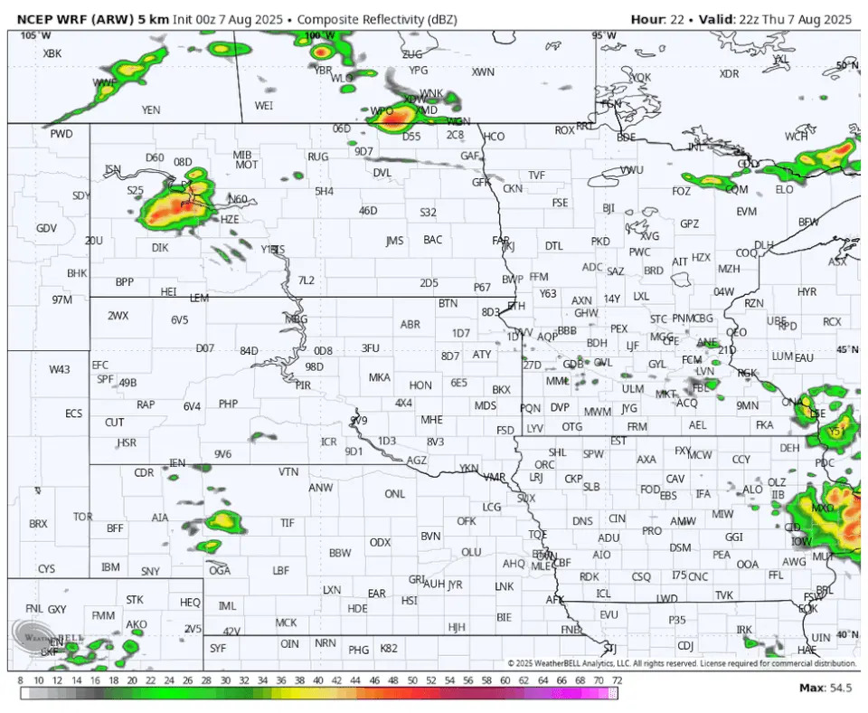
The WRF model tracks the storms more southeasterly, and the NWS Twin Cities is calling this possible outcome one that would "move the decaying MCS through tonight into early Friday morning with isolated severe winds."
Basically, the Twin Cities isn't in a serious danger zone for severe storms with the first batch Thursday night through Friday morning.
The bigger question for the Twin Cities is if the storms will stay far enough north to allow maximum heating on Friday. If storms dive southeast and bring rain and clouds to southern Minnesota Friday morning, then the odds of temps soaring into the low 90s with dew points in the mid 70s decrease, and therefore the severe threats could diminish.
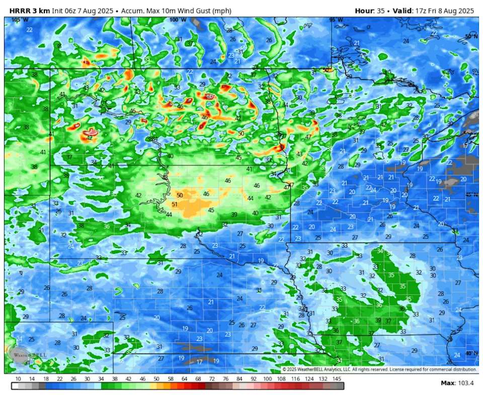
If Friday sets up without the heat and humidity being impeded by rain and clouds, the stage will be set for another robust line of storms — this one possibly tracking somewhere in the vicinity of Interstate 94.
"There is a stronger signal for an MCS/bow echo to track out of the Dakotas & trek down I-94 Friday night into Saturday. Latest guidance favors this solution," the NWS Twin Cities says.
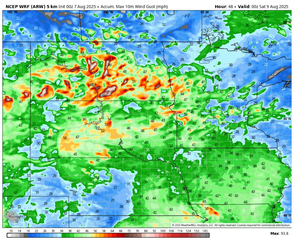
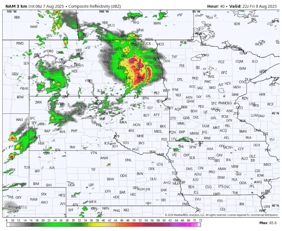
The NAM 3km model projects a big line of storms going right down I-94.
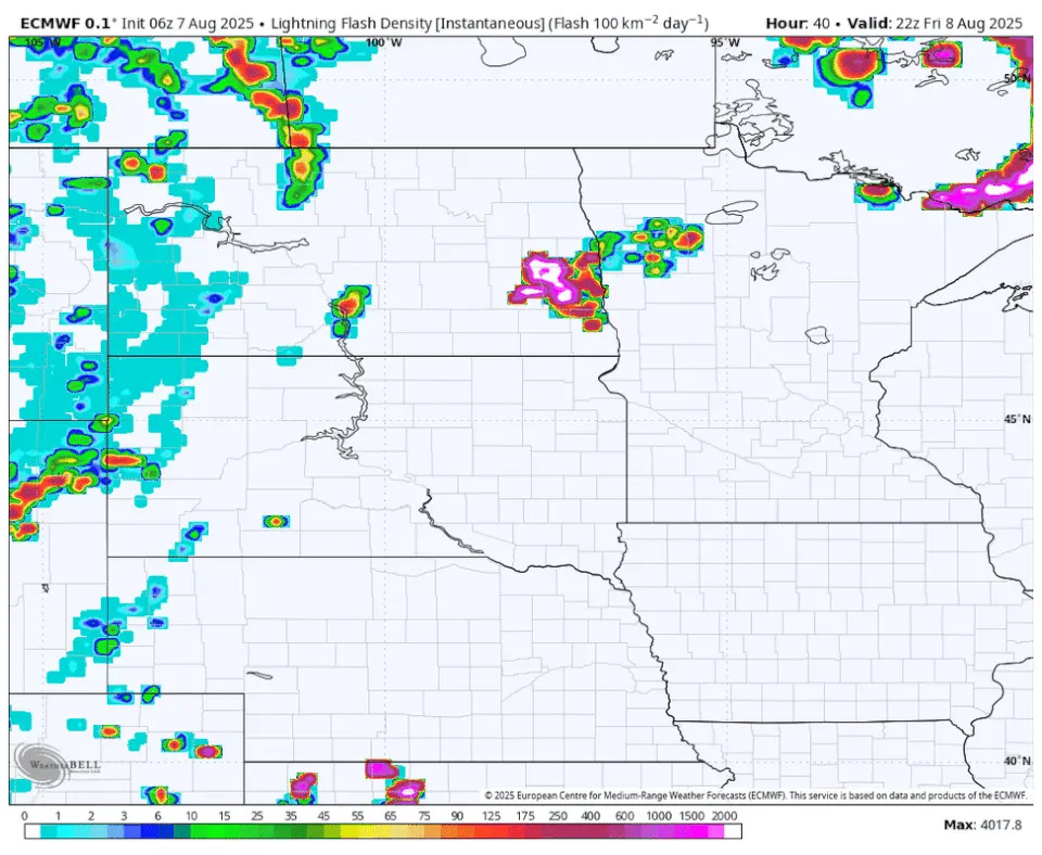
The European model is also honing in on a massive line of storms moving southeast across Minnesota late Friday into Saturday morning.
The situation will need to be monitored and we'll continue to provide updates.
This story was originally reported by Bring Me The News on Aug 7, 2025, where it first appeared.


Comments