Chances for development have decreased slightly for a tropical wave in the central Atlantic.
The National Hurricane Center has given Invest 96L a 50% chance for development over the next seven days.
A tropical depression could form early or middle part of next week, according to forecasters.
➤ Weather alerts via text: Sign up to get updates about current storms and weather events by location
Invest 96L poses no threat to Florida at this time but continues to be monitored, according to the Florida Department of Emergency Management.
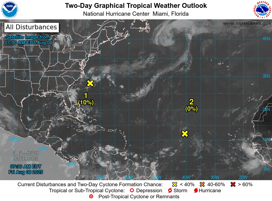
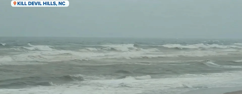
The National Hurricane Center also is watching one other system: A weak area of low pressure located a couple of hundred miles off the coast of North Carolina.
The next named storms of the season will be Erin and Fernand.
Map: Where is Invest 96L?
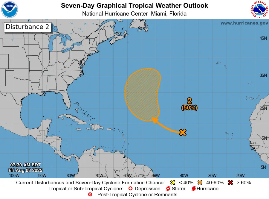
Invest 96L is a tropical wave in the central Atlantic. It's moving northwest to north.
Spaghetti models for Invest 96L
Special note about spaghetti models: Illustrations include an array of forecast tools and models, and not all are created equal. The hurricane center uses only the top four or five highest performing models to help make its forecasts.
Invest 96L could become tropical depression
A tropical wave over the central tropical Atlantic is producing minimal shower activity. Development of this system appears unlikely during the next day or two due to surrounding dry air, but environmental conditions are forecast to become more conducive in a few days.
A tropical depression could form during the early or middle part of next week while the system moves northwestward to northward across the central tropical and subtropical Atlantic.
Formation chance through 48 hours: low, near 0 percent.
Formation chance through 7 days: medium, 50 percent.
What impacts could Invest 96L have on Florida?
Invest 96L poses no threat to Florida at this time but continues to be monitored, according to the Florida Department of Emergency Management.
Officials continue to emphasize the time to prepare for hurricanes and tropical storms is before they are a threat.
"It only takes one storm to make it an impactful year for your community," the National Hurricane Center Miami posted on X. "Hurricane season is a marathon, not a sprint."
On Aug. 1, specific hurricane supplies became permanently tax free in Florida, ranging from batteries to generators.
➤ See list of emergency supplies you can now buy tax free
What is an invest?
Short for investigation, the National Hurricane Center uses the term invest for areas of low pressure it is monitoring for potential development into a tropical depression or storm.
Invests are not tropical depressions or tropical storms. They're usually clusters of showers and thunderstorms, and just because they've been designated as an invest does not guarantee they'll strengthen into a tropical storm or hurricane.
Invests run from 90 to 99, followed by a letter: L for the Atlantic basin and E for those in the eastern Pacific. After 99, it starts over again and the next invest would be 90.
Once something has been designated as an invest, specialized data sets and computer models can begin, including scheduling Hurricane Hunter aircraft missions and running spaghetti models.
Interactive map: What tropical storms, hurricanes have impacted your area in the past?
Stay informed. Get weather alerts via text
What's next?
We will update our tropical weather coverage daily.
Download your local site's app to ensure you're always connected to the news. And look for our special subscription offers here.
This article originally appeared on Florida Times-Union: Invest 96L Florida forecast impact, storm update and spaghetti models


Comments