The National Hurricane Center continued tracking a pair of weather systems in the Atlantic early Aug. 9, with neither looking like they will develop soon nor threaten land.
Invest 96L showed some signs of "collapsed" shower activity, but still has a chance, though lower overnight, to develop into a tropical depression sometime next week, NHC forecasters said in their Tropical Weather Outlook.
A system of low pressure that was being tracked off the coast of North Carolina has dissipated, according to the latest advisory from the National Hurricane Center.
➤ Weather alerts via text: Sign up to get updates about current storms and weather events by location
The next named storms of the Atlantic hurricane season will be Erin and Fernand. The fifth-named storm of the season historically develops Aug. 22, followed by the sixth-named storm on Aug. 29, according to AccuWeather.
Here's the latest advisory from the National Hurricane Center as of 2 a.m. Aug. 9:
Where is Invest 96L and where is it going?
Invest 96L is a tropical wave in the central Atlantic moving northwest to north.
It could become a tropical depression early to mid next week.
Spaghetti models for Invest 96L
Special note about spaghetti models: Illustrations include an array of forecast tools and models, and not all are created equal. The hurricane center uses only the top four or five highest performing models to help make its forecasts.
➤ How often has Florida been impacted, threatened by August hurricanes? We took a look back
What tropical waves, disturbances are in Atlantic basin now? How likely are they to strengthen?
Tropical wave: Located near the west coast of Africa, this system is producing a large area of disorganized showers and thunderstorms. Some slow development of this system is possible next week while the system moves west-northwestward at 15 to 20 mph across the eastern and central tropical Atlantic, forecasters said.
Formation chance through 48 hours: low, near zero percent.
Formation chance through seven days: low, 30 percent.
Invest 96L: Shower activity has collapsed and is limited in association with a tropical wave over the central tropical Atlantic, forecasters said. Development of this system appears unlikely during the next day or two due to surrounding dry air, but some gradual development is possible during the early or middle part of next week while the system moves northwestward to northward across the central Atlantic.
Formation chance through 48 hours: low, near 0 percent.
Formation chance through seven days: medium, 30 percent.
Heavy rains likely for Northeast Florida and Coastal Southeast Georgia
"The front lingering near the Florida/Georgia border — along with normal sea breezes — is expected to bring plenty of rain to Northeast Florida," according to Paige Klingler, meteorologist with the National Weather Service Jacksonville in a phone interview Friday morning. Also expect rough surf and dangerous rip currents.
The five-day rain forecast for Northeast Florida is 2-5 inches, with some areas possibly seeing 6-8 inches. Localized flash flooding remains a risk through the weekend.
Heavy rains at times will also be seen in South Florida, forecasts show, with areas of poor drainage susceptable to flooding.
Is there a hurricane coming toward Florida?
No, but remember conditions can change rapidly.
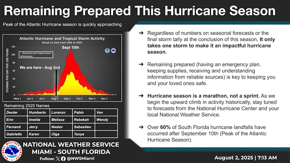
The busiest period of the hurricane season runs from mid-August through mid-October and activity is picking up.
What do the colored, hatched areas on the NOAA map mean?
The hatched areas on the National Hurricane Center's tropical outlook map indicate "areas where a tropical cyclone — which could be a tropical depression, tropical storm or hurricane — could develop," said National Hurricane Center Deputy Director Jamie Rhome.
The colors make it visibly clear how likely a system could develop, with yellow being low, orange medium, and red high.
The National Hurricane Center generally doesn't issue tropical advisories until there is a named storm, but there is an exception.
"If a system is near land and there is potential for development, the National Hurricane Center won't wait before it issues advisories, even if the system hasn't become an actual storm. This gives residents time to prepare," Rhome said.
What should you do now to prepare for hurricane season?
Officials regularly encourage Florida residents to prepare for storms before a hurricane is approaching while shelves are full stocked and you aren't battling crowds all rushing to the store at the same time.
"It only takes one storm to make it an impactful year for your community," the National Hurricane Center Miami posted on X. "Hurricane season is a marathon, not a sprint."
On Aug. 1, specific hurricane supplies became permanently tax free in Florida, ranging from batteries to generators.
➤ See list of emergency supplies you can now buy tax free
Florida weather radar for Aug. 9, 2025
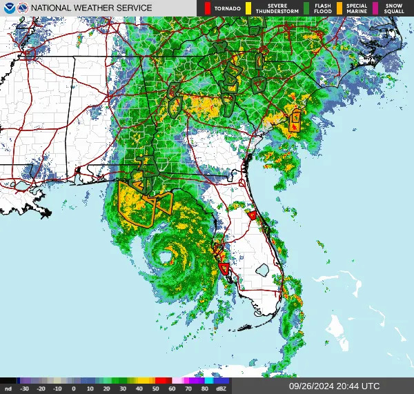
Weather watches and warnings issued in Florida
When is the Atlantic hurricane season?
The Atlantic hurricane season runs from June 1 through Nov. 30.
Ninety-seven percent of tropical cyclone activity occurs during this time period, NOAA said.
The Atlantic basin includes the northern Atlantic Ocean, Caribbean Sea and Gulf of America, as the Gulf of Mexico is now known in the U.S. per an order from President Trump. NOAA and the National Hurricane Center are now using Gulf of America on its maps and in its advisories.
When is the peak of hurricane season?
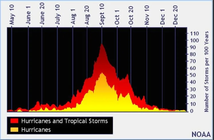
The peak of the season is Sept. 10, with the most activity happening between mid-August and mid-October, according to the Hurricane Center.
Hurricane names for 2025 season
Here are the names for the 2025 Atlantic hurricane season, along with how to pronounce them:
Andrea(June 20)Barry(June 29)Chantal(July 5)Dexter(Aug. 3)Erin: AIR-rin
Fernand: fair-NAHN
Gabrielle: ga-bree-ELL
Humberto: oom-BAIR-toh
Imelda: ee-MEHL-dah
Jerry: JEHR-ee
Karen: KAIR-ren
Lorenzo: loh-REN-zoh
Melissa: meh-LIH-suh
Nestor: NES-tor
Olga: OAL-guh
Pablo: PAHB-lo
Rebekah: reh-BEH-kuh
Sebastien: se-BAS-tee-en
Tanya: TAHN-yuh
Van: van
Wendy: WEN-dee
National Hurricane Center map: See what forecasters watching now
Systems currently being monitored by the National Hurricane Center include:
Interactive map: Hurricanes, tropical storms that have passed near your city
Stay informed. Get weather alerts via text
What's next?
We will update our tropical weather coverage daily.
Download your local site's app to ensure you're always connected to the news. And look for our special subscription offers here.
This article originally appeared on Naples Daily News: Hurricane Center tracks Invest 96L, tropical wave for storm activity


Comments