Cole Lindsay remembers embers from the 2024 Fossil Complex Fire blowing into a steep canyon, a place where crews feared new fire starts had the potential to form.
Lindsay, the Oregon Department of Forestry aviation coordinator, said firefighters would typically have to hike into the dark canyon to check for new fires — a time-consuming and potentially dangerous task on a wildfire that had already roared to 23,890 acres in Wheeler County.
But technology has advanced. Instead of sending people, Lindsay sent a drone equipped with an infrared camera to sweep across the canyon.
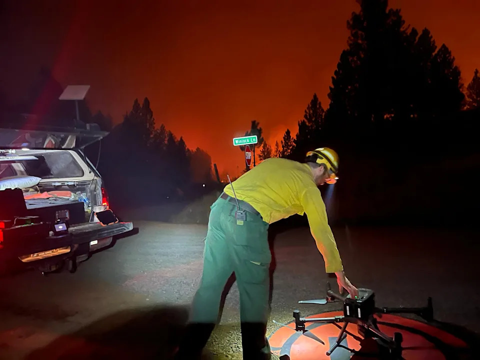
“The cameras and sensors are so good that it would have seen something way before the human eye,” Lindsay said.
Turns out, the canyon was clear — there were no new spot fires. They were able to focus efforts more on other places.
“We were able to clear this dangerous section that they were worried might have had a spot fire with the drone and not have to send any people down there, which was way more efficient as well as far safer,” Lindsay said.
The Oregon Department of Forestry has 29 pilots. In 2024, ODF and its contractors flew 482 drone missions, 364 of which were for fire purposes. Out of 136 hours of flight time, 98.5 hours were on fire missions.
So far in 2025, ODF, excluding its contractors, have flown 41 missions totaling 14 hours. Out of those 14 hours, 7.9 hours were for fire purposes.
“Pretty much anything ODF does you could use a drone for, but fire is our main driver,” Lindsay said.
How are drones used to fight Oregon wildfires?
Since 2017, ODF has used drones for multiple wildfire purposes, including helping them detect heat at night as well as mapping fire lines and hot spots.
When smoke is thick, drones can cut through the haze, and when embers rain, drones give the fire team an advantage with eyes in the sky.
“The sky’s the limit, pardon the pun, for what you can do with a drone,” Lindsay said.
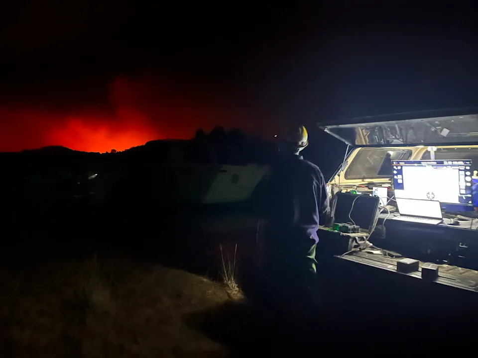
Drones are valuable for fire line and hot spot mapping, too. Crude aviation planes and helicopters can do mapping, but drones are able to get closer to the ground, creating a better map.
The drone takes pictures and videos along the fire line, and once the images are put into software, a thermal map of hot spots and the fire line is created.
“With some AI, it can pick out which ones are actually hot spots and which ones are false positives, and be able to help you draw that fire line in,” Lindsay said.
With 36 drones, only about a third of the fleet has infrared cameras on them that allows them to detect heat signatures. The others are normal color camera drones that are pocket-sized, so firefighters can easily carry them when scouting for fires.
“Even though it's not a thermal camera, you can still get a great lay of the land and look for smoke from the air,” Lindsay said. “It’s much easier than when you're stuck down in the trees.”
Drones in use for 2025 Oregon wildfire season
The Grizzly Complex Fire that ignited on July 9 and burned 887 acres in Jackson County is one example of drones being put into action this wildfire season.
During the fire, ODF brought in Rogue Reconnaissance, a drone contractor for the agency. They mapped the Neil Creek Fire within the complex and were able to pick up heat and classify it by intensity using infrared cameras.
Later in the month, on July 17, the Board Shanty Fire ignited and burned 474 acres in Jackson and Josephine counties.
For the first time, drone pilots with ODF and the Bureau of Land Management worked together on a joint operation for the fire.
The mission helped identify hot spots within the fire perimeter to assist crews with mop-up operations, ensuring there were no reignitions.
Other ways Oregon Department of Forestry uses drones
ODF is also interested in using the drones to light fires.
Currently, contractors do this work. Traditionally, a drip torch or berry pistol (which resembles a flare gun) is used to start small and controlled fires and can be done from the ground or from the sky, Lindsay said.
“The drones have been replacing the helicopters from the aerial ignitions because they can get closer, they can fly in the smoke a little bit more and you're not putting people at risk,” Lindsay said.
Lighting controlled fires with the drones helps starve the wildfire of fuels, such as dry vegetation or other flammable materials, to create a fire line and control the spread of the fire.
Although fighting fire is the drone's primary use, they’re used in other capacities as well, such as search and rescue missions, forest health, timber and recreation management.
Aside from the infrared cameras, drones with multispectral cameras that see different shades of green are being considered for plant health and identification, and for forest management.
LiDAR cameras to help with mapping for timber management and disaster response are being considered for future use, too.
Mariah Johnston is an outdoors journalism intern at the Statesman Journal. Reach her at [email protected].
This article originally appeared on Salem Statesman Journal: How Oregon Department of Forestry is using drones to battle wildfires


Comments