SALT LAKE CITY (ABC 4) — Happy Tuesday, Utah! We have high pressure building overhead, and while we may have started the work week a few degrees below average, the summer heat is making a major comeback today and tomorrow.
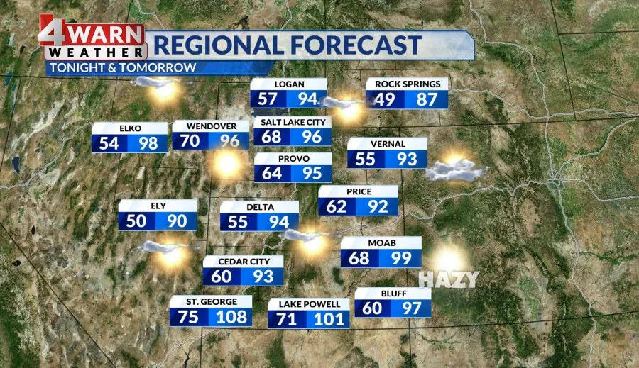
You can expect sunny skies statewide with a spike in temperatures. This time of year, St. George holds on to the heat with an average of 101 degrees, while Salt Lake typically sees highs around 93 degrees.
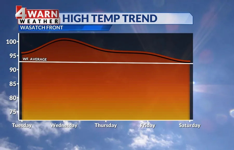
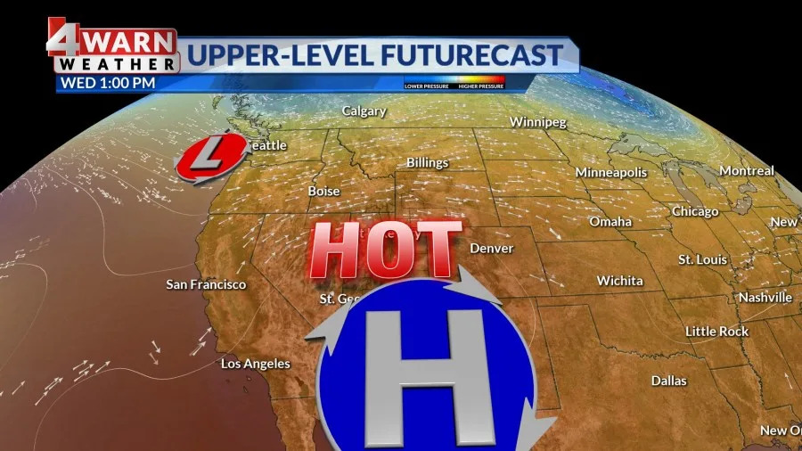
We have a ridge of high pressure over Utah and it’s going to be the key player in our weather through the midweek, and could even deliver our sixth triple digit day of the year in Salt Lake by the midweek as highs push 110 in St. George on Wednesday. This area of high pressure is pushing east towards the Four Corners and while it will usher in above average temperatures, it could also pull far enough east to open the door for an uptick in monsoon moisture.
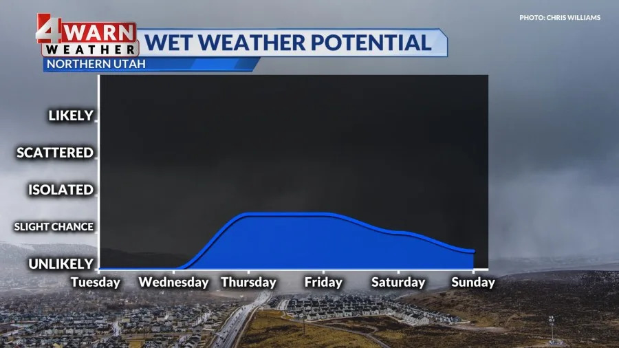
With more moisture potential and high heat, parts of the state could see the potential of isolated thunderstorms. Right now, it looks like the western side of the state and southern Utah have the best chance for a pop up storm, but we will monitor storm chances as we get closer to the close of the work week.
Currently, there is very dry air at the surface so these storms could just deliver gusty outflow winds and lightning, which would raise fire concerns for parts of the state. It’s been more 35 days in Salt Lake City without measurable moisture and more than 19 days in St. George. This dry streak leads to worsening drought conditions, so alittle wet weather is welcome at this point. We will see!
Increasing clouds will allow temperatures to cool slightly back into the mid 90s across northern Utah, and near 100 for southwest Utah through the upcoming weekend.
We’ll keep you updated on the latest developments in our 4Warn forecast both on-air and online, we are Good4Utah!
Building heat statewide
Triple digit potential midweek for SLC
Increasing moisture potential with high on the move
Slight chance of a storm late-week, not a lot of rain coverage
Temps ease with southerly flow and moisture uptick
Latest headlines:
Copyright 2025 Nexstar Media, Inc. All rights reserved. This material may not be published, broadcast, rewritten, or redistributed.
For the latest news, weather, sports, and streaming video, head to ABC4 Utah.


Comments