The Northeast will bake in heat that will flirt with daily records as it wraps up the week Friday then will have more hot and humid weather early next week before some much needed relief arrives.
(TRACK THE HEAT: Temperatures | Heat Index)
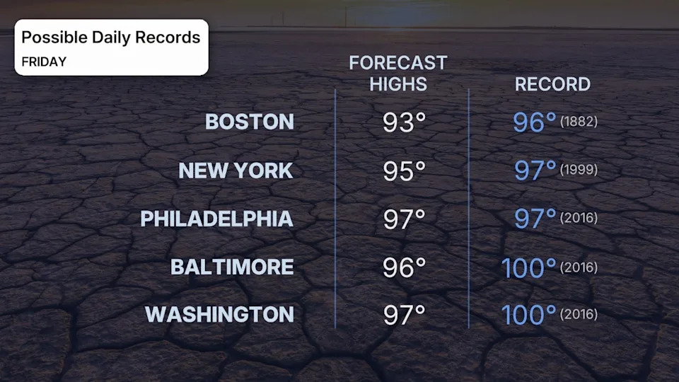
How Hot Will Friday Be?
- We're forecasting afternoon highs Friday in the middle to upper 90s along the Interstate 95 corridor from southern New England into Virginia. Parts of upstate New York and northern New England may hold in the upper 70s or 80s.
- Some locations along the Interstate 95 corridor will flirt with their record highs for July 25, as the graphic below shows.
- Accompanying that heat, more humid air will move in, sending heat indices soaring above 100 degrees near the I-95 corridor. Heat advisories and some extreme heat warnings have been issued by the National Weather Service.
- There is also a chance of strong to severe storms from around Boston to New York City and Philadelphia in the afternoon. Strong, damaging wind gusts would be the main threat from any storms that turn severe.
(MORE: Heat Advisories, Warnings Explained)
What You Should Do
- Heat is the No. 1 weather killer in the U.S., with hundreds of fatalities each year.
- The combination of heat and humidity is dangerous for those without access to air conditioning, especially in the cores of larger cities.
- Check on family, friends, the elderly and those with chronic illness who live without access to air conditioning.
- If possible, avoid being outdoors for long in the peak heat of the afternoon.
- If not, take frequent breaks, avoid strenuous activity, drink more water than usual and wear loose, lightweight clothing.
(MORE: Should You Turn Off Your A/C Or Leave It On When You Leave Home?)

How Long Will It Last?
- There will be heat relief this weekend along the I-95 corridor from New York into New England, including both cooler temperatures and less humid air, particularly on Saturday.
- The relief for the mid-Atlantic this weekend will be slight. Highs will be 5 to 10 degrees lower. And any small reduction in mugginess on Saturday will be replaced by a more-oppressively humid air mass on Sunday.
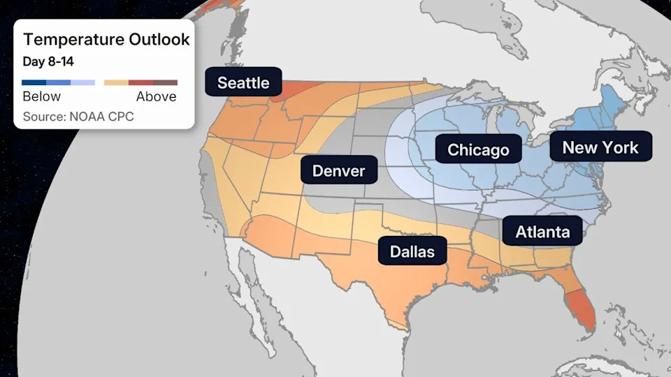
- It will become hot again in the first half of next week, before a stronger cold front slides through and brings cooler relief to the Northeast from north to south mid-late next week. Lower humidity and highs in the 70s and low 80s can be expected in the Midwest and Northeast as this cooler air spreads eastward Tuesday through Thursday.
(MAPS: 10-Day US Forecast Highs and Lows)
Jonathan Erdman is a senior meteorologist at weather.com and has been covering national and international weather since 1996. Extreme and bizarre weather are his favorite topics. Reach out to him on Bluesky, X (formerly Twitter) and Facebook.


Comments