Hurricane Erin is remaining a rare Category 5 hurricane as it passes north of the Northern Leeward Islands. Erin is expected to continue to bring rain, gusty winds and high surf to parts of the Caribbean this weekend before pivoting northward and passing between Bermuda and the U.S. East Coast.
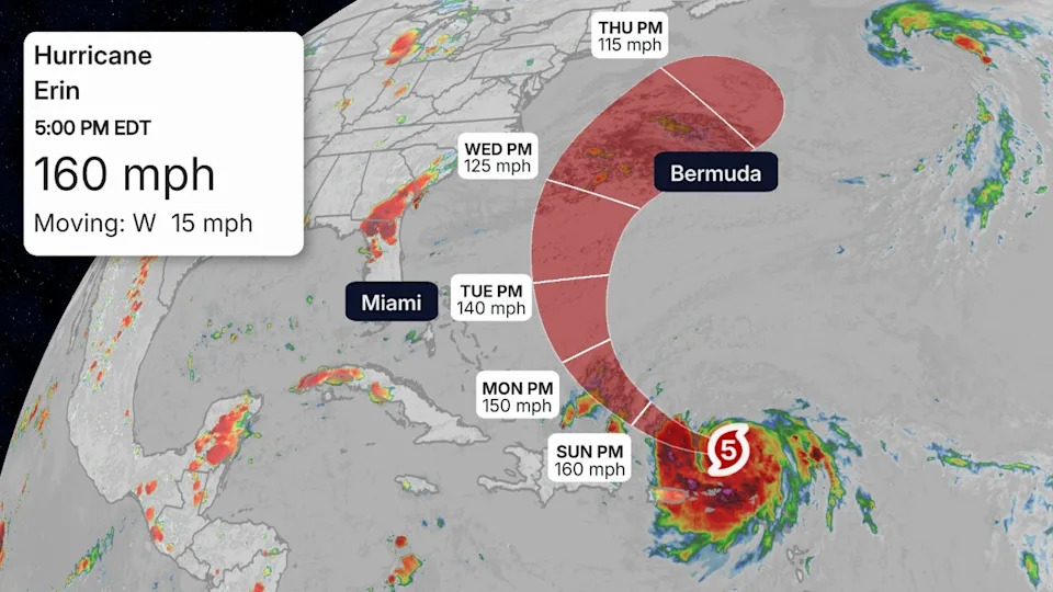
The NOAA Hurricane Hunters found sustained winds at 160 mph Saturday morning, making the storm a monster Category 5 hurricane on the Saffir-Simpson Hurricane Wind Scale. The first Category 3+ hurricane of the season typically forms on September 1, so Erin is slightly ahead of schedule.
Erin climbed from a tropical storm to Category 5 in just under 30 hours, and from a Category 3 to a Category 5 in just under 6 hours. Erin has also joined a rare group of only five hurricanes that have wind speeds of at least 145 mph by August 16 since 1970, according to Dr. Phil Klotzbach. Erin is the first Category 5 hurricane since Milton and Beryl in 2024.
Interests along the U.S. East Coast and Bermuda should continue to monitor the forecast. A significant rip current threat is expected in the week ahead from Florida to Massachusetts.
(MORE: Erin Maps Tracker - Spaghetti Models, Forecasts, More)
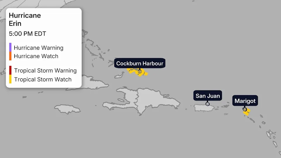
Watches And Warnings
While Erin's center is passing north of the Leeward Islands, Puerto Rico and the Virgin Islands, it could track close enough for at least some tropical storm force gusts in some areas. Tropical storm watches are in effect for St. Martin/Sint Maarten, St. Barthelemy and the Turks and Caicos Islands. Watches mean tropical storm force winds are possible, while warnings mean they are expected.
There could be other impacts in these areas other than winds, as we'll detail below.
Path, Intensity Forecast
Erin is located just under 200 miles northeast of Puerto Rico and winds have remained steady at 160 mph since Saturday morning, making it a Category 5 hurricane. Erin has been slowly gaining latitude over the course of Saturday afternoon, marking the beginning of it's northwestward curve later this weekend.
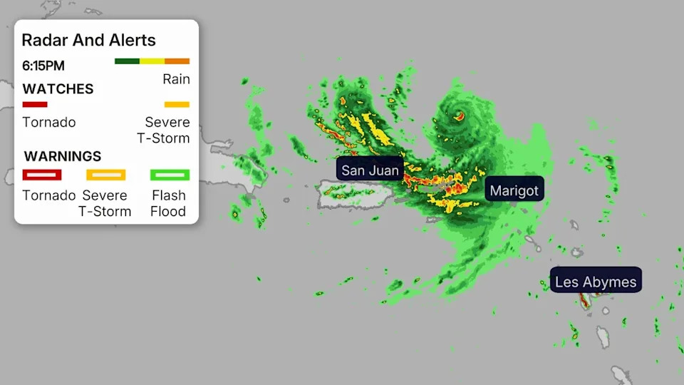
A wind gust of 57 mph was recently recorded on the island Tortola in the British Virgin Islands, but sustained tropical-storm-force winds have remained to the north of the islands so far today.
Erin is expected to turn toward the west-northwest and retain maximum sustained wind speeds of 160 mph into Sunday warm water and low wind shear conditions north of the northern Leeward Islands, Virgin Islands and Puerto Rico, but then, as the hurricane moves away from Puerto Rico, it should hit worsening environmental conditions. Beginning by Monday, a slow weakening trend will ensue as the hurricane turns northward.
Erin is expected to intensify for at least another 12 hours in warm water and low wind shear conditions north of the northern Leeward Islands, Virgin Islands and Puerto Rico, but then, as the hurricane moves away from Puerto Rico, it should hit worsening environmental conditions. Beginning by Monday, a slow weakening trend will ensue as the hurricane turns northward.
Fluctuations in intensity are expected this weekend.
Later in the upcoming week, Erin is expected to pass between North Carolina and Bermuda. Exactly where this happens remains uncertain, but Erin is expected to eventually turn northeastward to the north of Bermuda.
Potential Impacts
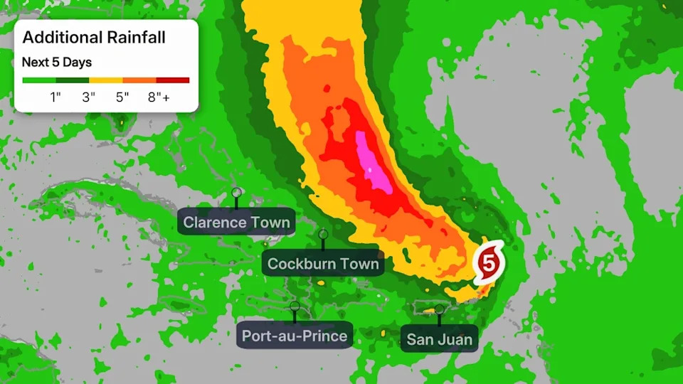
-Caribbean: The core of Erin is expected to pass just north of the northeast Caribbean islands, but some impacts are expected this weekend from Puerto Rico to Anguilla.
In addition to high surf and dangerous rip currents, bands of heavy rain containing gusty winds could impact the northern Leeward Islands, Virgin Islands and Puerto Rico through this weekend. This could lead to local flash flooding and landslides where bands of heavy rain persist, particularly over mountainous terrain. Up to 8 inches of rain is possible.
-Bermuda, U.S. East Coast: Beginning Monday, Erin will begin to turn more to the north between a developing break in high pressure. This will occur while Erin is growing dramatically in size. Between Saturday and Wednesday, Hurricane Erin will double or triple in size.
This change will help the hurricane generate high surf and dangerous rip currents along the U.S. East Coast for several days in the week ahead.
There is a high chance of rip currents from Florida to Massachusetts during much of the upcoming week. Of all hurricane hazards, 16% of all fatalities come from rip currents and rough seas. Please stay out of the Atlantic waters in the week ahead.
The probability of a landfall from Erin along the U.S. East Coast is very low at this time. However, interests along the East Coast should continue to monitor this system for possible changes.
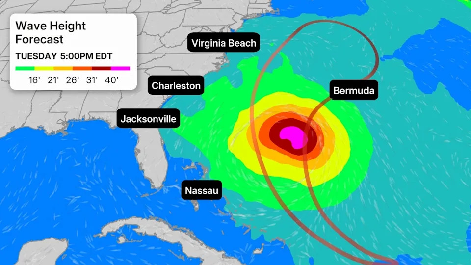
Interests in Bermuda should also continue to follow Erin's forecast closely since its eventual turn toward the north and northeast might take it close to the archipelago next week. And parts of Atlantic Canada — particularly Newfoundland — should also follow this forecast closely, as Erin could end up tracking close to some of those areas late in the week ahead.
Check back to weather.com and The Weather Channel app for updates as the forecast comes into focus.
Jennifer Gray is a weather and climate writer for weather.com. She has been covering some of the world's biggest weather and climate stories for the last two decades.


Comments