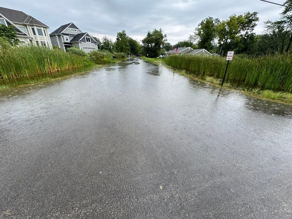
While Saturday's storms thankfully missed areas already hammered by flooding, more rain is coming Monday that could create pockets of flash flooding.
The National Weather Service doesn't yet have a map of rainfall totals from Aug. 16, but initial reports show that areas in southeastern Wisconsin that were hard hit by flooding last weekend got less than a quarter of an inch of new rain.
Those small amounts were "very helpful" in preventing flood conditions from getting worse, NWS meteorologist Marcia Cronce said.
But another round or two of thunderstorms will develop Sunday. It should stay mostly dry overnight Aug. 17, but most of the rain will fall during the day Monday.
"They will be slow moving and super heavy rainers. That could linger all the way into Monday night," Cronce said.
Milwaukee has a 71% chance of getting at least half an inch of rain now through Tuesday morning, and a 20% chance of one inch or more.
Areas closer to central Wisconsin, like Waupun and Fond du Lac, are more likely to see higher amounts.
Hard to predict where flash flooding could occur
While widespread flash flooding is not expected Aug. 18, the slow-moving storms could create localized flash flooding.
But it's impossible to know where exactly that will occur. It's sort of like a winter storm warning, Cronce said, where one area is expected to get lots of snowfall.
"Someone's going to get a lot of rain, just not sure exactly where it's going to be," she said. "The processes that feed into that are just so small, that no one can predict it."
It's possible another widespread flood watch could be issued. NWS is currently operating under an "excessive rainfall outlook," meaning there's a slight risk.
"Everyone is saturated (with rain), so any more rain is going to exacerbate our flooding issues," Cronce said. "Rivers can easily go back up ... if repeated rounds of rain hit them."
In a statement Aug. 15, Milwaukee County Executive David Crowley urged caution ahead of weekend storms, including Sunday into Monday.
"I am urging the public to stay vigilant, be informed, and take proactive steps now to protect your family, your property, and your community. Let’s stick together, watch out for one another, and stay safe this weekend," Crowley said.
Rest of week will have a break from rain
There is good news on the horizon: After Tuesday night, there is no more widespread rain in the forecast through at least Saturday afternoon.
And high temperatures will be fairly pleasant, in the high 70s to low 80s range.
"Overall, a drier pattern," Cronce said.
This article originally appeared on Milwaukee Journal Sentinel: Pockets of flash flooding, more heavy rain possible with Monday storms


Comments