The Brief
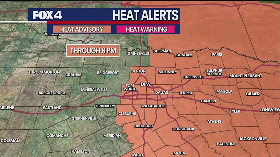
A heat advisory is in effect for Dallas-Fort Worth and points east until at least 8 p.m. Sunday, with a heat index reaching up to 105 degrees.
While the main metroplex may experience slightly lower "feels like" temperatures, areas to the east are expected to feel the full impact.
An increase in shower chances is expected midweek as a pattern shift brings a change from the current hot and humid conditions.
DALLAS - A heat advisory has been issued for the Dallas-Fort Worth area and points east, as a powerful and rapidly intensifying Hurricane Erin churns in the Caribbean.
Heat Advisory for Sunday
The advisory is in effect through at least 8 p.m. Sunday, with the possibility of being extended into Monday evening. While the immediate metroplex will see slightly drier air and a heat index just above 100 degrees, areas farther east are expected to experience a "feels like" temperature approaching 105 degrees.
The forecast calls for high temperatures in the mid-to-upper 90s through Tuesday. A weak front is expected to bring a pattern shift by midweek, which could increase shower chances and lower temperatures to the low to mid-90s by the end of the workweek.
Hurricane Erin
Erin, the first hurricane of the 2025 Atlantic season, exploded into a major storm over a 24-hour period, a phenomenon known as rapid intensification. On Saturday, its winds reached up to 160 mph, briefly making it a Category 5 hurricane, one of the fastest-growing Atlantic hurricanes on record.
The storm is currently a Category 3 hurricane churning north of Puerto Rico, bringing dangerous winds and a threat of flooding and landslides to nearby islands. Tropical storm warnings are in effect for the Turks and Caicos Islands.
According to the National Hurricane Center's 7 a.m. advisory, the storm is still expected to strengthen back into a Category 4 hurricane Sunday before making a northeasterly turn away from the Eastern Seaboard. Despite the projected track, dangerous surf and rip currents are still expected to impact the East Coast by the middle of the week.
North Texas Weather
In North Texas, muggy conditions are present with morning temperatures in the upper 70s and low 80s. Dew points are in the low 70s, contributing to the high heat index. While some relief is expected for the metroplex with dew points falling into the mid-60s, areas to the east will likely see little change.
A few isolated showers have popped up in areas well to the west of the metroplex, including Parker, Jack, and Young counties. These are lifting slowly to the north and northeast. Rain chances for the rest of the day are minimal, with about 10% coverage, but a few more spotty showers could develop in the heat of the day.
7-Day Forecast
Looking ahead, the seven-day forecast calls for highs in the mid-to-upper 90s through Tuesday. A pattern shift is expected midweek, which could bring an increase in shower chances.
The Source
Information in this article is from the FOX 4 News Weather Team.


Comments