Tight on time? This story is for you. It's an abbreviated, text view of what's happening with Hurricane Erin. Click here for more details and to see the latest spaghetti models.
Sign up to get weather alerts via text based on your interests or location.
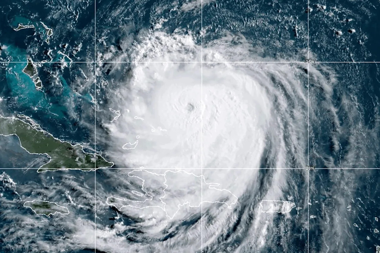
Hurricane Erin — the fifth named storm of the season — formed early Friday, Aug. 15, marking the first hurricane of the 2025 Atlantic hurricane season before exploding overnight and strengthening into a Category 5 storm by afternoon Saturday, Aug. 16.
It is only the fifth hurricane on record to reach Category 5 strength this early — and the first to do so outside the Gulf or Caribbean. The system strengthened to sustained winds of 160 mph, but later that day an eyewall replacement cycle caused Erin to weaken slightly.
Will Hurricane Erin hit North Carolina?
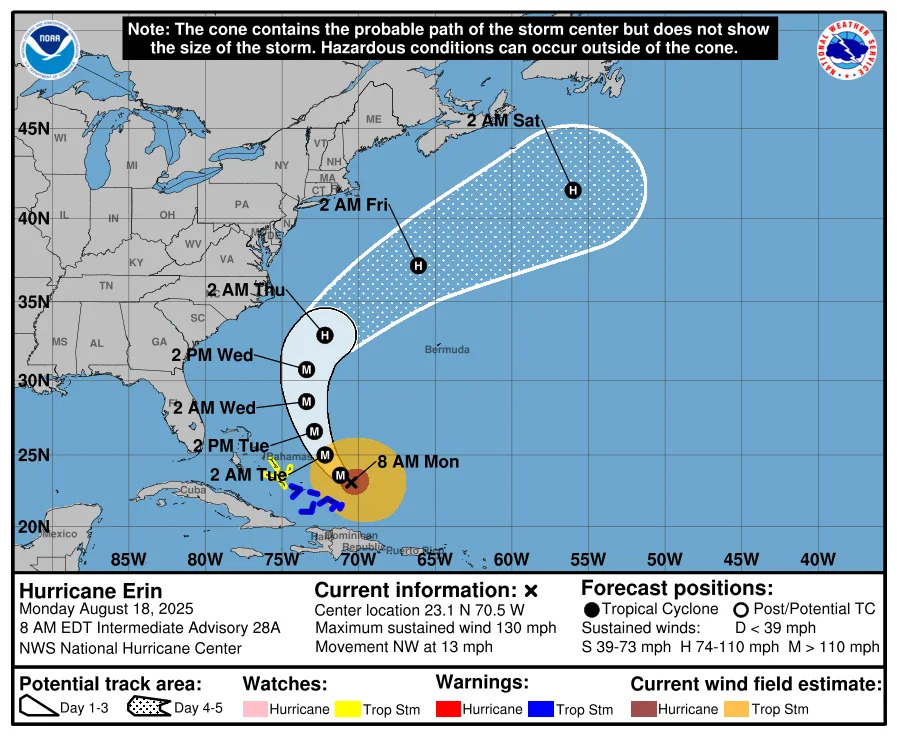
The Cat 4 Hurricane Erin is now moving northwest and is expected to remain off the U.S. coast and dissipate into the open Atlantic by Saturday, Aug. 23.
What impacts will Hurricane Erin have on North Carolina?
Though Hurricane Erin is not forecast to make landfall on the U.S., the storm’s rapid intensification has prompted increased emergency measures in North Carolina, and the Outer Banks are now under a state of emergency.
Officials mandated evacuations for Hatteras Island as forecasters warned of life-threatening rip currents, large swells, coastal flooding and road washouts:
Visitors must leave by 10 a.m. Monday, Aug. 18
Residents must leave by 8 a.m. Tuesday, Aug. 19
North Carolina Outer Banks evacuation routes
Dare County has two primary evacuation routes: U.S. 64 West and U.S. 158 North.
Emergency management officials are urging residents and visitors — particularly those evacuating Hatteras Island, Nags Head and Roanoke Island — to use U.S. 64 West whenever possible.
See more about evacuation routes on the Dare County website.
Where is Hurricane Erin right now?
As of 5 a.m. Aug. 18, Hurricane Erin was located about 90 miles south-southeast of Cape Hatteras, North Carolina.
How strong is Hurricane Erin?
Maximum sustained winds were at 130 mph at 8 a.m. and additional strengthening is expected. Winds are forecast to reach 145 mph later Aug. 18.
"Erin will remain a large and dangerous major hurricane through the middle of this week," the National Hurricane Center said.
How big is Hurricane Erin?
Hurricane Erin is a very large storm. Hurricane-force winds extend outward up to 80 miles from the center and tropical-storm-force winds extend outward up to 230 miles.
Do not focus on the cone!
The cone you see from the National Hurricane Center shows a consensus based on models on where the center could be over the next several days.
Track forecasts can be off by an average of 60 to 70 miles.
Direct impacts can be felt sometimes hundreds of miles from the center of the storm.
Brandi D. Addison covers weather across the United States as the Weather Connect Reporter for the USA TODAY Network. She can be reached at [email protected].
This article originally appeared on Wilmington StarNews: Cat 4 Hurricane Erin prompts Outer Banks evacuations. What to know


Comments