
The Brief
Hurricane Erin is set to bring strong waves and rip currents to the east coast of the United States.
Tropical storm-force wind gusts are possible in the Outer Banks of North Carolina, where tropical storm and storm surge watches are in effect.
The National Hurricane Center is also watching two tropical waves in the Atlantic for possible development.
TAMPA, Fla. - Hurricane Erin is moving east of the U.S. coast and will bring strong waves and rip currents to Florida's east coast – and it comes as the National Hurricane Center is eyeing two more tropical waves in the Atlantic.
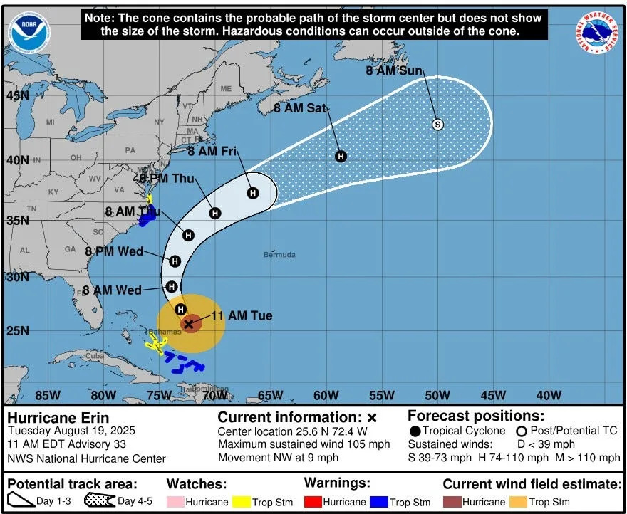
Hurricane Erin's track
As of 8 a.m. Tuesday, Erin was located at 25.2N and 72.2W with maximum sustained winds of 110 mph.
The Category 2 hurricane is moving northwest at 7 mph.
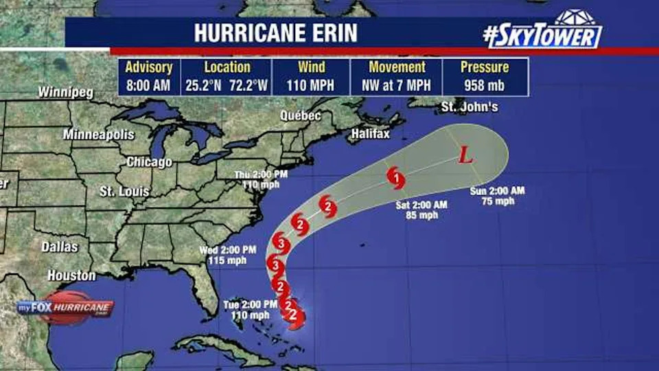
FOX 13 Meteorologist Dave Osterberg says that while Erin has weakened after previously reaching Category 5 strength, its wind field has expanded.
That could bring tropical storm-force wind gusts to the Outer Banks of North Carolina, where tropical storm and storm surge watches are in effect.
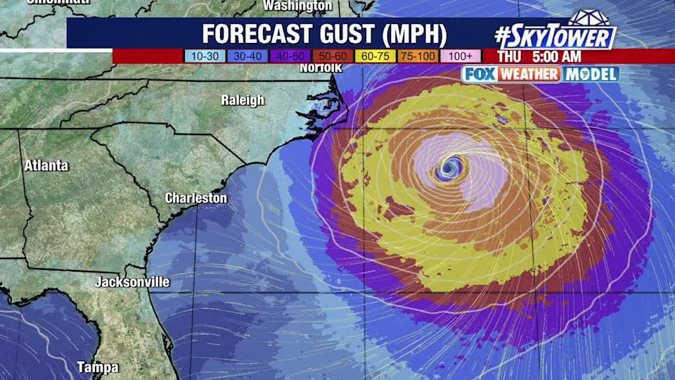
What will likely be the most significant impact for the U.S., however, is life-threatening surf and rip currents up and down the Eastern Seaboard.
"I would tell everybody to stay out of the water," Osterberg said when mentioning the Atlantic coast. "The surfers aren't going to listen, but maybe everybody else will."
Wave heights on the coast of Florida and Georgia could reach 5–10 feet, according to Osterberg, while waves might top 15 feet closer to North Carolina.
More tropical waves in the Atlantic
The NHC is watching a tropical wave over the central Atlantic, giving it a 60% chance of development in the next seven days.
Another wave coming off the coast of Africa has a 30% chance of development in the next week, according to the NHC.

FOX 13 meteorologists say it's still too early to determine the potential track or development of either wave.
The Source
This story was written with information from FOX 13 meteorologists and the National Hurricane Center.


Comments