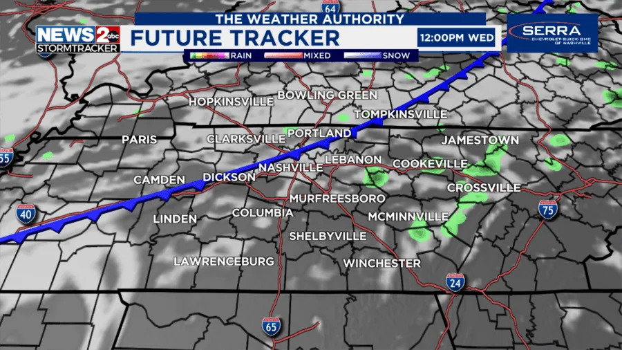
NASHVILLE, Tenn. (WKRN) — The first of two cold fronts move into the Middle Tennessee region on Wednesday. The first front will bring an increased coverage of rain and storms, especially south of Interstate 40. There is a small risk for a strong to severe storm. The result for everyone is lower humidity to end the week!
Nashville on Tuesday
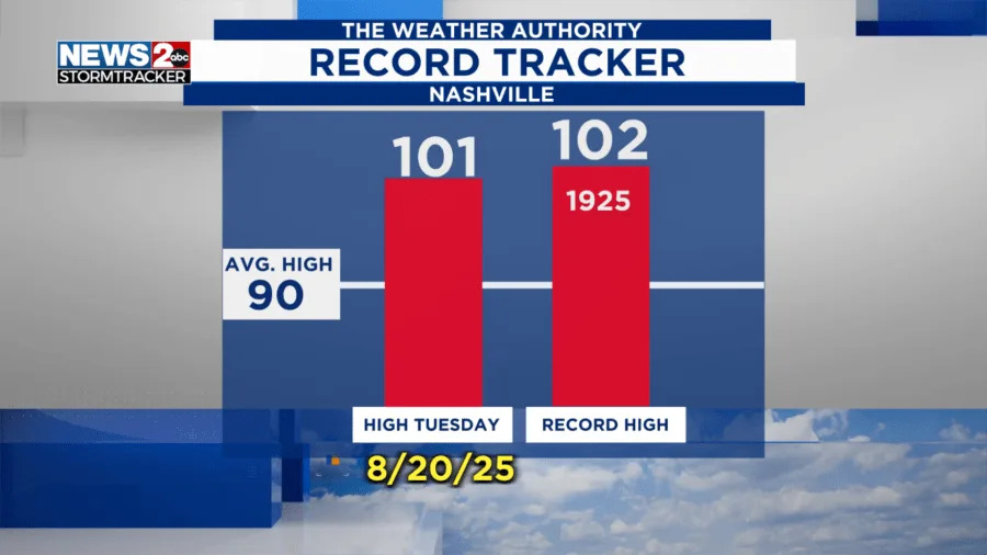
Nashville recorded its first 100-degree day of 2025 on Tuesday, August 19, with a high of 101°. This was one degree off from the record of 102° set back on August 19, 1925.
ALERTS | Weather advisories in Middle Tennessee
Storm chances Wednesday
The Storm Prediction Center has added a Marginal Risk (level 1/5) for the southern counties of Middle Tennessee for an isolated severe storm. A few storms could produce wind gusts and heavy rain with lightning.
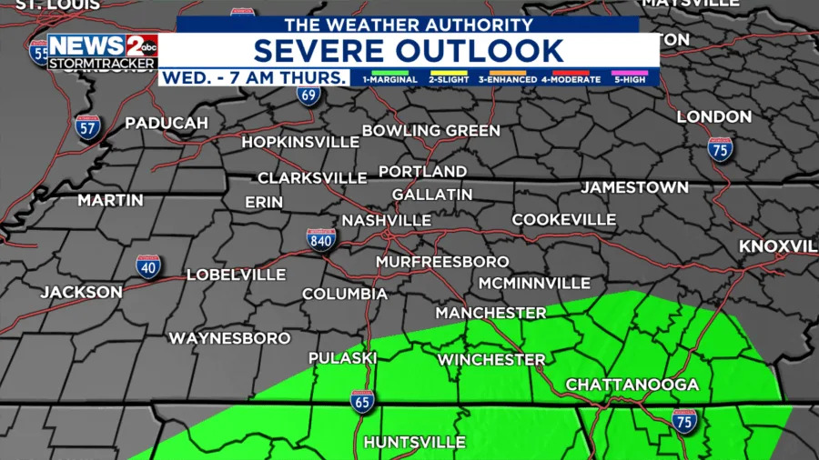
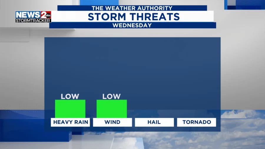
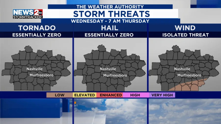
The storms will increase with additional daytime heating on Wednesday afternoon and interacting with a cold front. This front will set help the storms produce the heavy rain and lightning risk with an isolated severe storm capable of wind gusts over 40 mph. Storms end this evening as the loss of daytime heat occurs.
RADAR | Track weather across TN live
 Source: WKRN
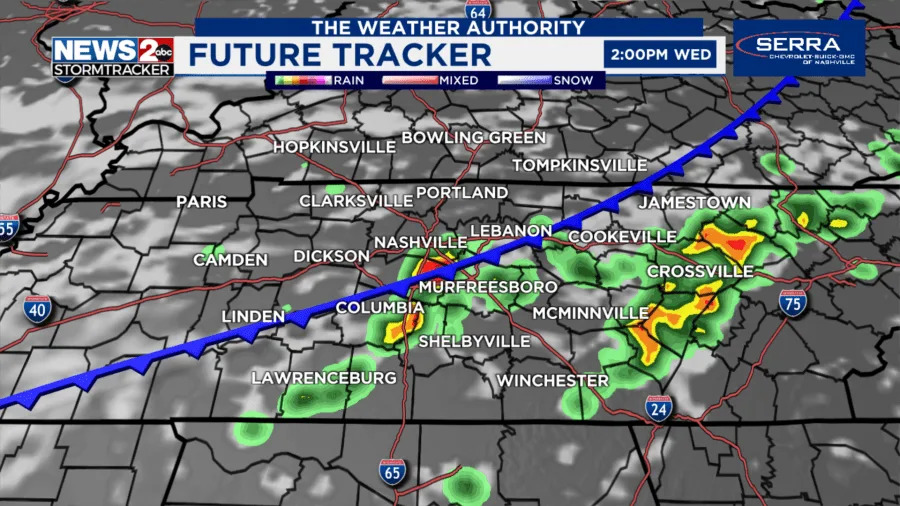 Source: WKRN
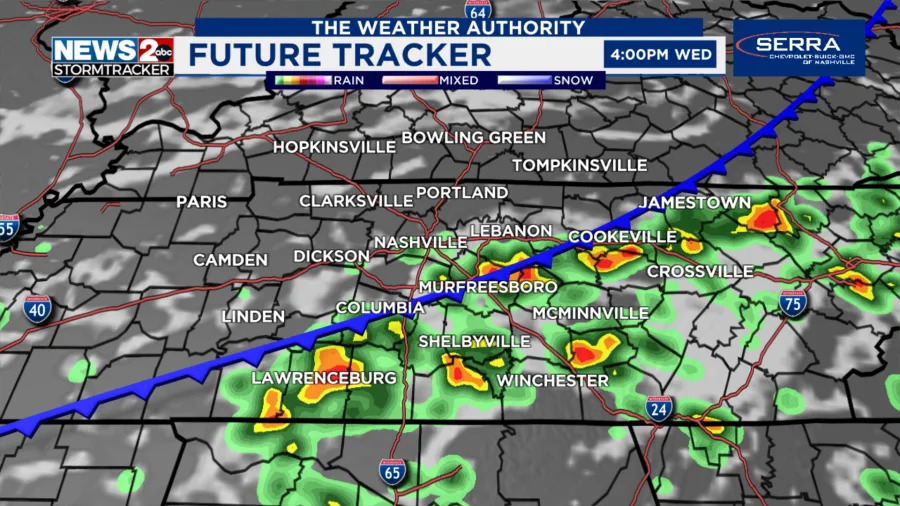 Source: WKRN
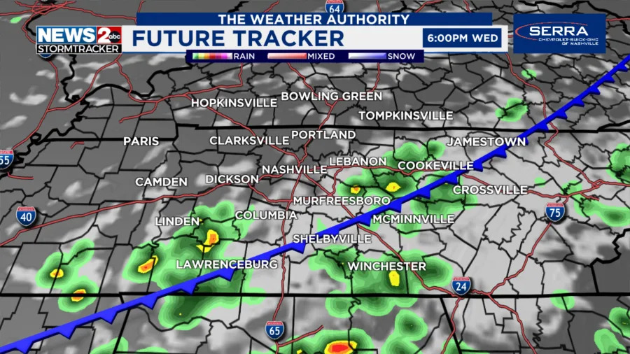 Source: WKRN
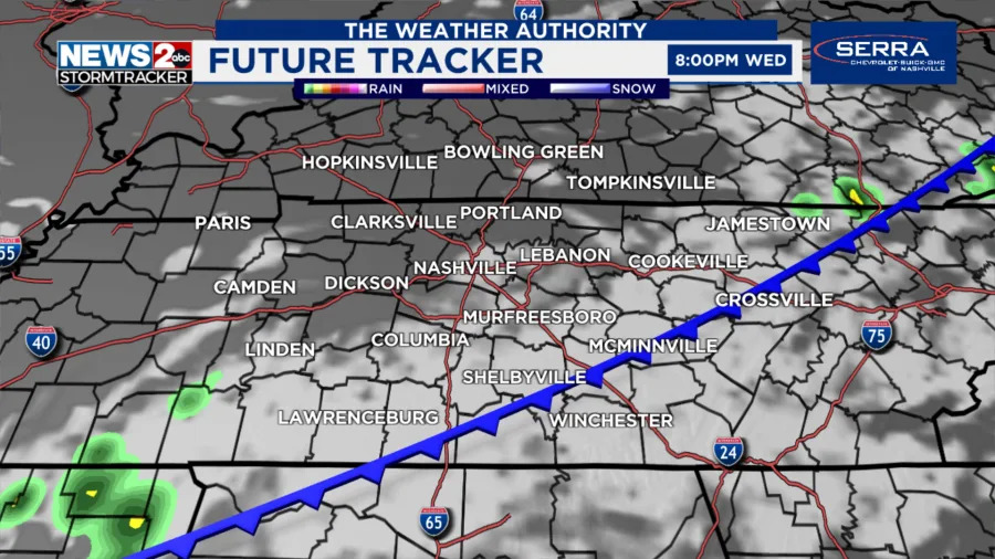 Source: WKRN
A break from the heat is coming!
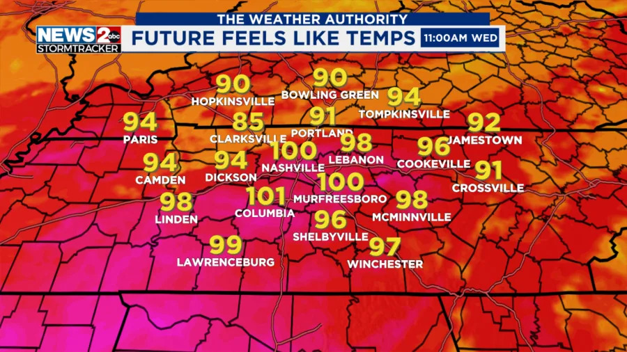
Even though temperatures will be in the 80s to lower 90s, today is still humid. Feels like temperatures around 100° through the late afternoon.
 Source: WKRN
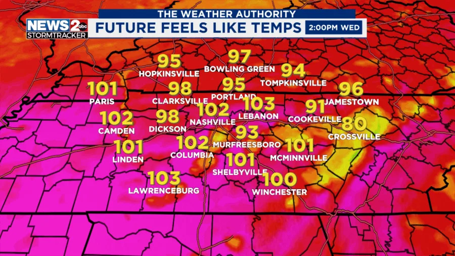 Source: WKRN
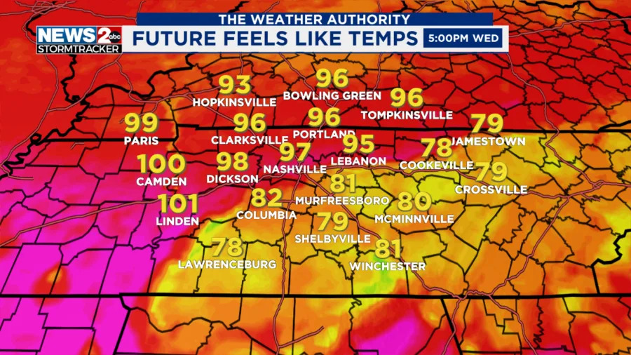 Source: WKRN
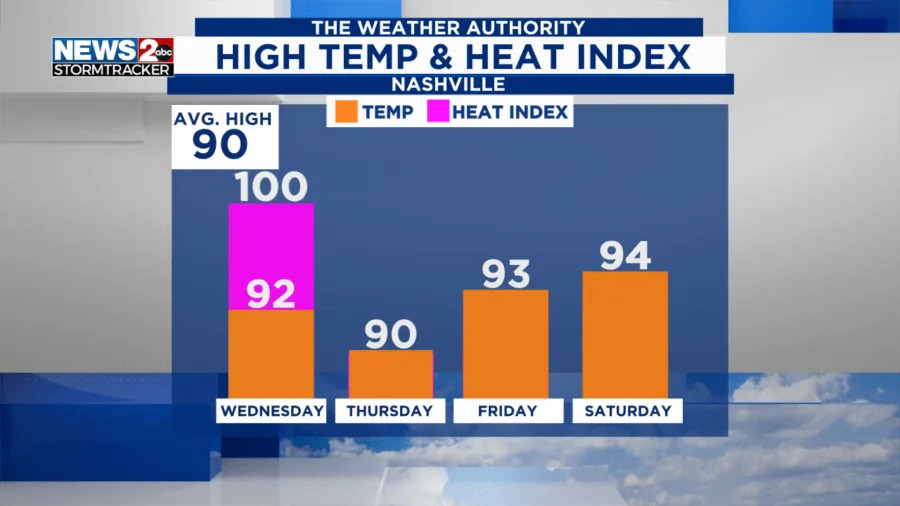
Note that on Thursday through Saturday, despite it remaining warm, feels like temperatures will mainly be at or a few degrees higher than the air temperature. This is a welcomed break from the heat.
FORECAST: Middle Tennessee & Southern Kentucky Weather
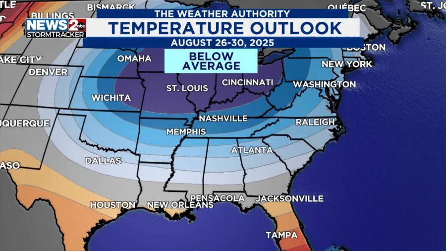
NEXT WEEK: even cooler
Looking toward the end of August, temperatures will likely end below average! Another cold front (stronger than the one from Wednesday) will arrive Sunday into Monday. There are low rain chances this weekend and into next week. But, the focus is where high temperatures will drop into the 80s for the region and lows in the 60s. This will be welcomed relief and bring a taste of fall.
Don’t forget to take the power and reliability of the WKRN Weather Authority with you at all times by downloading the News 2 Storm Tracker app.
Copyright 2025 Nexstar Media, Inc. All rights reserved. This material may not be published, broadcast, rewritten, or redistributed.
For the latest news, weather, sports, and streaming video, head to WKRN News 2.


Comments