Tight on time? This story is for you. It's an abbreviated, text view of what's happening with Hurricane Erin. Click here for more details and to see the latest spaghetti models.
Sign up to get weather alerts via text based on your interests or location.
Will Hurricane Erin hit North Carolina? Is there a hurricane coming to North Carolina?
Hurricane Erin will not make a direct hit on North Carolina.
On the forecast track, the center of Erin is expected to move over the western Atlantic between the U.S. East Coast and Bermuda Wednesday through early Friday, Aug. 20-22, and then pass south of Atlantic Canada Friday and Saturday, Aug. 22-23.
In the advisory, the NHC said Erin "is a large hurricane growing," with hurricane-force winds extending outward up to 90 miles from the center and tropical-storm-force winds extending outward up to 265 miles.
Where is Hurricane Erin right now?
The center of Hurricane Erin was located about 400 miles southeast of Cape Hatteras at 11 a.m. Aug. 20.
➤ Spaghetti models for Hurricane Erin
How strong is Hurricane Erin?
At 11 a.m., Hurricane Erin was a strong Category 2 storm with maximum sustained winds of 110 mph and is expected to strengthen into a Category 3 strong with 120-mph winds by Wednesday night, Aug. 20.
How big is Hurricane Erin?
Erin is a large hurricane. Hurricane-force winds extend outward up to 90 miles from the center and tropical-storm-force winds extend outward up to 265 miles.
What impacts will Hurricane Erin have on North Carolina?
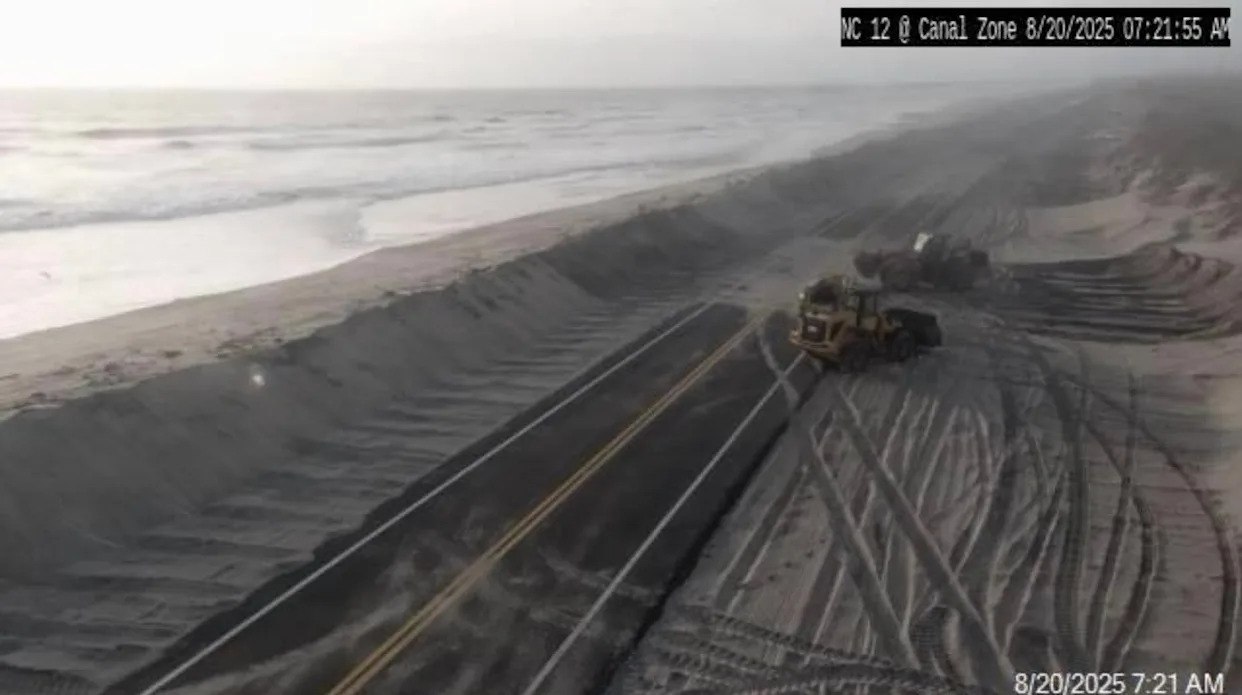
Hurricane Erin is expected to bring large ocean swells and life-threatening rip currents to North Carolina's coast. Coastal flooding, river rise and road washout are also possible.
Waves could reach between 20 to 25 feet high.
Hurricane Erin: North Carolina Outer Banks evacuation routes
Dare County has two primary evacuation routes: U.S. 64 West and U.S. 158 North.
Emergency management officials are urging residents and visitors — particularly those evacuating Hatteras Island, Nags Head, and Roanoke Island — to use U.S. 64 West whenever possible.
See more about evacuation routes on the Dare County website.
North Carolina watches and warnings
Tropical storm watch
Coastal waters from Oregon Inlet to Surf City, North Carolina, including Cape Hatteras, Ocracoke Inlet, Cape Lookout and the Monitor National Marine Sanctuary
Wednesday evening through Thursday afternoon, Aug. 20-21.
High surf advisories
Coastal Pender and Coastal New Hanover counties, North Carolina — 5 a.m. Tuesday, Aug. 19, to 11 p.m. Thursday, Aug. 21
Coastal Brunswick County, North Carolina; Coastal Horry and Coastal Georgetown counties, South Carolina — 5 a.m. Tuesday, Aug. 19, to 11 p.m. Thursday, Aug. 21
West Carteret and Coastal Onslow counties, North Carolina — noon Tuesday, Aug. 19, to 8 p.m. Thursday, Aug. 21
Coastal flood advisory
Lower Cape Fear River, including downtown Wilmington, North Carolina
Until 8 p.m. Monday
Coastal flood watch
West Carteret and Coastal Onslow counties, North Carolina
Tuesday afternoon through Thursday evening, Aug. 19-21.
Do not focus on the cone!
The cone from the National Hurricane Center shows a consensus based on models on where the center of the storm could be over the next several days.
Track forecasts can be off by an average of 60 to 70 miles.
Direct impacts can be felt sometimes hundreds of miles from the center of the storm.
This article originally appeared on Wilmington StarNews: Hurricane Erin in North Carolina. See quick answers to questions


Comments