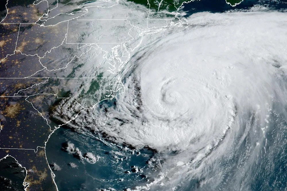
The effects of Hurricane Erin rocked the Outer Banks of North Carolina overnight, battering it with storm surge, flooding and destructive waves, despite it never making landfall.
The unusually large Category 2 storm is expected to bring coastal flooding and tropical storm conditions to parts of the mid-Atlantic on Thursday as it continues to barrel north parallel to the U.S. East Coast.
The National Hurricane Center warned that “life-threatening” surf and rip currents would affect the Bahamas, Bermuda and beaches up and down the East Coast over the next several days. "Beachgoers are cautioned against swimming at most U.S. East Coast beaches due to life-threatening surf and rip currents," the hurricane center said.
Erin formed in the eastern Atlantic Ocean last week, officially reaching hurricane status on Friday. It is the first hurricane of the 2025 Atlantic season.
Follow the live blog below for the latest updates on the storm.
 Dylan Stableford
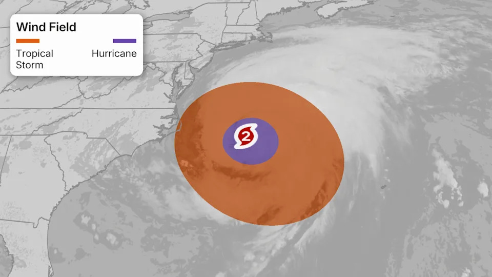
Why Erin is an unusually large hurricane
While it's not expected to make direct landfall, Erin is an unusually large hurricane, forecasters say.
According to the National Hurricane Center, hurricane-force winds extend outward up to 105 miles from its center, and tropical-storm-force winds extend outward up to 320 miles — which is why tropical storm conditions are being felt in North Carolina's Outer Banks and Virginia and expected along portions of the Atlantic Coast through Friday.
- Dylan Stableford
Where is Hurricane Erin now, and what is its path?
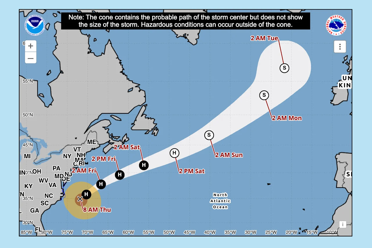 Hurricane Erin's expected path. (National Hurricane Center)
As of 8 a.m. ET Thursday:
Erin was located 210 miles east of Cape Hatteras, N.C., and about 440 miles west-northwest of Bermuda.
The storm has maximum sustained winds of 105 mph, making it a Category 2 storm.
It is moving north-northeast at 17 mph.
According to the National Hurricane Center's latest advisory, Erin is expected to gain speed as it turns toward the east-northeast by Friday.
“On the forecast track, the center of Erin will move over the western Atlantic between the U.S. East Coast and Bermuda through early Friday, and then pass south of Atlantic Canada Friday and Saturday,” the hurricane center said.


Comments