On the heels of a scorching heat wave, Southern California could be in for rainfall, thunderstorms and dangerous surf thanks to weakening Tropical Storm Juliette moving its way north off the coast of Mexico.
The National Weather Service hasn't issued any alerts for hazards from the cyclone, but forecasters are warning that the region could feel its effects as early at Wednesday night.
"For late tonight [Wednesday] and Thursday into Thursday evening, there will be increasing moisture from the remnants of Tropical Storm Juliette with scattered showers spreading ... across portions of southwestern California, along with a slight chance of thunderstorms," San Diego's weather service office forecast.
Some areas could see significant rainfall for this time of year — around a quarter of an inch — particularly along a path from San Diego up to the Coachella Valley, the weather service said. The chance for thunderstorms will be strongest over the Riverside and San Bernardino county mountains, where some patches of heavy rainfall could cause flash flooding.
The bulk of the tropical moisture will stay south and east of Los Angeles County, though showers will be possible, according to the weather service's Oxnard office. However, the incoming system will affect surf conditions, bringing an increased likelihood for dangerous rip currents Thursday and Friday.
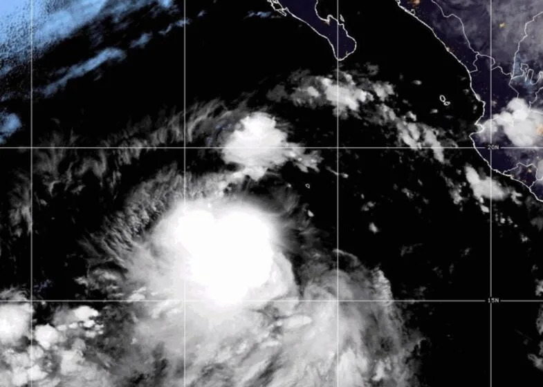
Juliette was expected to dissipate, losing its tropical storm designation by Thursday, according to the National Hurricane Center. Still, forecasters said the system was now coming to the Southland "a little faster and a little farther north" than initial predictions.
As of Tuesday, Tropical Storm Juliette was about 600 miles off the coast of Baja California, with sustained winds hitting up to 50 winds.
This story originally appeared in Los Angeles Times.


Comments