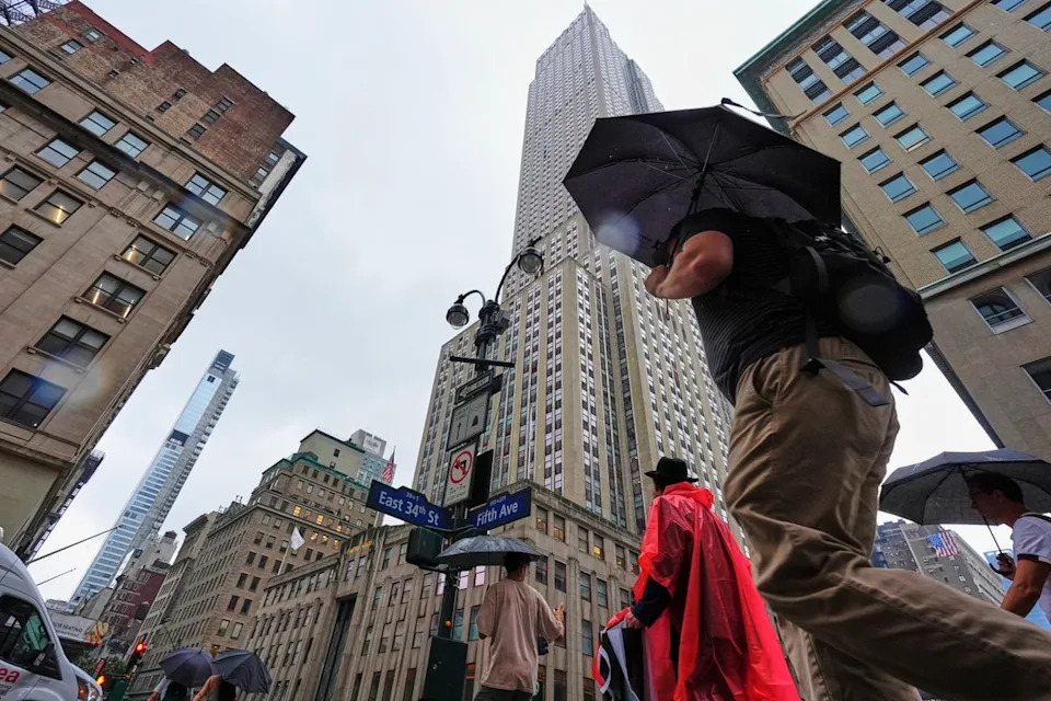
New Yorkers are facing a flash flood threat for the second time in two weeks, as severe thunderstorms and torrential downpours slammed the East Coast.
Some workers in the Big Apple and New Jersey were sent home early Thursday afternoon ahead of the evening commute. The city’s emergency management agency urged people to avoid unnecessary travel, warning that street, basement, and transit flooding were possible. States of emergency were declared in New York and New Jersey as the storms arrived.
"I am urging all New Yorkers to stay vigilant, stay informed, and use caution as we expect excessive rainfall with the potential for flash flooding," New York Governor Kathy Hochul said. "State agencies are on standby for heavy downpours and localized flooding and will be monitoring the situation in real-time to ensure the safety of all New Yorkers in the path of the storm."
Heavy rain and thunderstorms kept travelers grounded in New York and the surrounding areas. Hundreds of flights both in and out of Newark, LaGuardia, and JFK airports were canceled or delayed. JFK and Newark were reporting an average delay of three-and-a-half hours, while LaGuardia had a two-and-a-half-hour delay due to the weather.
The heaviest rain is expected from Thursday afternoon until midnight, forecasters warned.
A flash flood risk is present along a significant portion of the mid-Atlantic region to southern New England, with heavy rains potentially affecting around 43 million people.
Up to five inches of rain is set to drench New York City, with rainfall rates at up to 3 inches an hour, officials said. A flood watch was in place from 2 p.m. Thursday until 8 a.m. Friday.
The National Weather Service also forecast 1.5 to 3 inches of rain for the city through Friday afternoon.
“This storm system could bring intense rainfall rates and amounts in a very short period of time,” New York CEM Commissioner Zach Iscol said.
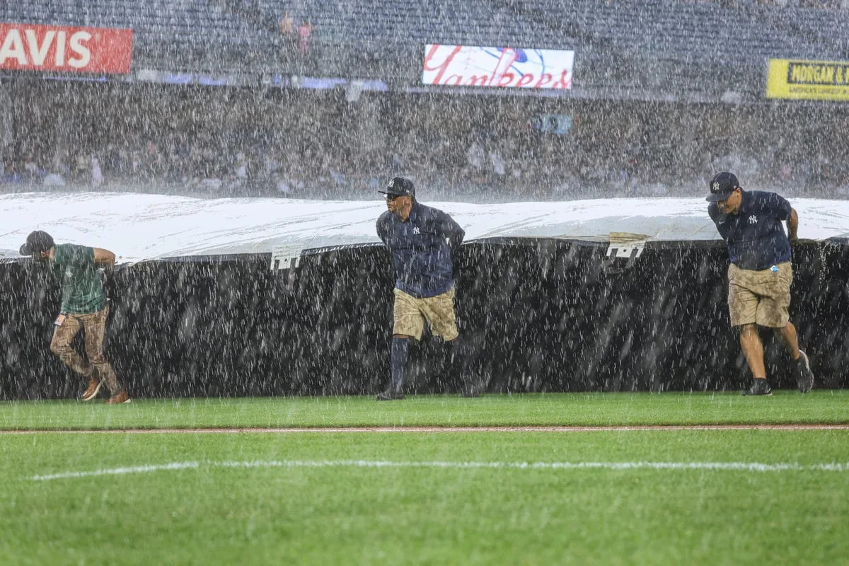
New York City Mayor Eric Adams issued a localized state of emergency for the Big Apple Thursday afternoon as city roads began to be inundated by floodwater.
“I’ve issued a state of emergency,” he said on X just before 5 p.m. E.T. “The Travel Advisory and Flood Watch are in effect until 8 AM. Stay where you are if you can. Don’t drive. Roadways are flooding, and crews are responding. If you live in a basement apartment and haven’t yet moved to higher ground, move now.”
The Long Island Rail Road’s Port Washington branch was suspended due to flooding, as the NYPD said all northbound lanes on the FDR Drive at E Houston Street were also closed.
The southbound lanes of the Cross Island Parkway were blocked at the Throggs Neck Bridge, the NYPD said.
Delays and service changes were also reported for the A, D, E, B, F, and C trains.
Videos shared on social media showed cars submerged in deep water on the Clearview Expressway in Queens. The Clearview Expressway is closed in both directions at Northern Boulevard, the NYPD said.
New Yorkers and residents of neighboring states braced for the worst, as flash flood warnings were issued throughout much of the northeast.
“This rain about to be crazy #nyc,” one X user posted.
Another noted: “It’s that subways are about to be flooded NYC weather.”
“Flash flooding almost every week in Jersey/NY areas is wild. Still don't believe in global warming???” another social media user complained.
The storm comes just over a week after New York and the tri-state area experienced flash flooding that left subway stations teeming with water. The storm left commuters stranded in deep water and sent torrents of water flowing down into subway stations. It also claimed the lives of two people in the Garden State.
Thursday’s flood warnings also come on the tail of intense heatwaves and humidity across the U.S. East Coast. The significant amount of moisture in the atmosphere, when released, has contributed to flash flooding, according to AccuWeather.
Portions of eastern Pennsylvania, eastern Maryland, northern Virginia, and northern Delaware to the lower Hudson Valley area of New York, including Connecticut, parts of Massachusetts, and Rhode Island, are set to be walloped with two to four inches of rain, AccuWeather said.
In addition to flooded subways in the Big Apple, travel disruptions are possible within 100 miles of I-95 moving into Thursday night.
Some areas may be hit with an inch of rain pouring down in a span of 15 to 30 minutes, AccuWeather warned.
Cellphones buzzed north and west of Baltimore as more than two inches of rain fell in some areas within 30 minutes, The Washington Post noted.
A meteorologist with the National Weather Service’s Baltimore/Washington forecast office, Jeremy Geiger, wrote in a message to emergency managers and the press that “Unfortunately, this heavy rain/flood threat is overlapping with the evening rush hour, which may increase the flood threat.”
The office issued a flash flood warning at 4.35 p.m. E.T. saying that the area could face as much as four inches of rain per hours for the next several hours, adding that there’s a “considerable” risk of damage from flash floods.
“In hilly terrain, there are hundreds of low water crossings which are potentially dangerous in heavy rain,” the warning said. “Do not attempt to cross flooded roads. Find an alternate route.”


Comments