Over the last few decades, a world of changes has come to Oklahoma City — and satellite imagery has been witness to much of it.
Oklahoma City's transformation includes a variety of new skyscrapers, sports venues, restaurants, parks, landscaping, revitalized neighborhoods and the tearing down of old buildings and iconic landmarks.
These changes have been possible largely through a series of sales-tax initiatives which set out to improve Oklahoma City's quality of life, as well as development and investments that were spurred on by these additions.
Here's what two to three decades of change looks like in OKC, from both the written and visual perspective.
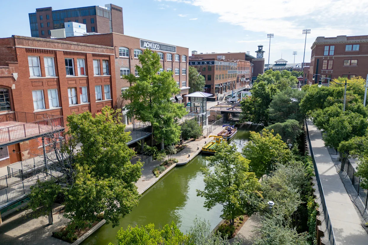
Bricktown rises as an entertainment district
In 1995, the first satellite photo of Bricktown we included, big plans were brewing in the city's old warehouse district, but had yet to take visible shape.
Before statehood, Bricktown began as a designated spot for an Army detachment to keep law and order in the city newly formed after the 1889 Land Run. It then became a bustling commercial district which was home to four major railroad passings, and the iconic red-brick warehouse buildings we associate the area with today.
But after the effects of the Great Depression and World War II, the area was virtually forgotten until developer Neal Horton began purchasing and renovating buildings in 1789. While Horton went bankrupt during the oil bust, his plan set things in motion and was carried out by other developers — Spaghetti Warehouse opened in late 1989, followed by Bricktown Brewery, Abuelo's and Chelino's the next spring.
In 1993, Oklahoma City voters approved the first Metropolitan Area Projects (MAPS), which included the creation of the Bricktown Canal and the Bricktown Ballpark. Both of these projects opened to huge crowds and praise, and helped the district's renaissance chug right along. The third iteration of MAPS included the OKC Streetcar, which consists of a loop through Bricktown.
Related: MAPS is now on it's fourth iteration, here's what Mayor Holt said is ahead for MAPS 4
Today, the area is home to 45 restaurants, bars, and retail shops. As seen from above, some of the most notable additions built along the canal are the Bass Pro Shops, the former Sonic headquarters, the Harkins movie theater, Toby Keith's I Love This Bar & Grill and Charleston's Restaurant.
The water taxi ride down the Bricktown Canal is one of the district's main tourist draws, and other attractions include Brickopolis Entertainment, the American Banjo Museum, the Jim Thorpe Museum the Oklahoma Sports Hall of Fame and the Oklahoma Land Run Monument. A plan to add more historical context to the latter is in the works, with hopes of including the Native American perspective.
Landscape of downtown changes
Around the same time, changes started taking shape in Bricktown, and downtown Oklahoma City was far from left out.
The capital city was initially founded on a bend in the North Canadian River on April 22, 1889, during the Land Run. Flooding and shifts in the river's path caused many to go to higher ground, and by the late 1900s, the dry riverbed became an eyesore for many.
The dry riverbed was an eyesore for decades. But this all changed when, as part of the first MAPS. To accomplish the Oklahoma River's new look, which will be the backdrop for the 2028 Summer Olympics hosted just upstream, three low-water dams and river-lakes were installed on a section of the river.
The landscape of downtown continued to change with the construction of the Paycom Center, soon to be replaced as the home of the Oklahoma City Thunder. Whether you call it Loud City, the Ford Center or Chesapeake Energy Arena, the 2002 project not only changed the physical landscape of downtown but also the energy.
The new arena ushered in developments like the Omni Hotel and at Scissortail Park with MAPS 3, which would go on to alter how the city interacts with that portion of downtown as a whole and solidified its long-envisioned status as a "Big League City."
The downtown sector reached new heights with the completion of the Devon Tower in 2012. The 844-foot skyscraper houses the corporate headquarters for Devon Energy, and the restaurant Vast is housed in the top two levels.
This article originally appeared on Oklahoman: What does 20 years of change in OKC looks like, seen by Google Earth?


Comments