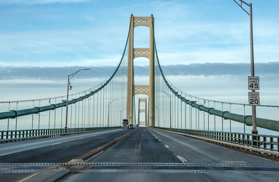
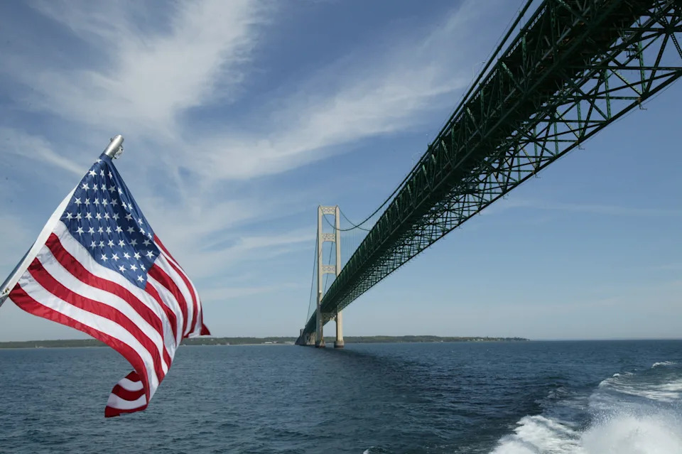
The Mackinac Bridge towers over the Straits of Mackinac, providing the only link between Michigan's Upper Peninsula and Lower Peninsula.
From Mackinaw City in the south to St. Ignace in the north, the bridge spans the meeting point between Lake Michigan and Lake Huron, two of the region's five Great Lakes.
About 3,500 people worked on the bridge as it was constructed across the straits, with another 7,500 contributing at off-site locations, the Bridge Authority says.
Opening in 1957, barely three years after construction began, the Mackinac Bridge was the first long-span suspension bridge to incorporate specific design features, including a porous deck, to manage the forces imposed on it by winds, the American Society of Civil Engineers said.
Since opening, the bridge has seen increasing traffic, and witnessed its 100 millionth crossing in June 1998.
In July 2021, more than 641,000 vehicles crossed the bridge. More than 640,000 vehicles crossed in August 2024. Through May this year, about 1.2 million vehicles had crossed the bridge.
Research indicates the bridge has a significant economic impact for nearby communities and the state as a whole. A study conducted by Michigan-based Public Sector Consultants in 2024 found that for every $1 in tolls paid at the bridge, $7.27 was generated in spending in Michigan. An economic impact of $161.6 million alone was concentrated in the Straits area of Mackinac, Emmet and Cheboygan counties.
Here's what to know about the Mackinac Bridge.
Where is the Mackinac Bridge?
Located in the Straits of Mackinac where Lake Michigan and Lake Huron meet, the Mackinac Bridge links Michigan's Lower Peninsula in Mackinaw City to Michigan's Upper Peninsula in St. Ignace.
The steel, concrete and cable wire structure includes two towers reaching 554 feet high above water and 210 feet down to the lake bedrock, according to Mackinac.com.
More: Looking for a new way to see the Mackinac Bridge? 5 vehicle parades to cross span soon
How long is the Mackinac Bridge?
The suspension bridge runs 5 miles long, the Mackinac Bridge Authority says.
The Mackinac Bridge is currently among the five longest suspension bridges by suspended length worldwide, the Authority said. The main span between the two towers is 3,800 feet long, making it the third-longest suspension bridge by main span length in the U.S. behind the Golden Gate and Verrazano-Narrows bridges, the ASCE said.
The 5-mile bridge (including approaches) was the world's longest suspension bridge between cable anchorages when it opened, the ASCE notes. By stating "between anchorages," the bridge was considered longer than the Golden Gate Bridge, even though the Golden Gate Bridge's main span exceeds that of the Mackinac Bridge. At 8,614 feet, the Mackinac Bridge is still the longest suspension bridge between anchorages in the Western Hemisphere.
How did the idea for the bridge come about?
Proposals to build a structure connecting Michigan's two peninsulas date back decades prior to the bridge's construction and opening, the Mackinac Bridge Authority said. Attempts to enact a bridge faced financial and political setbacks, including delays from wars abroad.
Funds and approval were eventually secured and work on the Mackinac Bridge officially began with ceremonies May 7-8, 1954, according to the Bridge Authority.
American engineer David B. Steinmann designed the bridge, and the 48-month construction cost of $99.8 million, Mackinac.com says.
The design of the bridge was directly influenced by the lessons of the first Tacoma Narrows Bridge, which failed on Nov. 7, 1940, under wind stresses. Steinman published a theoretical analysis of suspension-bridge stability, recommending that future bridge designs include deep trusses to stiffen the bridge deck and an open-grid roadway to reduce its wind resistance.
When did the Mackinac Bridge open?
The Mackinac Bridge opened to vehicular traffic on Nov. 1, 1957, according to the Bridge Authority's website.
How much is the toll to cross the Mackinac Bridge?
Drivers must pay a toll when crossing the Mackinac Bridge.
The toll rate for passenger vehicles is $4 per car or $2 per axle, the Bridge Authority's website says. This includes passenger cars, vans, motorcycles, station wagons, SUVs, pick-up trucks and school buses.
For all other vehicle types the rate is $5 per axle. This includes tractor trailers, buses, motor homes and step or cube vans.
Is there a live feed to the Mackinac Bridge?
The Mackinac Bridge has five bridge cams that update every 1 minute showing conditions on the bridge, per the Mackinac Bridge Authority.
The cameras are stationed at the bridge administration building looking south, the St. Ignace dock looking south, Bridge View Park in St. Ignace looking south, Mackinaw City looking north and on U.S. 2/Interstate 75 in St. Ignace.
Nuts and bolts about the bridge
A few numbers related to the Mackinac Bridge:
Depth of water at mid span: 295 feet
Height of road at mid span: 199 feet
Clearance for ships: 155 feet
Length of wire in cables: 42,000 miles
Wires in each cable: 12,500
Diameter of cables: 24.5 inches
Weight of bridge: 1 million tons
Number of rivets in bridge: 4,851,700
Number of bolts: 1,016,600
Contact Jenna Prestininzi: [email protected].
This article originally appeared on Detroit Free Press: Spanning the Straits: Things to know about Michigan's Mackinac Bridge


Comments