The Brief
A warm and humid stretch of weather is on the way Friday and Saturday.
There's a chance of thunderstorms as well into most of next week.
Wildfire smoke could return on Friday night.
MILWAUKEE - A warm and humid stretch of weather is on the way, and with it comes a chance for thunderstorms. Here's what to expect.
Heat and humidity
Local perspective
As we wrap up the first full week of August, a warm and humid weather pattern will settle in. Air temperatures are expected in the 90s on Friday and again on Saturday.
"It's not the heat, it's the humidity" is a common phrase we hear this time of year. Gulf moisture streaming north, combined with "corn sweat" or evapotranspiration – that is, moisture from the corn crop – are both increasing humidity levels across the Midwest.
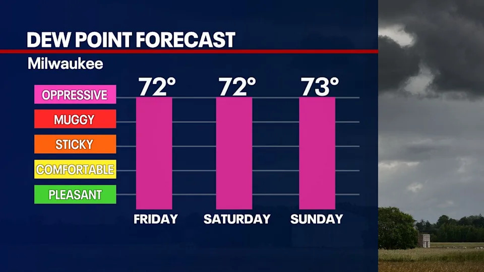
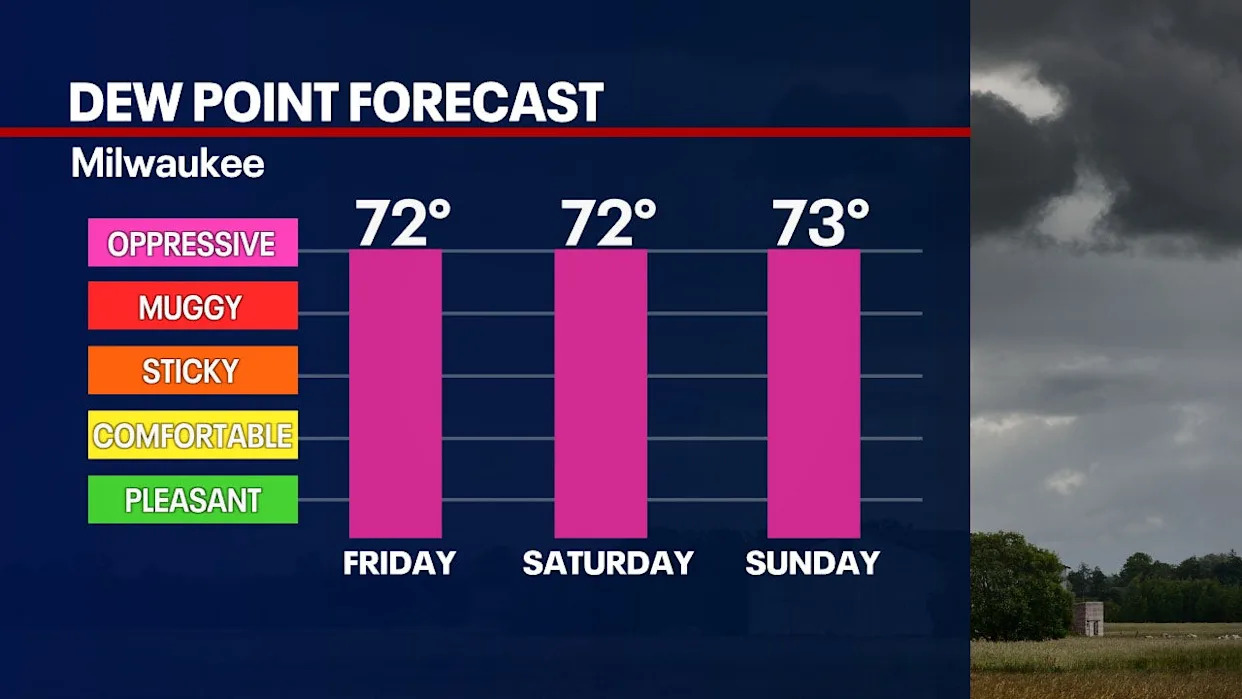
Dew points will remain in the 70s through most of next week. This is important, because not only does the dew point tell us how humid it feels (dew points above 70 feel like the tropics), it also dictates what low temperatures will be at night.
FREE DOWNLOAD: Get breaking news alerts in the FOX LOCAL Mobile app for iOS or Android
The air temperature will never drop below the dew point. When we have a really humid environment like this, it's not only the daytime heat we need to be concerned about, but also the fact that low temperatures will not drop below 70 degrees through next week. Make sure to find a way to keep cool at night as well.
Thunderstorm outlook
Dig deeper
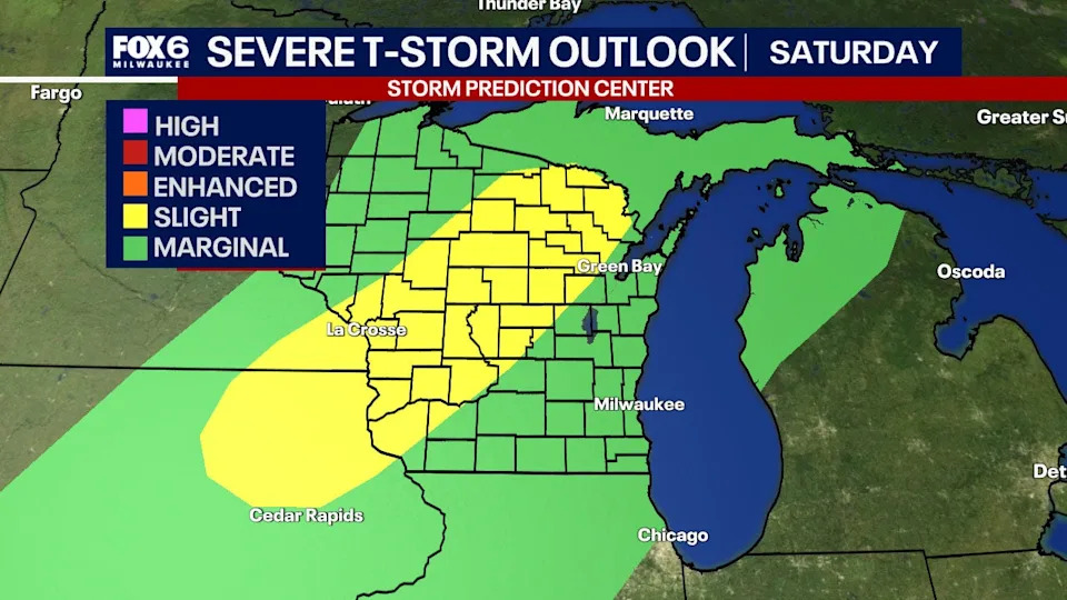
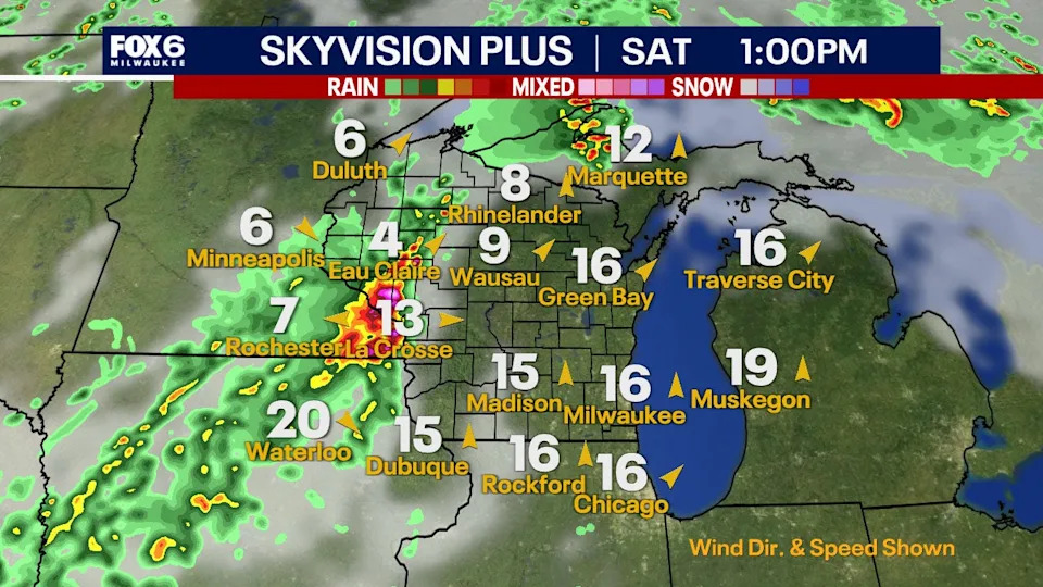
With all of this heat and humidity in place, there will also be several chances for thunderstorms over the next week. As of now, many of these chances are relatively scattered in nature.
However, Saturday night appears to be the best chance in the coming days for widespread storms and possibly a line of strong storms. Strong winds and heavy rain are the main threats should this line develop. The timeframe is after 4-6 p.m. on Saturday, but that could change.
It will be a hot and humid day on Saturday with a chance for thunderstorms at night. This also includes Green Bay, so if you are heading to the Packers pre-season game, make sure to have the FOX LOCAL Mobile App and the FOX6 Storm Center App.
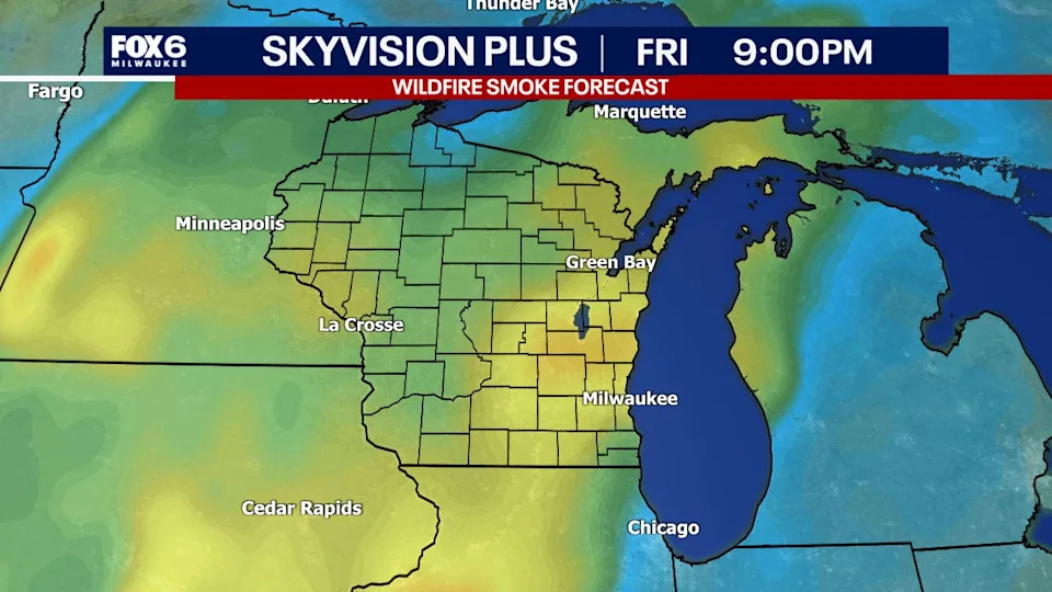
Wildfire Smoke
Local perspective
Wildfire smoke has largely left our skies. However, we could see a little more move in from the west on Friday night and Saturday. As of now, most of this should remain elevated, meaning we will see it but not breathe it in here at the surface.
FOX6 Weather Extras
Local perspective
Meanwhile, FOX6Now.com offers a variety of extremely useful weather tools to help you navigate the stormy season. They include the following:
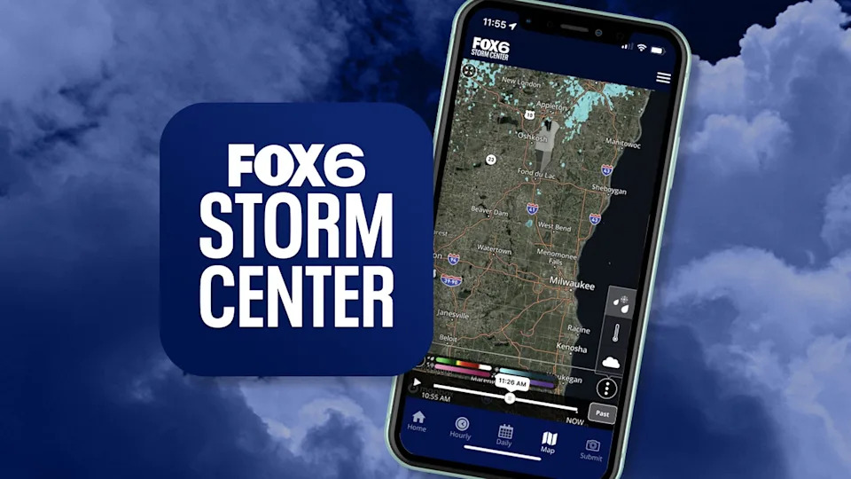
FOX6 Storm Center app
FOX LOCAL Mobile app
FOX Weather app
What is the FOX Model?
FOX Weather
Maps and radar
We have a host of maps and radars on the FOX6 Weather page that are updating regularly — to provide you the most accurate assessment of the weather. From a county-by-county view to the Midwest regional radar and a national view — it’s all there.
School and business closings
When the weather gets a little dicey, schools and businesses may shut down. Monitor the latest list of closings, cancellations, and delays reported in southeast Wisconsin.
FOX6 Weather Experts in social media
CLICK HERE to "Like" the FOX6 Weather Team on Facebook
CLICK HERE to "Like" Rob Haswell on Facebook
CLICK HERE to "Like" Tom Wachs on Facebook
CLICK HERE to "Like" Stephanie Barichello on Facebook
CLICK HERE to "Like" Lisa Michaels on Facebook
CLICK HERE to "Like" Holly Baker on Facebook
CLICK HERE to "Follow" the FOX6 Weather Team on X
CLICK HERE to "Follow" Rob Haswell on X
CLICK HERE to "Follow" Tom Wachs on X
CLICK HERE to "Follow" Stephanie Barichello on X
CLICK HERE to "Follow" Lisa Michaels on X
CLICK HERE to "Follow" Holly Baker on X
The Source
Information in this story is from the FOX6 Weather Experts.


Comments