Minnesota derecho threat: 100 mph winds, widespread damage possible originally appeared on Bring Me The News.
Severe weather is expected to redevelopment in the Dakotas Monday and speed across southern Minnesota — and it could be in the form of a derecho.
What's a derecho? It's a widespread, long-lived wind storm that can produce "destruction similar to the strength of tornadoes," according to NOAA's formal definition. By definition, a derecho's swath of straight-line wind damage spans at least 240 miles.
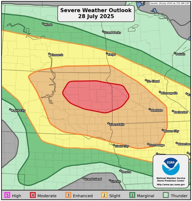
In advance of the dangerous weather, the Storm Prediction Center (SPC) upgraded the threat for severe weather to enhanced and moderate risks in the Dakotas and Minnesota. Not only that, but the SPC says a derecho is "likely," with potential gusts along its path exceeding 75 mph.
Renowned storm chaser and meteorologist Reed Timmer says there is potential for 100 mph wind gusts along the derecho's path.
Fellow meteorologist Matthew Cappucci agrees that 100 mph winds are possible.
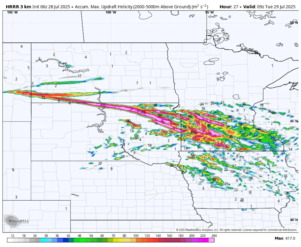
The HRRR model hints at storms erupting in western North Dakota by around lunchtime and then charged rapidly to the east, southeast. In this outcome, storms would enter western Minnesota around 5-6 p.m. and then race towards eastern Minnesota, including the Twin Cities, by 10 p.m.
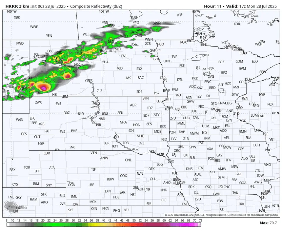
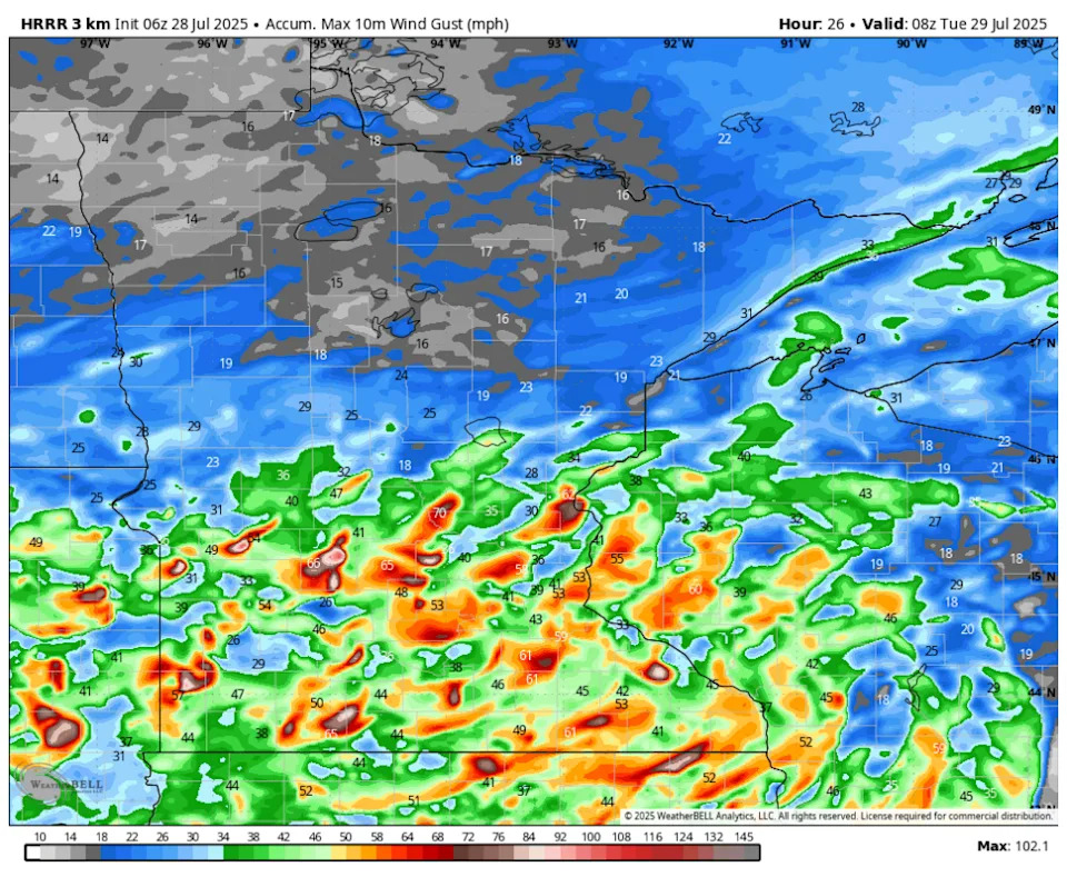
Wind damage would likely be widespread in the HRRR model's outcome, as the model's wind gust swath solution shows potential for gusts to exceed 75 mph all along the line's path across southern Minnesota.
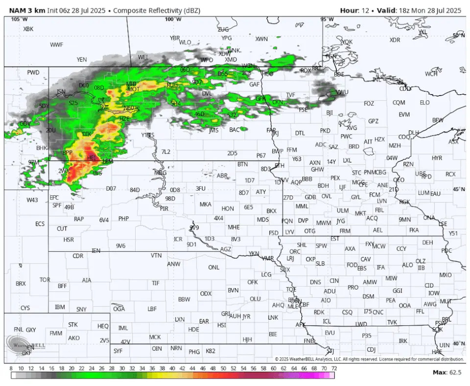
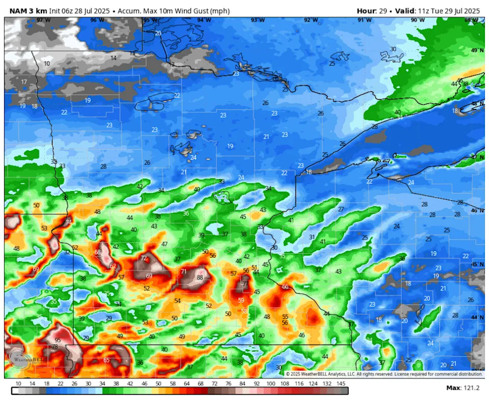
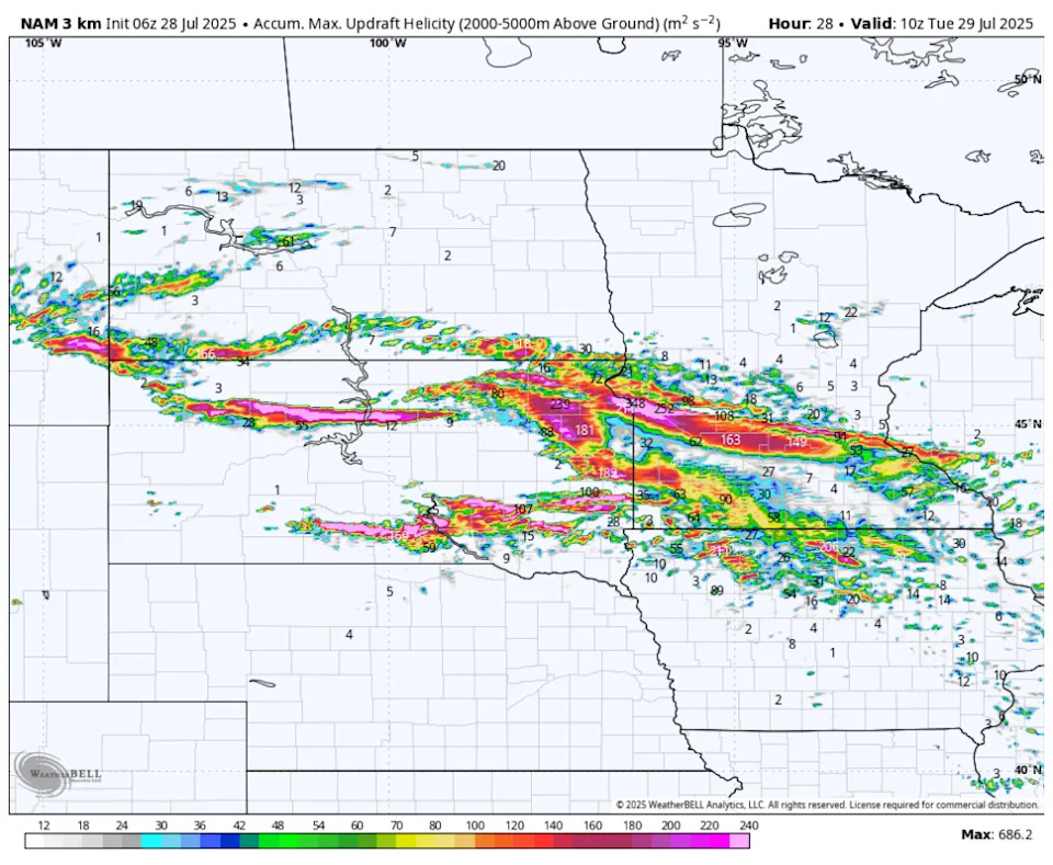
The NAM 3km model has a similar evolution of storm development and track.
The NAM model's wind gust swath projection indicates potential for the derecho to produce 90 mph winds.
The RRFS model also has a similar evolution and track.
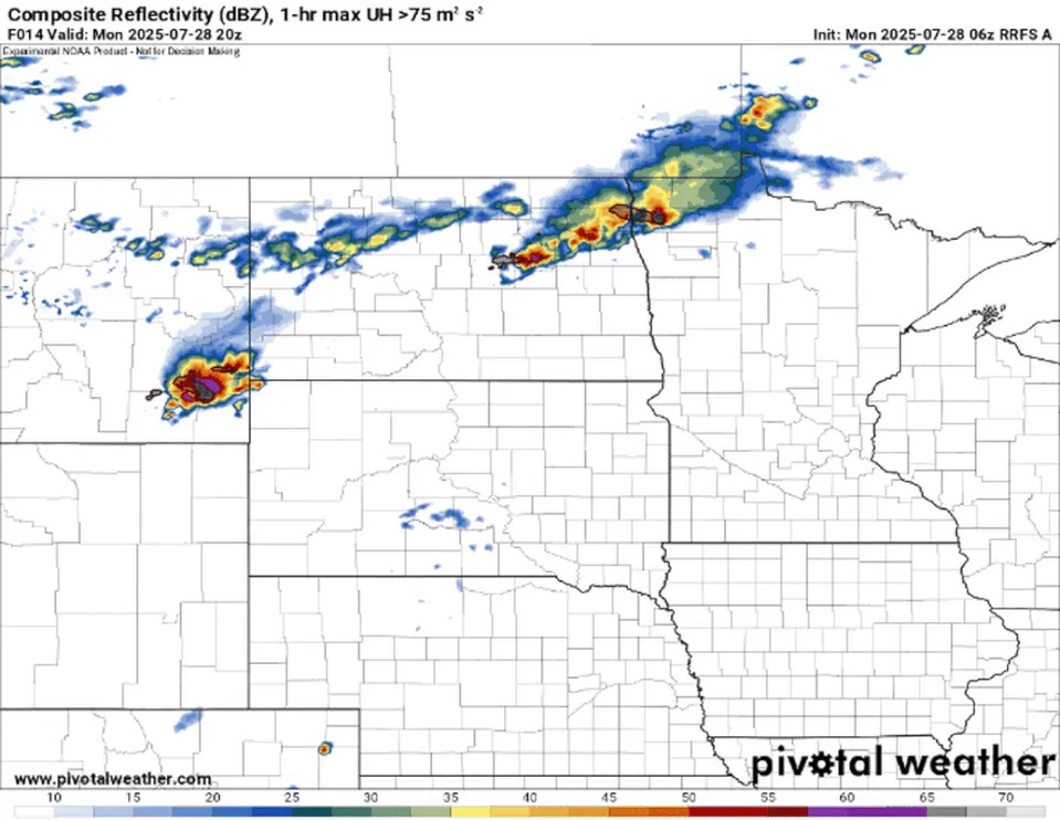
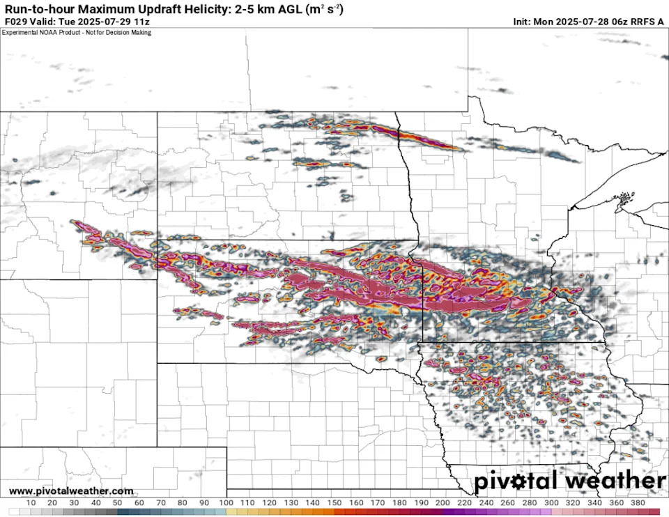
"As storms develop across the Dakotas, they should move eastward pretty quickly and form into a line with bowing segments. Some of the HiRes guidance shows discrete cells with long UH tracks, so tornadoes and hail are also threat, mainly across western Minnesota," says the National Weather Service.
The "UH tracks," otherwise known was updraft helicity tracks, indicate where the strongest updrafts (powerful storms that can rotate) could occur. The HRRR, RRFS and NAM models are all producing significant updraft helicity tracks.
The National Weather Service in the Twin Cities is advising Minnesotans to "monitor the weather closely later today, and be prepared to seek shelter in a sturdy structure if warnings are issued for your location."

This story was originally reported by Bring Me The News on Jul 28, 2025, where it first appeared.


Comments