Tropical Storm Erin has begun to strengthen and is expected to reach major hurricane intensity this weekend as it tracks just north of the Caribbean islands, where it could bring rain, gusty winds and high surf.
Erin's longer-term future through next week is still somewhat uncertain, so interests across the Caribbean, the U.S. East Coast and Bermuda should continue to monitor the forecast.
(MORE: Erin Maps Tracker - Spaghetti Models, Forecasts, More)
Path, Intensity Forecast
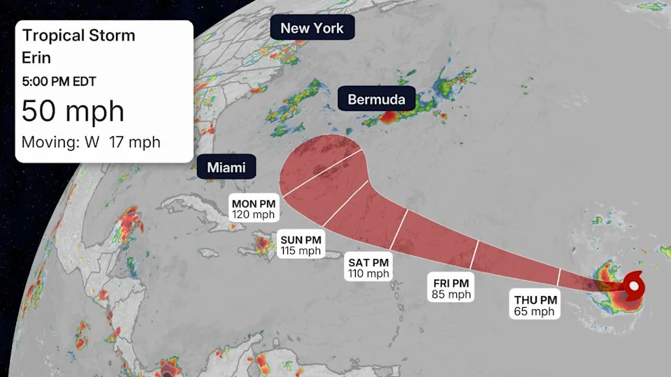
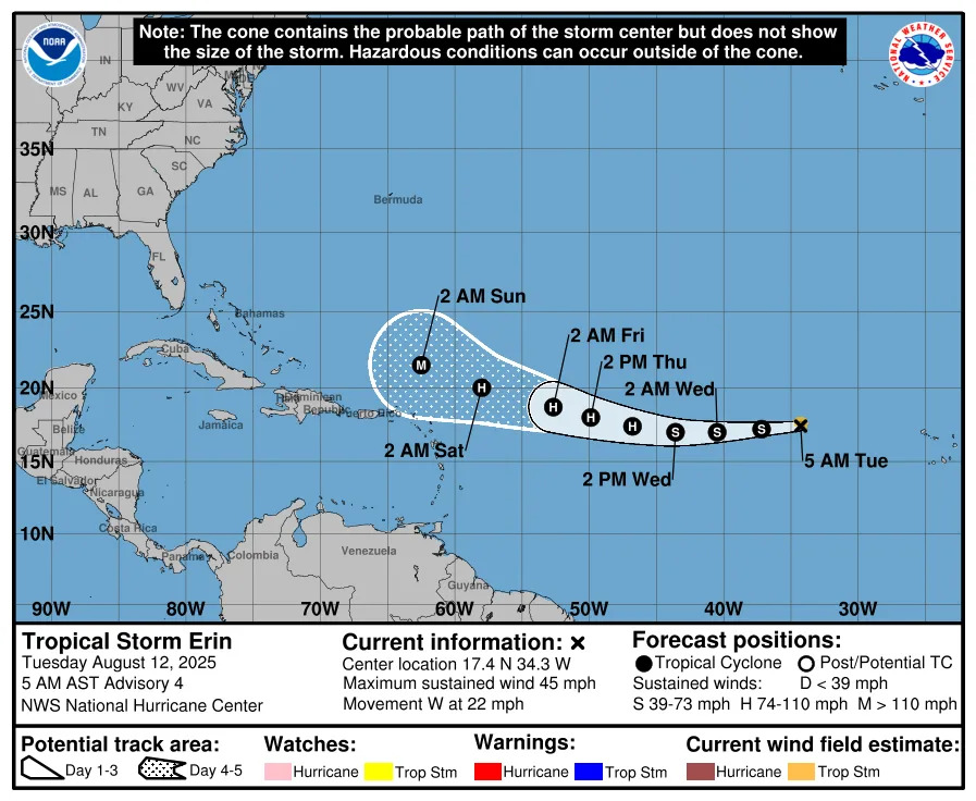
Tropical Storm Erin is located more than 1000 miles east of the northern Leeward Islands.
Erin is forecast to track westward with a slow bend to the west-northwest later this week. A westward trend in computer model guidance continues to result in a forecast track that is shifting in that direction this weekend and into next week.
This path will take Erin toward progressively warmer waters, which, in tandem with low wind shear, should allow the storm to become a hurricane by Thursday night or Friday.
Erin could reach Category 3 strength later this weekend as it makes a close brush, or travels just north of the Caribbean islands.
Potential Impacts
-Caribbean: Even if the core of Erin passes north of the northeast Caribbean islands, it could still deliver some impacts.
In addition to high surf and dangerous rip currents, bands of heavy rain containing gusty winds could impact the northern Leeward Islands Friday night into this weekend. That includes the Virgin Islands and Puerto Rico.
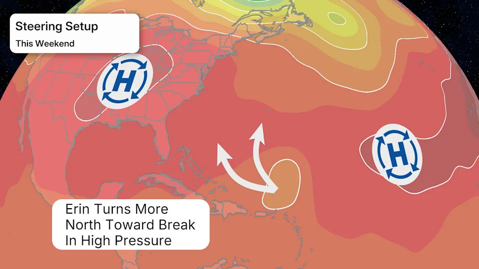
-Bermuda, U.S. East Coast: This weekend into early next week is when this system will begin to turn more to the north between a developing break in high pressure. Where that turn occurs between the area of high pressure over the eastern U.S. and another one east of Bermuda is still uncertain and will determine what, if any, land areas might see impacts next week.
The probability of a landfall from Erin along the U.S. East Coast is low at this time. However, interests along the East Coast should continue to monitor this system for possible changes. Erin will generate high surf and dangerous rip currents along the U.S. East Coast next week, no matter where it tracks.
Bermuda should also continue to follow Erin's forecast closely since its eventual turn toward the north and northeast might take it close to the archipelago next week.
Check back to weather.com and The Weather Channel app in the coming days for updates as the forecast comes more into focus.
Jennifer Gray is a weather and climate writer for weather.com. She has been covering some of the world's biggest weather and climate stories for the last two decades.


Comments