Storms could go severe in southern Minnesota Friday; more rounds through the weekend originally appeared on Bring Me The News.
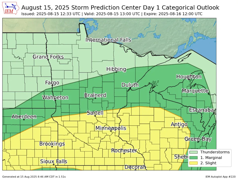
What's going to happen with storm evolution in Minnesota on Friday? While the models are a bit of a mess, NOAA's Storm Prediction Center expects morning storms in South Dakota and Nebraska to stay alive long enough that they'll have a chance to intensify as they track across southern Minnesota during the afternoon.
"A cluster of intense thunderstorms has tracked across central/eastern SD overnight producing occasional wind damage. Another small cluster of storms is over northeast NE. Both of these areas of convection are moving into a moist and potentially moderately unstable air mass, although they may take a few hours of heating to intensify further," the SPC said in its 7:30 a.m. update.
"Despite short-term uncertainty, a consensus of overnight [Convective-Allowing Models] depicts storms intensifying by early afternoon and tracking eastward across parts of MN, northeast IA, and western WI. Locally damaging wind gusts and hail will be possible."
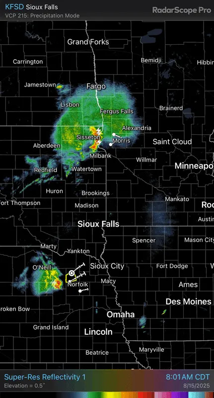
As of 8:50 a.m., there isn't much to speak of in terms of storm coverage in South Dakota and Nebraska. In fact, some rain has entered western Minnesota and there's a lone thunderstorm in northeast Nebraska, but it's quiet outside of those two areas.
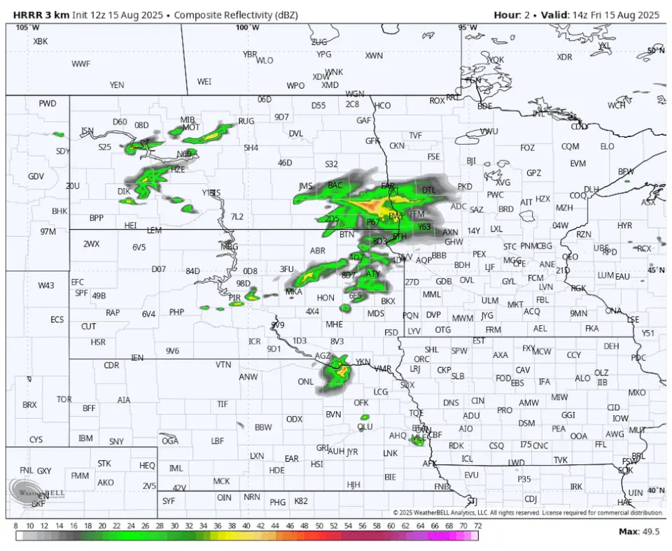
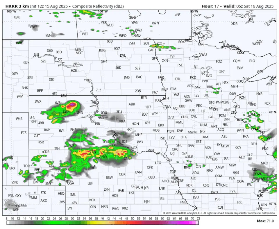
The HRRR model had a pretty good read on what was happening around 9 a.m., and its showing the lone cell in Nebraska intensifying during the early afternoon over northern Iowa, followed by some spotty storms developing in southern Minnesota.
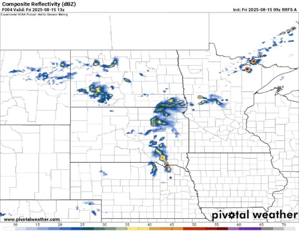
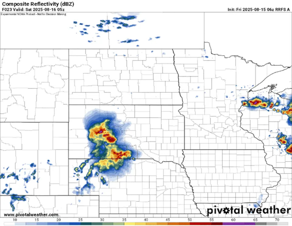
The RRFS model has a similar evolution, showing that one cell in Nebraska intensifying as it tracks somewhere near the Minnesota-Iowa border.
What's going to happen late Friday night into the weekend?
"Recent HRRR/RRFS runs suggest an upscale-organizing MCS could occur after midnight, tracking into western MN," the SPC says.
Here's the HRRR model from midnight to noon Saturday.
Here's the RRFS from around midnight until early afternoon Saturday.
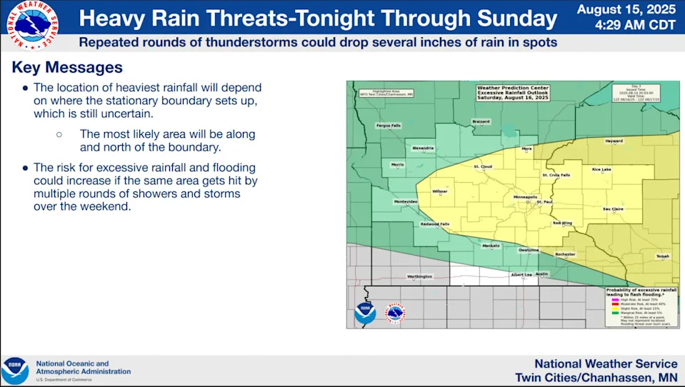
Multiple rounds of storms with heavy rain has prompted the Weather Prediction Center (WPC) to place eastern Minnesota and a big chunk of Wisconsin in a slight risk for excessive rainfall, which could lead to flash flooding through the weekend.
This story was originally reported by Bring Me The News on Aug 15, 2025, where it first appeared.


Comments