Hurricane Erin isn’t the only severe weather business happening in the Atlantic Ocean. The National Hurricane Center is also watching two disturbances.
READ MORE: Hurricane Erin weakens to a Category 3. See who’s in the projected path
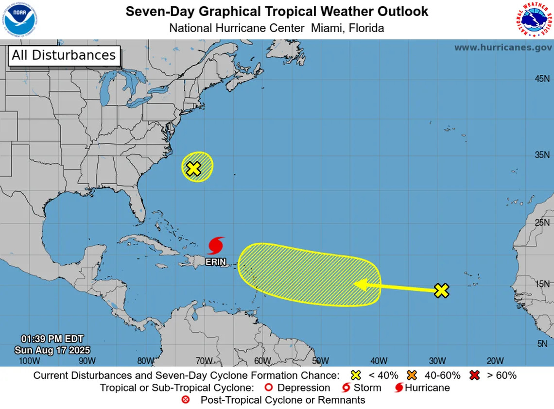
Disturbance No. 1
This “broad area of low pressure” is hanging out a couple of hundred miles off the North Carolina coast.
“...Development, if any, of this system should be slow to occur during the next day or so, while it drifts generally eastward,” the hurricane center said. “The opportunity for development should end on Monday, when environmental upper-level winds are expected to become unfavorable.”
Formation chance before Tuesday: 10%
Formation chance in the next seven days: 10%.
Disturbance No. 2
This tropical wave near the Cabo Verde Islands is far from the reaches of Florida, and it is still too early to tell where it will go.
“Some gradual development of this system is possible during the middle to latter portion of the week while the system moves westward to west-northwestward at 15 to 20 mph across the eastern and central tropical Atlantic,” the hurricane center said.
Formation chance before Tuesday: almost none.
Formation chance in the next seven days: 30%.


Comments