
PIEDMONT TRIAD, N.C. (WGHP) — It’s a cloudy start to the day, and we will continue to have persistent clouds around even through the lunch hour. Later this afternoon, skies will become partly cloudy and highs will hit the mid-80s.
We will start the evening with partly cloudy skies, but clouds are expected to build up overnight. Lows will hover near 70 degrees.

Temperatures are going to stay in the mid-80s on Wednesday and Thursday under partly cloudy skies. By Friday, a cold front will have dropped to our south, which will put us in a cooler air mass for the weekend.
Highs Friday through Sunday are going to be near 80 degrees and while there is only a 20% chance of rain Friday and Saturday, another cold front will approach the Piedmont on Sunday, bringing a 30% chance of afternoon thunderstorms back to the forecast.
Monday will be beautiful, with mostly sunny skies and highs in the mid-80s.
*********************************
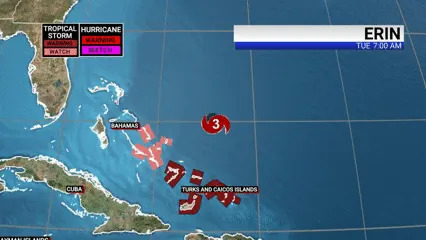
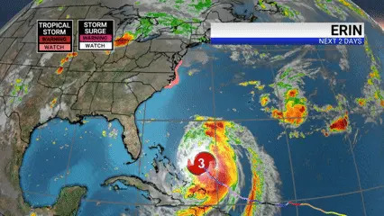
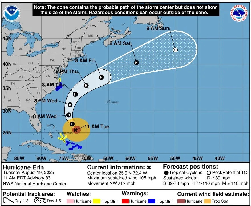
Hurricane Erin has lost ground in both structure and intensity over the past 24 hours. It remains a dangerous, Category 3 hurricane, however, and will be threatening the North Carolina coast with tropical storm force winds, storm surge, dangerous surf, and rip currents Wednesday night through Thursday.
Copyright 2025 Nexstar Media, Inc. All rights reserved. This material may not be published, broadcast, rewritten, or redistributed.
For the latest news, weather, sports, and streaming video, head to FOX8 WGHP.


Comments