Here are the latest updates on Hurricane Erin from the National Hurricane Center.
Erin is considered a Category 2 storm based on its sustained wind speeds.
Weather alerts via text: Sign up to get updates about current storms and weather events by location
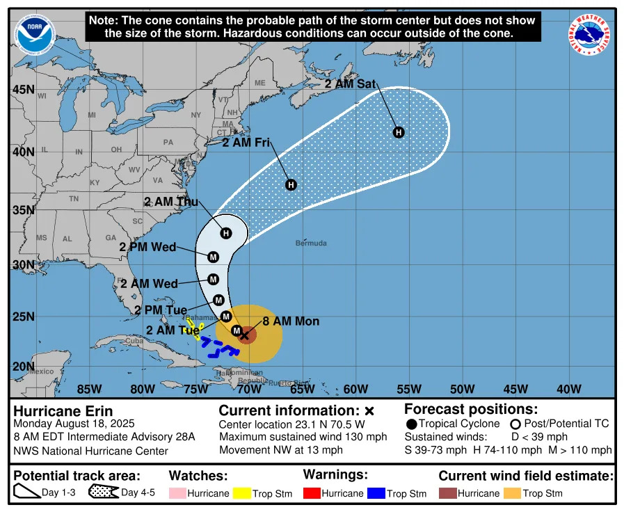
Hurricane Erin located 445 miles northeast of Stuart, Florida
Special note on the NHC cone: The forecast track shows the most likely path of the center of the storm. It does not illustrate the full width of the storm or its impacts, and the center of the storm is likely to travel outside the cone up to 33% of the time.
Location: 30.1N, 73.7W
445 miles northeast of Stuart
Maximum sustained winds: 110 mph
Present movement: North at 13 mph
Minimum central pressure: 941 millibars
Latest advisory from National Hurricane Center on Hurricane Erin
At 11 a.m. ET, the eye of Hurricane Erin was located near latitude 30.1 North, longitude 73.7 West.
Erin is moving toward the north near 13 mph. A turn toward the north-northeast is expected later today and tonight, followed by a faster motion toward the northeast and east-northeast by Thursday and Friday.
On the forecast track, the center of Erin will move over the western Atlantic between the U.S. east coast and Bermuda today through early Friday, and then pass south of Atlantic Canada Friday and Saturday.
Maximum sustained winds have increased to near 110 mph, with higher gusts.
Some additional strengthening is likely during the next day or so, and Erin could become a major hurricane again by tonight.
Weakening is likely to begin by Friday, but Erin is forecast to remain a hurricane into the weekend.
Erin is a large hurricane. Hurricane-force winds extend outward up to 90 miles from the center and tropical-storm-force winds extend outward up to 265 miles.
Expected impacts from Hurricane Erin
The advisory warns of the following dangers: WIND: Tropical storm conditions are expected over portions of the North Carolina Outer Banks and the Virginia coastline beginning late today. Elsewhere along the mid-Atlantic and southern New England coast, wind gusts to tropical storm force are likely Thursday through early Friday. Tropical storm conditions are possible on Bermuda Thursday and Friday. SURF: Swells generated by Erin will affect the Bahamas, Bermuda, the east coast of the United States, and Atlantic Canada during the next several days. These rough ocean conditions are expected to cause life-threatening surf and rip currents. Please consult products from your local weather forecast office for more information. A depiction of rip current risk for the United States can be found at: hurricanes.gov/graphics_at5.shtml?ripCurrents STORM SURGE: The combination of a dangerous storm surge and the tide will cause normally dry areas near the coast to be flooded by rising waters moving inland from the shoreline. The water could reach the following heights above ground somewhere in the indicated areas if the peak surge occurs at the time of high tide, Cape Lookout to Duck, North Carolina, 2 To 4 ft The deepest water will occur along the immediate coast where the surge will be accompanied by large and dangerous waves. Surge-related flooding depends on the relative timing of the surge and the tidal cycle, and can vary greatly over short distances. For information specific to your area, please see products issued by your local National Weather Service forecast office. For a complete depiction of areas at risk of storm surge inundation, please see the National Weather Service Peak Storm Surge Graphic, available at hurricanes.gov/graphics_at5.shtml?peakSurge. RAINFALL: The outer bands of Erin may bring 1 to 2 inches of rainfall to the Outer Banks of North Carolina this afternoon into Thursday. For a complete depiction of forecast rainfall and flash flooding associated with Erin, please see the National Weather Service Storm Total Rainfall Graphic, available at hurricanes.gov/graphics_at5.shtml?rainqpf
Hurricane Erin spaghetti models
Special note about spaghetti models: Illustrations include an array of forecast tools and models, and not all are created equal. The hurricane center uses only the top four or five highest performing models to help make its forecasts.
Hurricane Erin: See projected path, storm tracker
Watches, warnings issued for Hurricane Erin
A storm surge warning is in effect for:
Cape Lookout to Duck, North Carolina
A tropical storm warning is in effect for:
Beaufort Inlet, North Carolina to Chincoteague, Virginia, including Pamlico and Albemarle sounds.
A tropical storm watch is in effect for:
Bermuda
A storm surge warning means there is a danger of life-threatening inundation, from rising water moving inland from the coastline, during the next 36 hours in the indicated locations.
A tropical storm warning means tropical storm conditions are expected somewhere within the warning area, in this case within the next 24 hours.
Watches and warnings issued for Florida
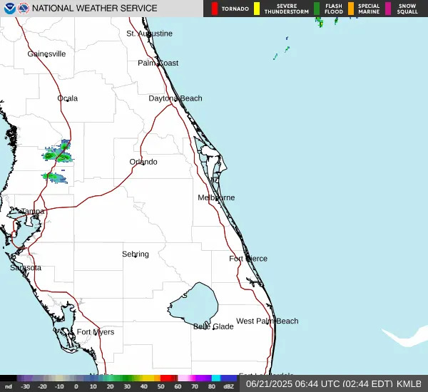
NWS radar for Treasure Coast on Florida east coast
Helpful hurricane resources and links
Need to prepare for a hurricane? Here's what you should have in a disaster supply kit
Hurricanes, typhoons, and cyclones: What's an invest and why do they keep saying tropical cyclone?
Officials encourage residents to assemble a hurricane kit early, storing enough supplies to last at least three days. Doing so ensures there are adequate supplies available on store shelves and prevents a rush and shortages that regularly occur when a storm is imminent.
Stay informed. Get weather alerts via text
What's next?
We will update our tropical weather coverage daily.
Download your local site's app to ensure you're always connected to the news. And look for our special subscription offers here.
This article originally appeared on Treasure Coast Newspapers: Hurricane Erin: Follow the storm, possible impacts in Stuart


Comments