The Brief
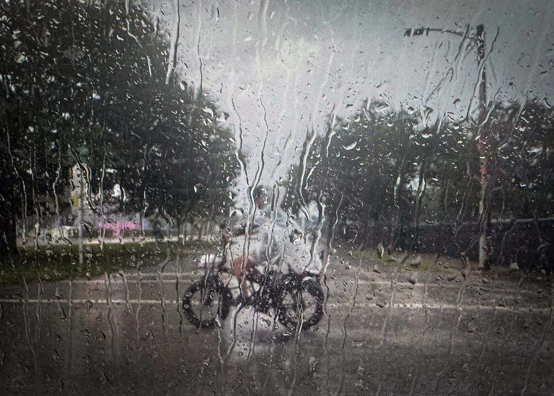
After a somewhat unsettled Saturday, we look to end the weekend in a similar fashion. We have an 80% chance of afternoon storms.
An area of upstairs energy in the atmosphere slides our way and, with a stalled front draped across the region, we hold onto the threat of widespread rain.
Storms will again be capable of producing torrential rain and lightning as well as brief gusty winds.
ORLANDO, Fla. - We're expecting numerous scattered showers and thunderstorms across Orlando and Central Florida on Sunday. These showers and thunderstorms are expected to develop early and then push east towards the Atlantic Coast.
Rain chances are high: 70-90% coverage.
Highs should stay in the mid 80s and 90s due to the higher rain chances and cloud cover. Expect frequent lightning, windy conditions, and locally heavy rainfall.
Orlando Weather Forecast Today
What will the weather look like tonight?
An area of upstairs energy in the atmosphere slides our way and, with a stalled front draped across the region, we hold onto the threat of widespread rain.
Highs look to top out in the upper 80s and lower 90s, and humidity will keep it feeling steamy.
Storms will again be capable of producing torrential rain and lightning as well as brief gusty winds.
What will the weather be like tomorrow?
The unsettled weather pattern continues into early next week as the weak front remains parked over the region. We'll also have a bit of upper-level energy that should aid in getting hit-or-miss storms going. Highs look to top out around 90° with the humidity making it feel more like the upper 90s to around 100°.
What will the weather look like next week?
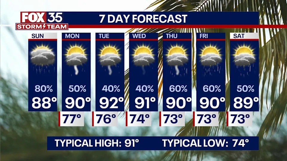
Daily afternoon storms are likely, with highs in the low 90s and heat index values in the low 100s. Rain chances look to dip slightly as this front attempts to shift to the SE as another front works in from the NW.
This one drops our temps just a touch with highs topping out near 90° midweek.
Rain chances fall to near 40% before popping back up to end the workweek. We get into more of an onshore flow which will help get us back to our more typical sea-breeze set-up.
Afternoon storms look to develop with the help of the sea breeze collision. Highs are seasonable for this time of the year, topping out at around 90° through the latter half of the workweek.
TROPICAL UPDATE: Tropical Storm Fernand has formed, and it's expected to remain at tropical storm status as we progress through the first half of next week.
It could get close to hurricane strength, but with the cooler water, it should limit its strength. Thankfully, this system will remain a fish storm as it works off to the NNE.
Aside from some higher rip current risks along the Eastern Seaboard, it shouldn't bring any impacts to the U.S. Another wave in the Southern Atlantic now has a 40% chance of development over the next week.
This one will need to be monitored as well as it looks to work closer to the Caribbean into the first half of next week. This wave has been designated Invest 99-L.
The Source
This story was written based off information shared by the FOX 35 Storm Team on Aug. 24, 2025.


Comments