The Brief
Afternoon temperatures will reach the low to mid-90s, but the heat index could feel closer to 100 degrees due to high humidity.
There is a slight chance of isolated showers and storms west of I-35W and north of I-30 this afternoon.
A second round of storms is expected late tonight, primarily west of I-35, with a Level 2 "slight risk" for severe weather due to potential gusty winds.
DALLAS - North Texas residents are starting the day under a muggy blanket of air, with temperatures similar to Sunday morning's, hovering in the mid- to upper-70s.
Sunday Forecast
What we know
A few spots in outlying areas and along the Red River are slightly cooler, dipping into the low 70s and even upper 60s in some western and southwestern locations.
As the day progresses, afternoon high temperatures are expected to reach the low to mid-90s. With dew points remaining in the low 70s, the heat index could climb into the upper 90s, making it feel even hotter outside.
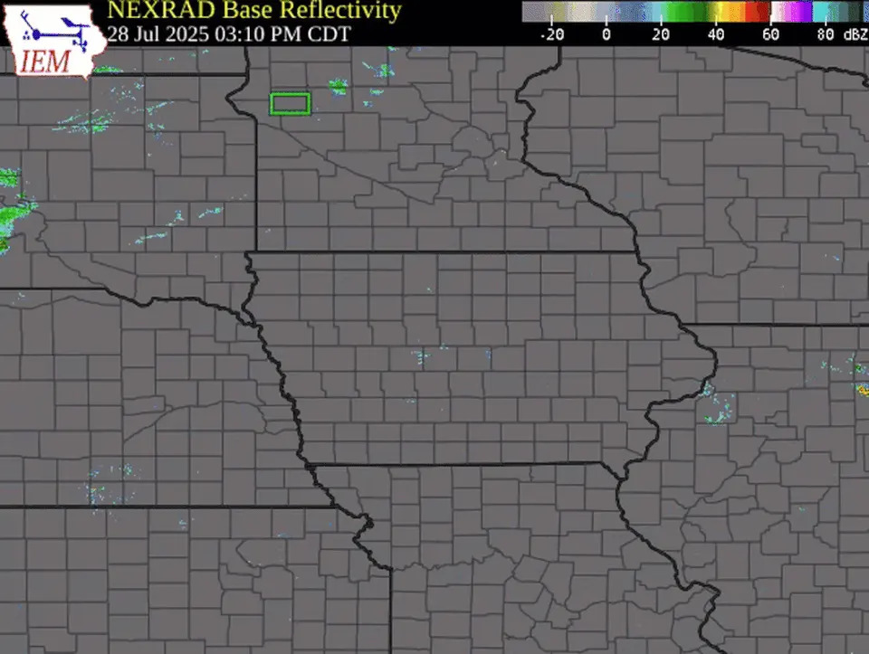
A complex of storms is approaching the Wichita Falls area and moving southeast, though we've seen a slight weakening of the system. While severe thunderstorm warnings along the leading edge have expired, isolated showers and storms could still survive the trip to areas west of Interstate 35W and north of Interstate 30. There is a 20 to 30% chance of rain for those areas.
North Texas Live Radar
What's next
Another storm system is expected to arrive late tonight after midnight, primarily impacting areas west of I-35. The National Weather Service has placed part of North Texas under a Level 2 slight risk for severe weather, noting the initial storms could produce gusty winds.
The storm activity is expected to be short-lived, with high pressure returning after the weekend. That system will likely bring a return to triple-digit temperatures and dry conditions early next week.
7-Day Forecast
The Source
Information in this article is from the FOX 4 News Weather Team.


Comments