The Brief
Stormy evenings and scorching heat are expected across Central Florida this week.
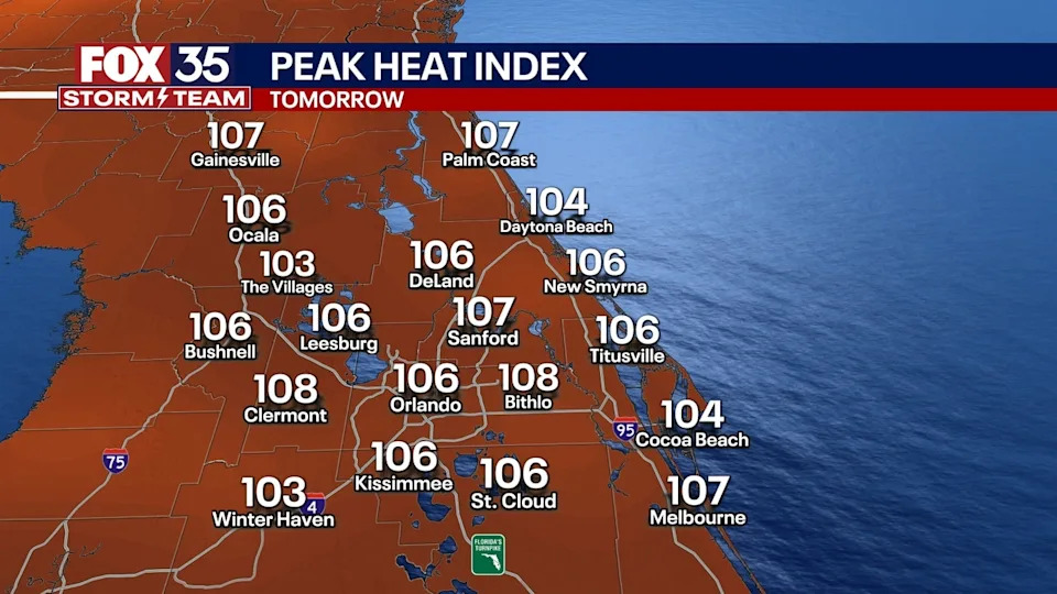
Temperatures could feel as high as 107°F with daily afternoon storms likely.
Dangerous lightning, heavy rain, and hail are possible in stronger systems.
ORLANDO, Fla. - Central Florida is in for a stretch of hot, stormy weather starting Sunday evening, as sea breeze interactions fuel strong storms across the region. These storms could produce gusty winds, heavy rainfall, vivid lightning, and even hail.
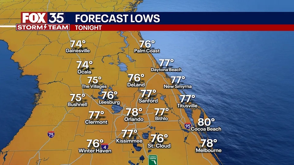
What will the weather be like tonight?
What To Expect
Evening sea breeze storms will continue to fire up across the region. With the clashing of the sea breezes, we could see some stronger storms pop up. Main threats include gusty winds, torrential rain, vivid lightning and the possibility of hail in the stronger storms.
Storms will fizzle during the overnight hours as temperatures drop into the mid-70s with partly cloudy skies.
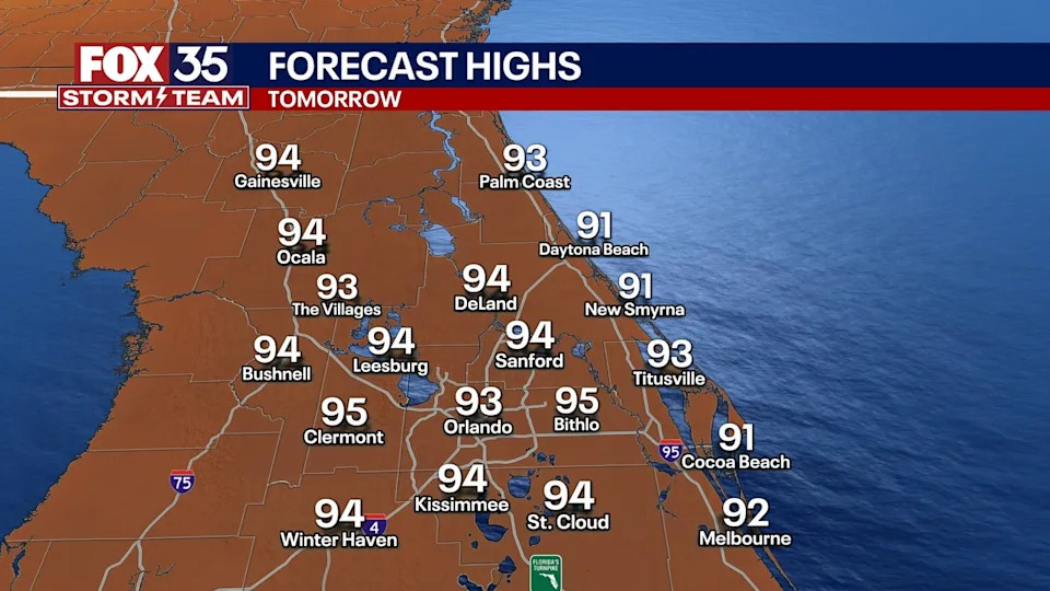
What will the weather look like on Monday?
What's next
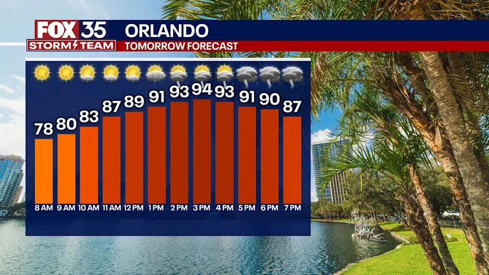
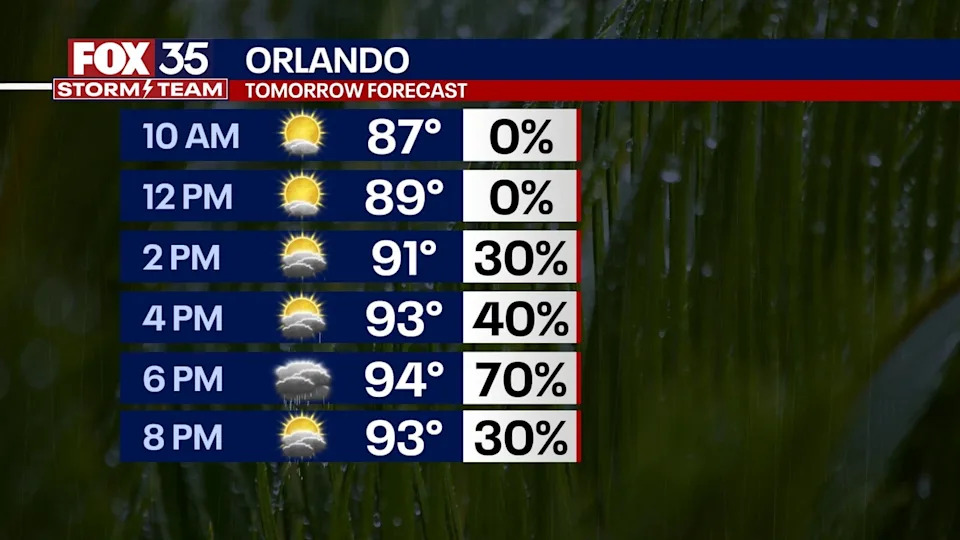
Monday morning starts off dry with the temperatures climbing back into the mid-90s quickly. With the humidity, temps will feel like 100 to 107 degrees, riding the line of heat advisories being issued.
Showers and storms will start to pick up Monday afternoon with scattered storms lingering into the overnight hours.
Main threats: gusty winds, torrential rain, vivid lightning and the possibility of hail in the stronger storms. Lows Monday night fall back into the mid and upper 70s with muggy conditions.
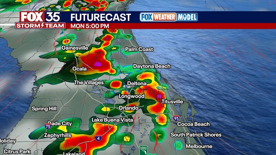
The start of the workweek looks a lot more typical for this time of year. Daily opportunities for afternoon showers and storms are on the docket with the help of sea breeze interaction.
That, along with a stalled front to our north, will likely bring more widespread showers and storms for the latter half of the day.
The heaviest rain does look to be focused to our north, near the stalled boundary, but either way, our weather pattern becomes more typical for this time of year.
We do get into more of an onshore flow and that should help get the sea breeze collision focused more across the heart of the state. With that, showers and storms look more numerous on Monday afternoon.
What will the weather look like the rest of the week?
Looking ahead
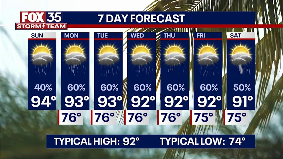
Rain chances hold each and every afternoon into late week. The plus is that more clouds and moisture will mean slightly cooler temperatures. It likely won't be terribly noticeable, but at least we'll be cooler.
Highs look to top out around 92° next week, which average for this time of the year. Later in the workweek, our wind comes mainly from the east, which will likely keep our rain chances elevated. Tropics wise, the water temps have climbed back above normal in the Basin and, with a little less dust, any tropical wave over the next few weeks will need to be monitored.
We have two waves that we're particularly watching with the NHC now outlooking each for development. One on the SE Atlantic Coast has a 40% chance of development while one deeper in the tropics has a 20% chance of development.
FOX 35 Storm Tracker Radar and Live Weather Cameras
Track live when storms move across your area using the FOX 35 Storm Tracker Radar below. You can also watch as heavy rain moves across Central Florida on our Live Weather Cameras' page here.


Comments