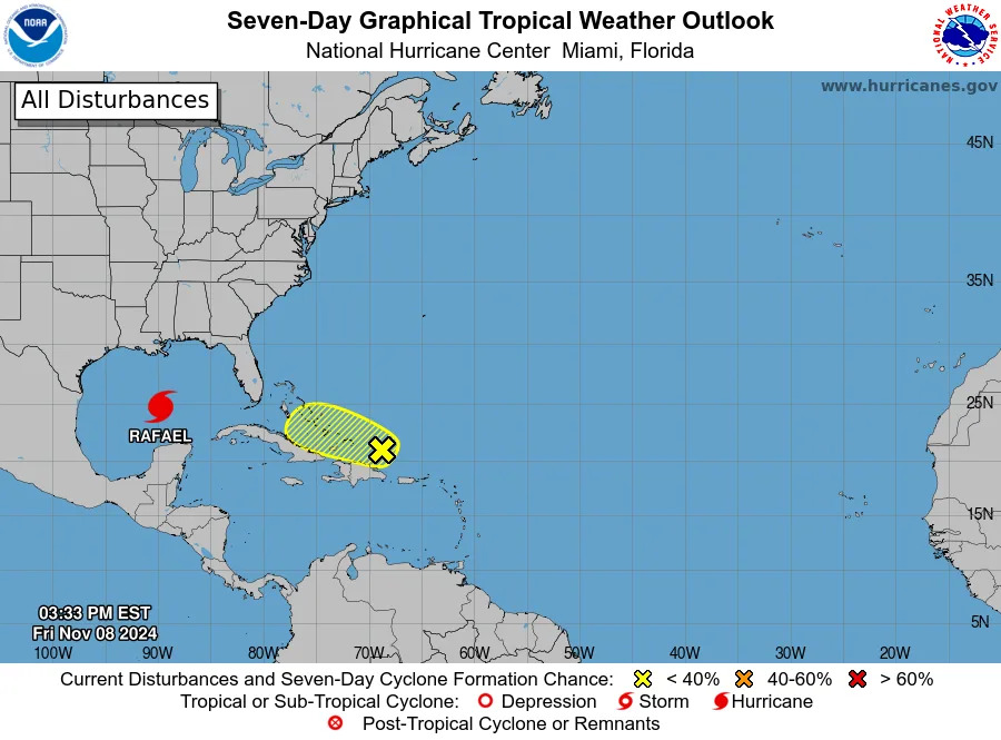
The National Hurricane Center is tracking four tropical waves on Saturday, July 26, though no cyclone formation is expected in the next seven days, according to the agency's latest advisory.
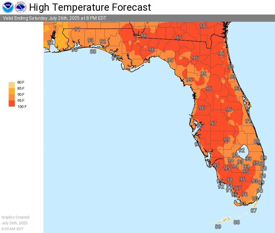
Meanwhile, the Sunshine State continues to sizzle, with heat advisories issued for much of Florida and expected to be re-issued Sunday, July 27, the National Weather Service reported.
While actual temperatures will be in the 90s, high humidity values will push the "feels like" heat index to the 105-110 degree mark.
➤ Weather alerts via text: Sign up to get updates about current storms and weather events by location
Stay hydrated, stay in air-conditioned areas and avoid outdoor activities. If outdoors, take frequent breaks in the shade and wear light clothing.
Here's the latest tropical advisory from the National Hurricane Center as of 8 a.m. July 26:
What is the National Hurricane Center tracking in the tropics?
The National Hurricane Center is tracking four tropical waves.
Tropical wave 1: A tropical wave is analyzed over the eastern Atlantic near 25W, from 17N southward, moving west at 10 kt. No significant convection is evident near this wave.
Tropical wave 2: A central Atlantic tropical wave is near 47W, from 20N southward, moving west at 10 to 15 kt. Scattered moderate convection is depicted from 14N to 17N between 47W and 50W.
Tropical wave 3: A western Atlantic tropical wave is near 60W, from 19N southward, moving west at 10 to 15 kt. Scattered moderate convection is occurring from 12N to 16N between 55W and 60W.
Tropical wave 4: A Caribbean tropical wave is along 73W from 19N southward, moving west at 5 to 10 kt. Scattered moderate convection is evident from 17N to 19N between 70W and 75W.
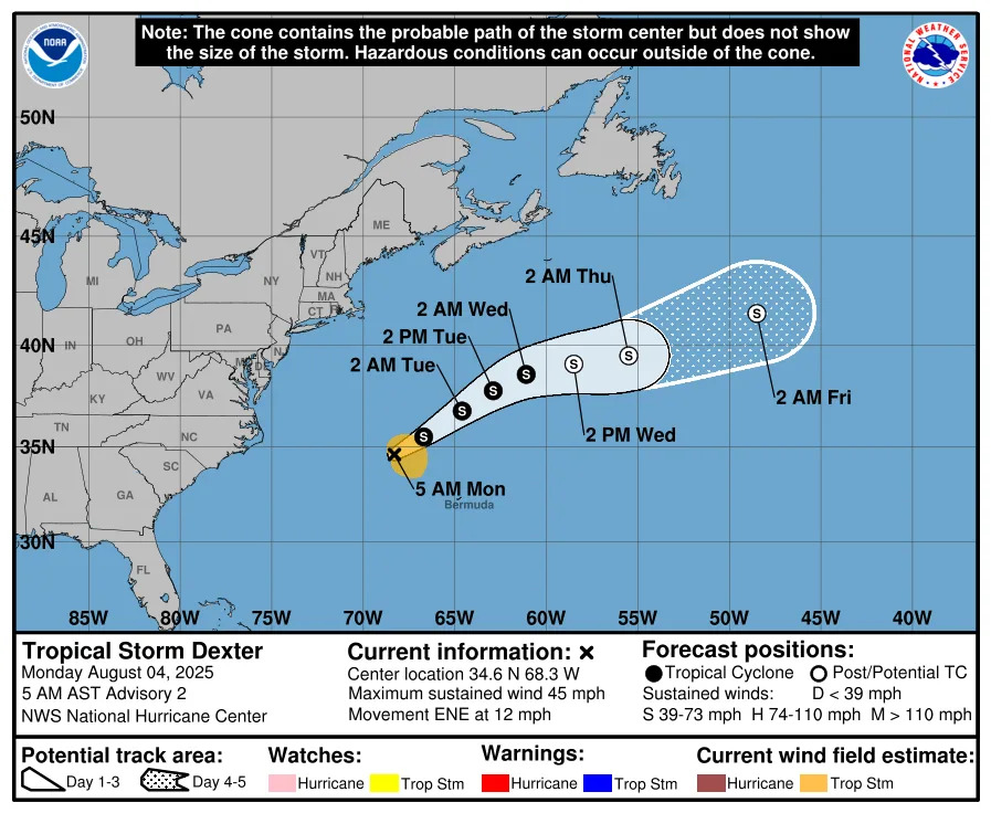
The next named storm of the 2025 Atlantic hurricane season will be Dexter.
Historically, the fourth named storm of the Atlantic hurricane season arrives Aug. 15. The last two named storms of the season — Barry and Chantal — developed earlier than normal.
Heat advisory issued for portions of Florida. Here's where
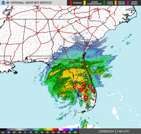
Florida live weather radar for July 26, 2025
2025 hurricane season so far
An average Atlantic hurricane season has 14 named storms, seven hurricanes, and three major hurricanes.
Here's when this year's named storms have developed, compared to historical averages:
Tropical Storm Andrea: formed June 24. Average start date: June 20
Tropical Storm Barry: formed June 29. Average start date: July 17
Tropical Storm Chantal: formed July 5. Average start date: Aug. 3.
Next up, Dexter: Average state date: Aug. 15, with the average first hurricane forming Aug. 11.
➤ How to set up emergency cellphone notifications for flash flood warnings and safety tips
Hurricane names for 2025 season
Here are the names for the 2025 Atlantic hurricane season, along with how to pronounce them:
Andrea(June 24)Barry(June 29)Chantal(July 5)Dexter: DEHK-ster
Erin: AIR-rin
Fernand: fair-NAHN
Gabrielle: ga-bree-ELL
Humberto: oom-BAIR-toh
Imelda: ee-MEHL-dah
Jerry: JEHR-ee
Karen: KAIR-ren
Lorenzo: loh-REN-zoh
Melissa: meh-LIH-suh
Nestor: NES-tor
Olga: OAL-guh
Pablo: PAHB-lo
Rebekah: reh-BEH-kuh
Sebastien: se-BAS-tee-en
Tanya: TAHN-yuh
Van: van
Wendy: WEN-dee
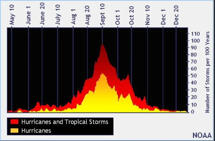
When is the Atlantic hurricane season?
The Atlantic hurricane season runs from June 1 through Nov. 30.
Ninety-seven percent of tropical cyclone activity occurs during this time period, NOAA said.
The Atlantic basin includes the northern Atlantic Ocean, Caribbean Sea and Gulf of America, as the Gulf of Mexico is now known in the U.S. per an order from President Trump. NOAA and the National Hurricane Center are now using Gulf of America on its maps and in its advisories.
When is the peak of hurricane season?
National Hurricane Center map: See what forecasters watching now
Systems currently being monitored by the National Hurricane Center include:
Why does NHC say 'tropical cyclone' on its maps instead of hurricane or tropical storm?
Tropical cyclone is the generic term used by the National Weather Service, NOAA and the National Hurricane Center for any tropical system, even if it's in the tropical Atlantic basin.
To be more precise, a tropical cyclone is a "rotating, organized system of clouds and thunderstorms that originates over tropical or subtropical waters and has closed, low-level circulation," NOAA said.
Once maximum sustained winds reach 74 mph, what it is called is determined by where it originated:
Hurricane: for storms in the North Atlantic, central North Pacific, and eastern North Pacific.
Typhoon: for storms in the Northwest Pacific.
Cyclone: for storms in the South Pacific and Indian Ocean.
Interactive map: Hurricanes, tropical storms that have passed near your city
Stay informed. Get weather alerts via text
What's next?
We will update our tropical weather coverage daily.
Download your local site's app to ensure you're always connected to the news. And look for our special subscription offers here.
This article originally appeared on Fort Myers News-Press: NOAA hurricane tracker: Tropics quiet. Sizzling heat in Florida


Comments