The Brief
Rain chances are going up for the Tampa Bay area, with increased coverage lasting into this weekend.
Deep tropical moisture, which FOX 13 meteorologists say is not related to any tropical system, will move over Florida.
Although tropical activity is picking up, there's no imminent threat to the U.S.
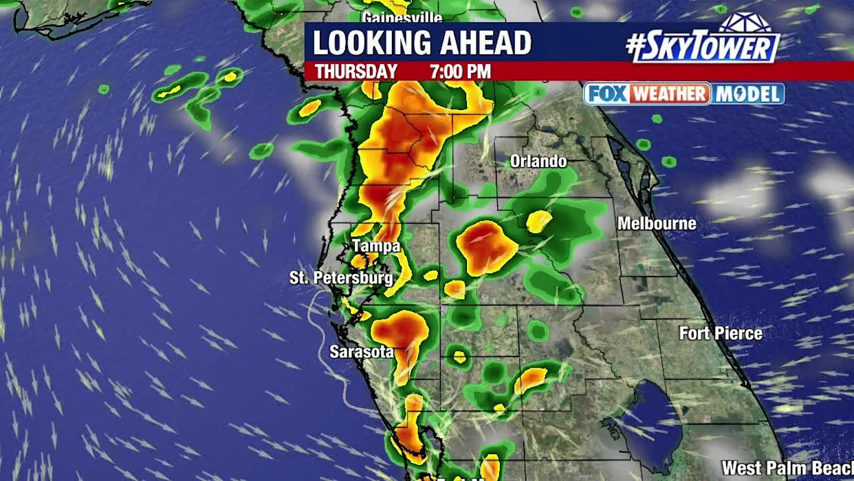
TAMPA, Fla. - Thursday could be an active day for rain and storms in the Tampa Bay area, especially during the later hours, and it comes as deep tropical moisture moves toward Florida.
Thursday weather forecast
FOX 13 Meteorologist Dave Osterberg says rain coverage will increase to about 60-70% on Thursday, with much of the wet weather coming during the evening and nighttime hours.
Osterberg says that while tropical activity is picking up, this particular moisture that's bringing more rain over the next few days is not related to any tropical system.
"There's a lot of deep tropical moisture over the Bahamas," Osterberg said. "And that moisture is going to move our way… We have a lot of moisture in the atmosphere. Our cup is full. We're just going to add more water to that same full cup and it's going to overflow, and that overflow is going to be the rainfall."
Rain chances will stay at about 70% at least through Saturday, according to Osterberg, before a gradual drop in coverage next week.

Activity in the tropics
The National Hurricane Center is watching multiple areas in the Atlantic for possible development, but there is no imminent threat to the U.S.
Tropical Storm Dexter continues to move east-northeast over the Atlantic, away from land.

Meanwhile, an area dubbed Invest 96L has a 60% chance of development in the next seven days and is expected to move over the central Atlantic, according to the NHC.

The NHC is giving another weak area of low pressure off the southeastern U.S. coast a 30% chance of development.
"Even if it does develop, it's probably not going to happen until it's well east of the Carolinas and north of Bermuda, and that puts it out of play for everybody," Osterberg said.
The Source
This story was written with information from FOX 13 meteorologists and the National Hurricane Center.


Comments