Severe thunderstorm threat: Latest implications for Minnesota, Wisconsin on Friday originally appeared on Bring Me The News.
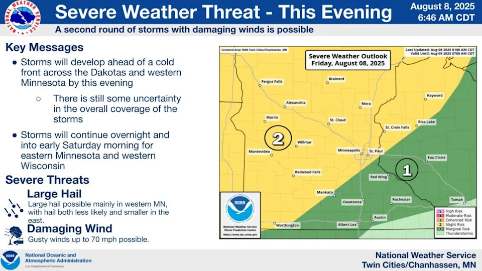
Officials continue to monitor the potential for severe storms that could bring large hail and damaging winds to Minnesota on Friday evening.
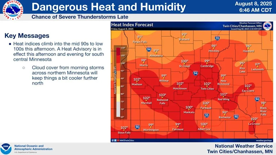
A series of strong thunderstorms were ongoing in west-central Minnesota on Friday morning, setting the stage for a hot and steamy day that could send heat indices over 100 in the Twin Cities and parts of southern Minnesota.
This in turn will provide the energy needed for another round of storms – this time severe – as a cool front approaches on Friday evening, though the National Weather Service notes that there is still some uncertainty over the storm's track and severity.
It says the main risk is large hail and winds of up to 70 mph, which could "persist for much of the night as the front heads east."
As things stand, the best chance of severe storms is in the northern half of Minnesota, which then becomes "more scattered" as it proceeds south.
As Friday turns to Saturday, the cold front will slow "and could stall from central Wisconsin to Iowa" on Saturday, the NWS says, which could bring additional storm development.
The best chance for storms on Saturday will be in west-central Wisconsin, near Eau Claire.
Most of Minnesota, including the Twin Cities, is in the "slight" risk zone for severe storms.
A heat advisory is also in place for the Twin Cities on Friday, with heat index values in the 98-103 range expected.
Drink plenty of fluids, stay in an air-conditioned room, stay out of the sun, and check up on relatives and neighbors," the NWS says.
This story was originally reported by Bring Me The News on Aug 8, 2025, where it first appeared.


Comments