Hurricane Erin became the first hurricane of the 2025 Atlantic hurricane season Friday morning several hundred miles east-northeast of the Caribbean, where it is expected to bring rain, gusty winds and high surf this weekend.
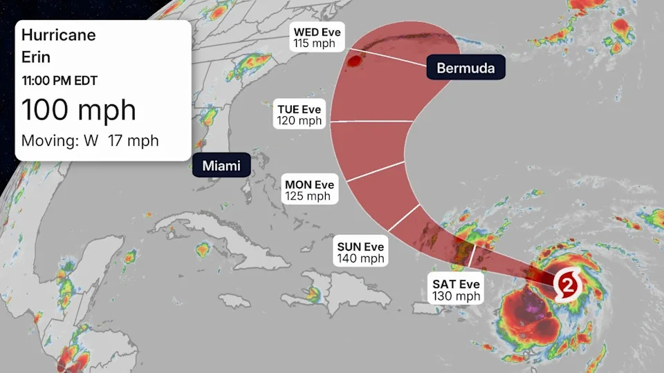
While Erin's longer-term future after the Caribbean is still somewhat uncertain, the National Hurricane Center is forecasting rapid intensification this weekend to Category 4 strength by Sunday.
Interests along the U.S. East Coast and Bermuda should continue to monitor the forecast. A significant rip current threat is expected in the week ahead from Florida to Massachusetts.
(MORE: Erin Maps Tracker - Spaghetti Models, Forecasts, More)
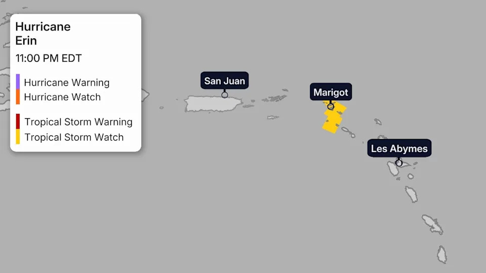
Watches And Warnings
While Erin's center is forecast to pass north of the Leeward Islands, Puerto Rico and the Virgin Islands, it could track close enough for at least some tropical storm force winds in some areas. The map below shows any tropical storm watches and/or warnings in effect. Watches mean tropical storm force winds are possible, while warnings mean they are expected.
There could be other impacts in these areas other than winds, as we'll detail below.
Path, Intensity Forecast
Erin is located a few hundred miles east-northeast of the northern Leeward Islands.
Erin has turned toward the west-northwest as it strengthens. This path will take Erin toward progressively warmer waters, which, in tandem with low wind shear, should allow Erin to become a major hurricane this weekend as its center tracks north of the northern Leeward Islands, Virgin Islands and Puerto Rico.
By early next week, Erin is expected to reach sustained winds over 130 mph (Category 4 intensity), according to the National Hurricane Center.
Later next week, Erin is expected to pass between North Carolina and Bermuda. Exactly where this happens remains uncertain, but Erin is expected to eventually turn northeastward to the north of Bermuda.
Potential Impacts
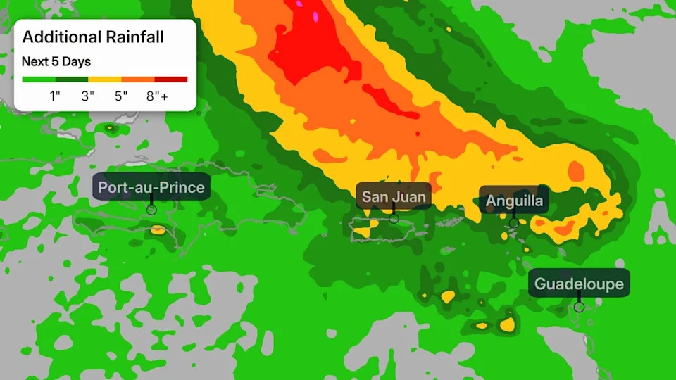
-Caribbean: The core of Erin is expected to pass just north of the northeast Caribbean islands, but some impacts are expected this weekend from Puerto Rico to Martinique.
In addition to high surf and dangerous rip currents, bands of heavy rain containing gusty winds could impact the northern Leeward Islands, Virgin Islands and Puerto Rico through this weekend. This could lead to local flash flooding and landslides where bands of heavy rain persist, particularly over mountainous terrain.
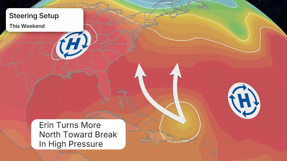
-Bermuda, U.S. East Coast: Beginning Monday, Erin will begin to turn more to the north between a developing break in high pressure. Where that turn occurs between the area of high pressure over the eastern U.S. and another one east of Bermuda is still uncertain and will determine what, if any, land areas might see impacts next week.
The probability of a landfall from Erin along the U.S. East Coast is very low at this time. However, interests along the East Coast should continue to monitor this system for possible changes.
Erin will generate high surf and dangerous rip currents along the U.S. East Coast for several days in the week ahead, no matter where it tracks.
Interests in Bermuda should also continue to follow Erin's forecast closely since its eventual turn toward the north and northeast might take it close to the archipelago next week. And parts of Atlantic Canada — particularly Newfoundland — should also follow this forecast closely, as Erin could end up tracking close to some of those areas late in the week ahead.
Check back to weather.com and The Weather Channel app for updates as the forecast comes into focus.
Jennifer Gray is a weather and climate writer for weather.com. She has been covering some of the world's biggest weather and climate stories for the last two decades.


Comments