
PIEDMONT TRIAD, N.C. (WGHP) — We have some patchy fog across the FOX8 viewing area this morning, but the fog is patchy and hasn’t reduced visibility to dangerous levels. Later this morning, skies will become partly cloudy and highs will hit the mid-80s. There is a small chance (20%) of a few showers or thunderstorms later this afternoon through the North Carolina mountains and foothills.
Partly cloudy skies are expected overnight with lows near 70 degrees.

Temperatures are going to stay in the mid-80s on Thursday with partly cloudy skies. Friday, a cold front drops to our south, which will put us in a cooler air mass for the weekend. Highs on Friday and Saturday are going to be near 80 degrees with increasing clouds. Another cold front will approach the Piedmont on Sunday, bringing a 40% chance of afternoon thunderstorms.
Monday will be beautiful, with mostly sunny skies and highs in the mid-80s. Even nicer weather is on the way to the Piedmont on Tuesday, as highs squeak into the upper-70s under partly cloudy skies.
Hurricane Erin
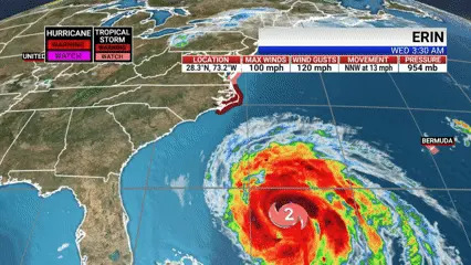
As of 5 am Wednesday, Hurricane Erin has improved its structure over the past 24 hours and has remained steady in intensity at Category 2, with 100 mph sustained winds.
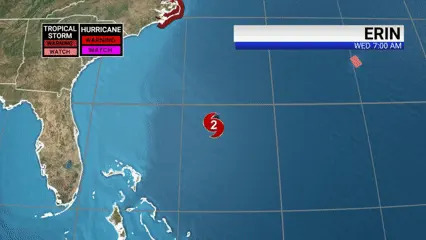
Its track keeps Erin’s center well offshore, but we are expecting tropical storm force winds, storm surge, dangerous surf, and rip currents tonight through Thursday.

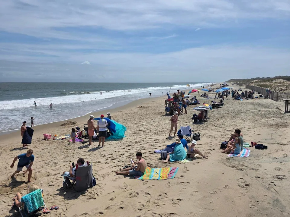
Erin is expected to bring large waves to the Outer Banks, leading to substantial beach erosion and overwash, according to the National Weather Service.
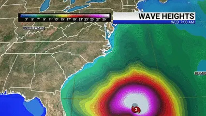
Some roads, such as NC 12, will be made impassable. Mandatory evacuations have already taken place in the Outer Banks.
Erin is expected to move north of the Outer Banks on Thursday.
Copyright 2025 Nexstar Media, Inc. All rights reserved. This material may not be published, broadcast, rewritten, or redistributed.
For the latest news, weather, sports, and streaming video, head to FOX8 WGHP.


Comments