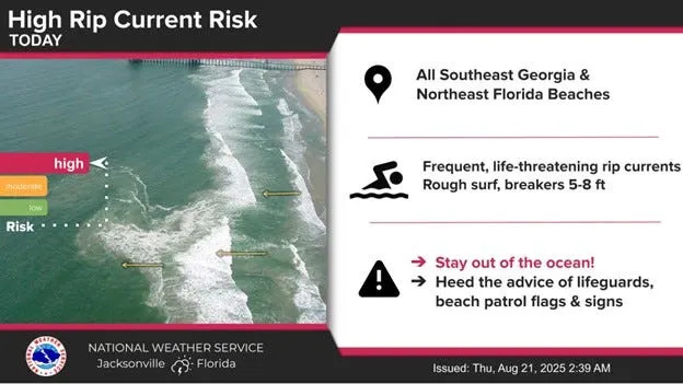
Hurricane Erin has begun to move away from the North Carolina coast, although beachgoers are still cautioned against swimming at most beaches along the U.S. East Coast due to rough conditions caused by the storm.
The hurricane center said Erin is moving toward the north-northeast near 17 mph, with a turn toward the northeast with an increase in forward speed expected later Thursday, Aug. 21, followed by an acceleration toward the east-northeast on Friday, Aug. 22, and into the weekend. Gradual weakening is forecast during the next few days, with Erin expected to become post-tropical by Saturday, Aug. 23.
The center of Erin is forecast to move over the western Atlantic between the U.S. East Coast and Bermuda through early Friday and then pass south of Atlantic Canada on Friday, Aug. 22, and Saturday, Aug. 23, according to the NHC.
Now with the storm moving offshore and the greatest dangers behind us — though life-threatening conditions are expected to linger through Friday — we can take a closer look at the stats that defined Erin.
How massive did Hurricane Erin get?
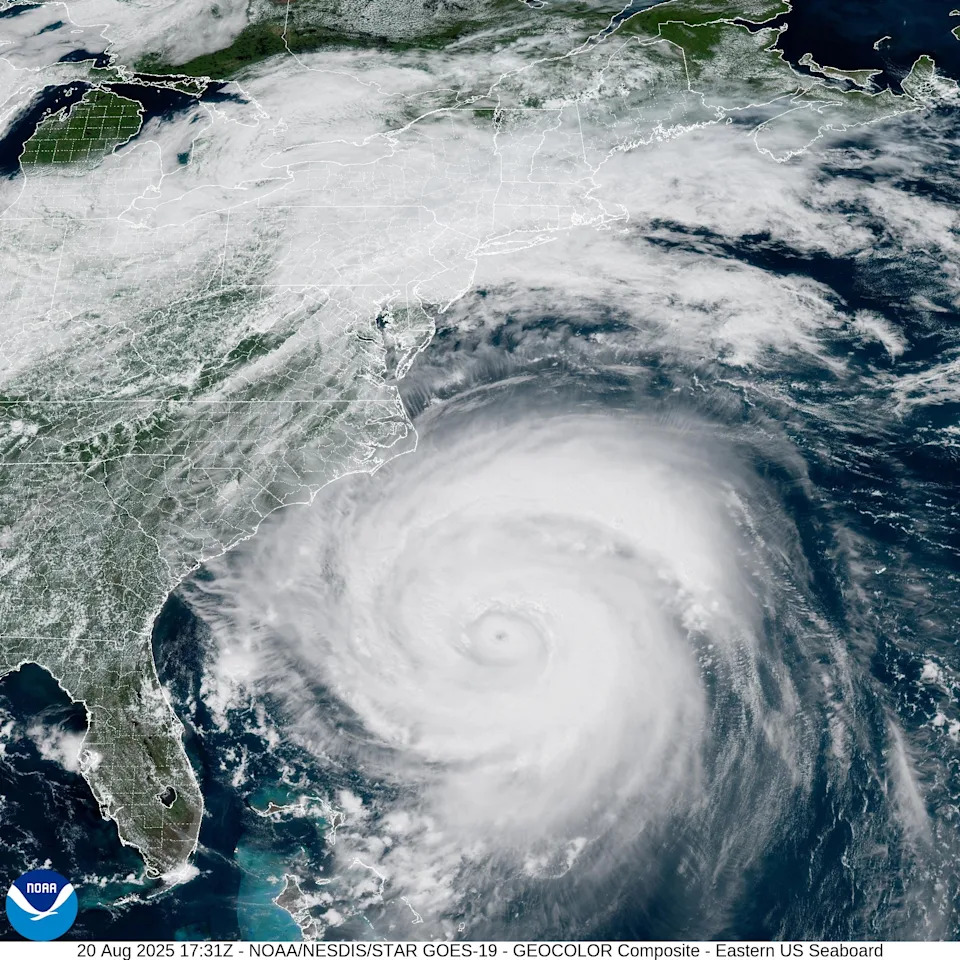
Hurricane Erin reached a maximum north-to-south span of around 790 miles, stretching visibly from the North Carolina–South Carolina border down to the southern tip of the Florida peninsula — or roughly the length of Texas, according to the San Antonio Express-News.
At its largest, the storm had an overall storm diameter of about 500 miles (800 km), according to AP News.
How close did Hurricane Erin get to the U.S. East Coast?
Erin passed about 200 miles off Cape Hatteras, North Carolina, at its closest approach.
What were Hurricane Erin's strongest winds?
Erin reached peak sustained winds of 160 mph (257 km/h) on Saturday, Aug. 16, making it a powerful Category 5 hurricane.
What are the highest waves reported from Hurricane Erin?

Offshore buoys reported wave heights of up to 40 feet (about 12 meters) in the open Atlantic, while waves reached up to 20 feet along the U.S. coast, according to CNN.
What was the lowest central pressure recorded for Hurricane Erin?
The storm’s minimum central pressure dropped to 915 millibars on Saturday, Aug. 16.
Low central pressure is a key indicator if a hurricane's strength. The lower the pressure, the stronger the winds and the more powerful the storm becomes because air moves from areas of high pressure to low pressure, and when that difference is so extreme, it increases wind activity.
In fair weather, the typical central pressure ranges between 1,015 and 1,030 millibars (mb). The pressure beneath an average rain cloud — such as during rain showers or thunderstorms — is usually around 1,010 to 1,020 mb. A tropical storm typically has a central pressure between 990 and 1,000 mb, while a Cat 1 storm is slightly less at around 980 to 995 mb.
What was Hurricane Erin’s fastest and slowest forward speed?
While still a tropical storm, Erin moved westward at 23 mph on Tuesday, Aug. 12, as it approached the Leeward Islands.
The following Tuesday, Aug. 19, Erin — then a Category 2 hurricane — slowed to a forward speed of just 7 mph, moving northward as it passed southwest of Bermuda.
When a storm moves more slowly, it can cause more damage as it lingers over the same areas for a longer time. The slow movement allows for heavier rainfall, longer-lasting strong winds, and extended storm surge impacts.
How far did winds extend from the center?
Hurricane-force winds extended about 105 miles from Erin's center early Thursday, Aug. 21, while tropical-storm-force winds stretched to about 320 miles from the center, according to data from the National Hurricane Center.
How far did Erin’s cloud cover extend?
Satellite images showed Erin’s cloud shield stretching more than 1,000 miles (~1,600 km) across — from the Bahamas to New England — according to the Washington Post.

This article originally appeared on Asheville Citizen Times: Hurricane Erin's size spanned NC to Florida. Just wide is that?


Comments