The Brief
Active storms woke up many Twin Cities residents as heavy rain, thunder and lightning rolled across Minnesota.
Most areas saw between 1 to 2 inches of rain from the storms.
The bulk of the storms have moved on, but some residents could see unsettled weather until the afternoon.
MINNEAPOLIS (FOX 9) - Overnight storms blew through the Twin Cities, leaving behind some cloud cover and muggy conditions on Saturday morning.
Saturday forecast
Local perspective
After plenty of thunder, lightening and rain from vigorous storms rolled across the state, Twin Cities residents are waking up to tropical-feeling conditions.
While Saturday is starting out with unsettled weather, all the storm threats will likely clear out by the early afternoon.
A stray shower, or even a thundershower, could still pop up around the Twin Cities.
Severe weather risks remain in southeastern Minnesota.
More sunshine will start to move in with skies clearing later in the day.
High temperatures are expected to reach about 83 degrees, with dew points falling in the afternoon and low temperatures hitting about 69 degrees.
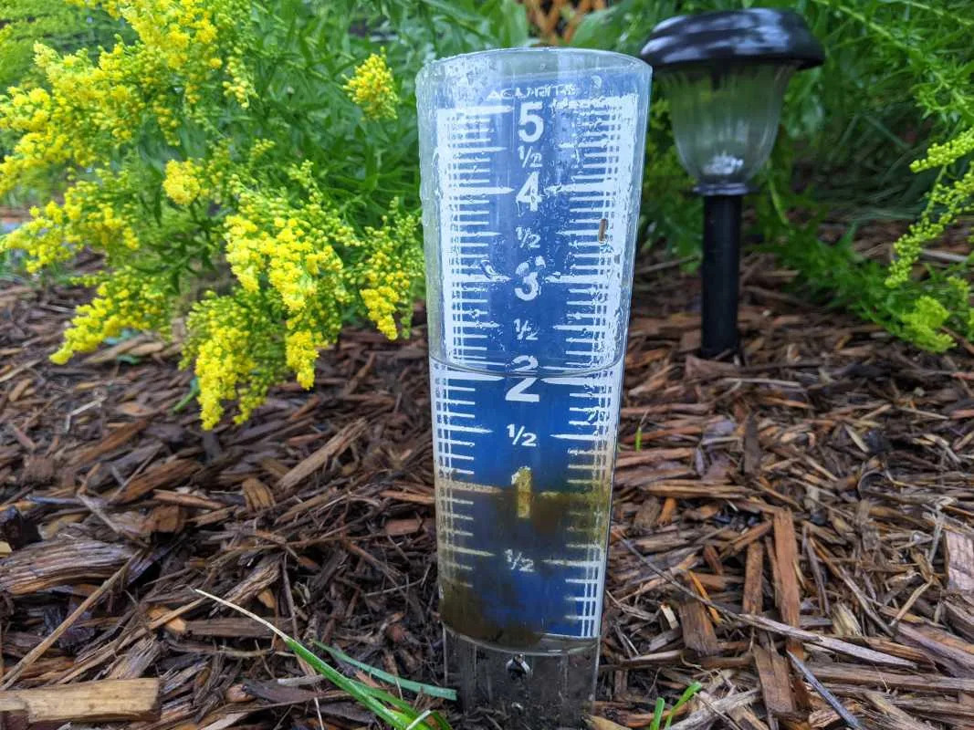
Rain totals
By the numbers
Rain measurements landed between 1–2 inches for most areas in the metro.

Extended forecast
What's next
Sunday will bring back some sunshine to the area.
A smoky haze could move in on Sunday and Monday.
Highs on Sunday are expected to reach the mid-80s.
The Source
This story uses information from the FOX 9 weather forecast.


Comments