Rain totals in Minnesota: Up to 10 inches recorded in weekend deluge originally appeared on Bring Me The News.
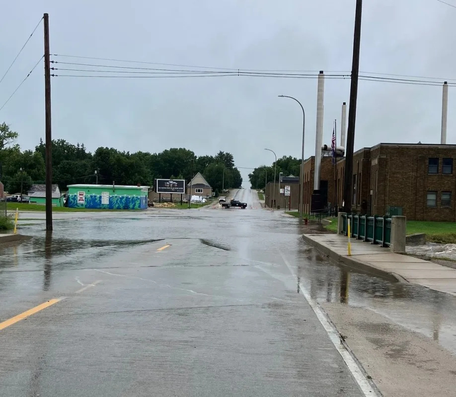
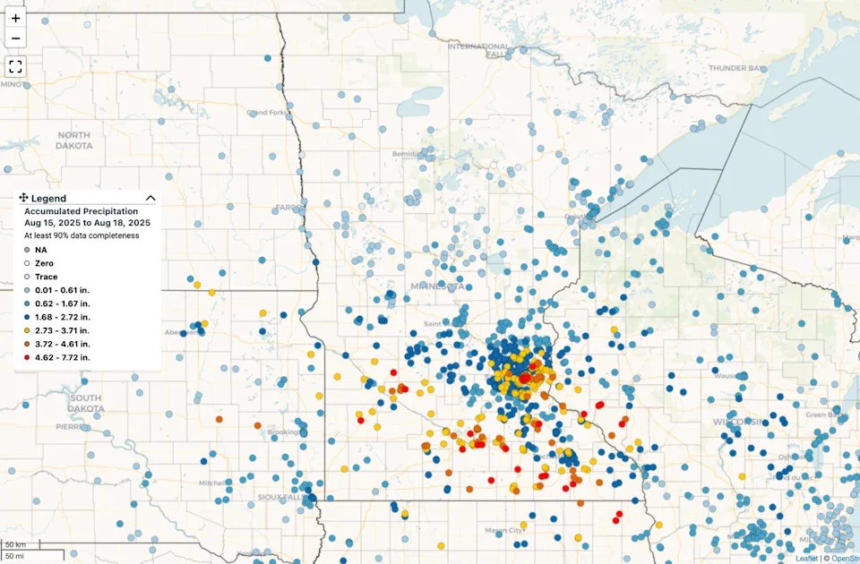
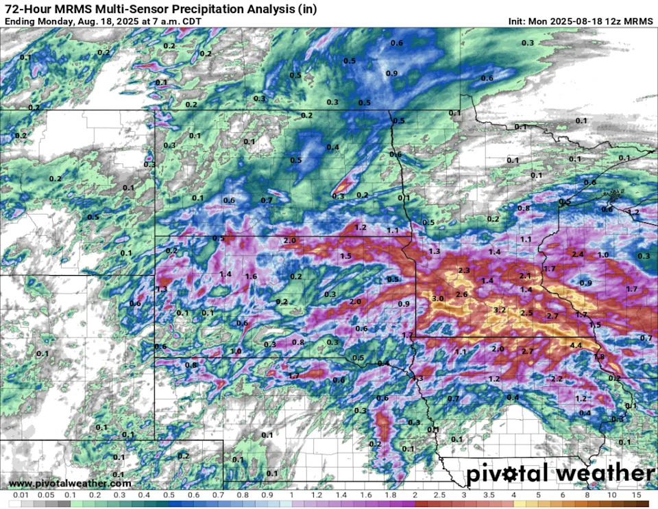
The weekend deluge in Minnesota was well-advertised and the end result was quite accurate, as the southern third of the state was drenched with 2-10 inches of rain.
The Brainerd Lakes Area wound up with about a half inch of rain. Saint Cloud received around an inch, with totals rising at locations further south. While 2-4 inches was commonplace in places like the Twin Cities and Rochester, there were more isolated pockets that got smacked with 4-6 inches — and a few totals between 8-10 inches.
The highest totals were in Spring Valley and Waseca, where around 10 inches was recorded and heavy street flooding reported. Other pockets of heavier rain were in and around St. Paul, Rosemount, Hastings, Mankato, Marshall and down along the Interstate 90 corridor in far southern Minnesota.
Notable totals Aug. 15-18
Spring Valley: 10.18 inches
Waseca: 9.48 inches
Grand Meadow: 8.47 inches
Wells: 7.64 inches
Janesville: 7.72 inches
Marshall: 6.92 inches
Ellendale: 6.39 inches
Ostrander: 5.85 inches
Eagle Lake: 5.34 inches
Mankato: 5.15 inches
Saint Peter: 5.00 inches
St. Paul: 4.93 inches
Lake Crystal: 4.89 inches
SE Minneapolis: 4.79 inches
Renville: 4.79 inches
Hastings: 4.59 inches
Comfrey: 4.41 inches
Austin: 4.39 inches
Blue Earth: 4.35 inches
Rosemount: 4.21 inches
St. Paul Park: 3.93 inches
Plymouth: 3.85 inches
White Bear Lake: 3.41 inches
Benson: 2.63 inches
Willmar: 2.54 inches
Eau Claire: 2.25 inches
You can find more totals at the interactive map here.
The rain came in waves, starting Friday as severe storms exploded over the Twin Cities and tracked to the southeast. Minnesota was hit hard again overnight into Saturday morning as a line of severe storms produced winds up to 80 mph — hammering Marshall and dropping more heavy rain as they moved from west to east.
A third round of intense storms developed Saturday night into Sunday morning, dumping extremely heavy rain across far southern Minnesota. The fourth round then developed Sunday night and lasted through Monday morning before dying out around midday.
This story was originally reported by Bring Me The News on Aug 18, 2025, where it first appeared.


Comments