Much of Oregon is under fire weather watch and red flag warnings.
The National Weather Service issued red flag warnings from 2 p.m. to 11 p.m. July 29 due to thunderstorms producing abundant lightning and wind gusts up to 50-60 mph, in combination with dry fuels, the alert said.
Affected areas include:
Western forested Blue Mountains
Central Blue Mountains
Southern Blue Mountains
Central mountains of Oregon
Southern Deschutes National Forest
Southern Oregon Cascades
Klamath Basin
Fremont-Winema National Forest
South Central Oregon Desert, including Bureau of Land Management land in eastern Lake and western Harney counties
Burns BLM
Southern Grasslands
A red flag warning means that critical fire weather conditions are either occurring now, or will occur shortly.
NWS also issued a fire weather advisory from 2 p.m. to 11 p.m. July 29 due to potential lightning from thunderstorms that could spark new fires and wind gusts that could impact new and existing fires.
Affected areas include:
John Day Valley
Western forested Blue Mountains
Southern Oregon Cascades
Klamath Basin
Fremont-Winema National Forest
South Central Oregon Desert, including BLM land in eastern Lake and western Harney counties
Central mountains of Oregon
Southern Deschutes National Forest
Western Klamath National Forest
Western Rogue Basin, including the Illinois Valley
Eastern Rogue Valley
Siskiyou Mountains
Northern Willamette National Forest
Southern Willamette National Forest
A fire weather watch means conditions can promote the rapid spread of wildfires.
Here's the latest on wildfires burning around Oregon.
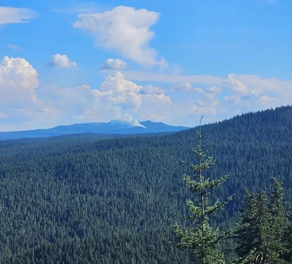
Piper Fire burning in Three Sisters Wilderness
The Piper Fire sparked on July 28 from thunderstorms 3 miles northeast of Skookum Creek Campground in the Three Sisters Wilderness. It was estimated to be 20 acres as of July 28.
This is the largest of the multiple new fire starts in the Cascade Range from thunderstorms.
Burdoin Fire in Columbia River Gorge is 69% contained
The Burdoin Fire in the Columbia River Gorge on the Washington state side has reached 69% containment according to the Klickitat County 911 Dispatch/Emergency Management and has burned 11,224 acres as of July 29.
Highways 14 and 142 are open to through traffic. All other roads are restricted to local traffic.
Level 1 and 2 evacuations remain in place in some areas.
An evacuation shelter is available at Grace Baptist, 1280 W Jewitt in White Salmon, Washington.
2 wildfires reported in Malheur County
The High Horn Fire in Malheur County had burned 120 acres as of July 28.
The Skyline Fire, also burning in Malheur County, had burned 38.5 acres as of July 28.
Mariah Johnston is an outdoors journalism intern at the Statesman Journal. Reach her at [email protected].
This article originally appeared on Salem Statesman Journal: Oregon wildfires: Much of Oregon under fire weather, red flag warnings


Comments