HATTERAS, N.C. – A powerful and sprawling Hurricane Erin continued lashing hundreds of miles of coastline along the Eastern Seaboard with its outer bands Thursday morning, proving a storm of such size doesn't need to make landfall to bring widespread impacts.
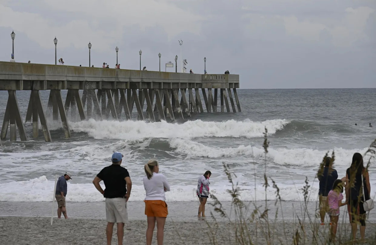
Tens of thousands had been evacuated off the most vulnerable of North Carolina's Outer Banks as a storm surge of up to 4 feet was likely. Meanwhile, beaches remained off limits to swimming up and down the East Coast as dangerous waves and potentially deadly rip currents angrily pounded the shorelines.
Hurricane Erin was still a Category 2 storm with maximum sustained winds of 105 mph on Thursday morning.
While the center of Erin and its peak winds were some 200 miles east-southeast of Cape Hatteras, North Carolina, tropical-storm-force winds extended outward up to 320 miles, reaching parts of the North Carolina and Virginia coastlines, where Tropical Storm Warnings lingered into Thursday.
According to the National Hurricane Center, a weather station at Jennette's Pier in Nags Head, North Carolina, measured sustained winds of 41 mph and a gust of 49 mph early Thursday morning.
The greatest impacts from Erin were focused on the central Outer Banks, where waves of up to 20 feet combined with a storm surge of 2-4 feet continued to overwhelm some of the barrier islands.
North Carolina Department of Transportation crews had to shut down Highway 12 – the main road along the Outer Banks – from Oregon Inlet to Hatteras Village Wednesday evening as the encroaching surf began covering the road.
Track Hurricane Erin: Live East Coast Rip Current Threat, Maps, Forecast Cone
"Unfortunately, Hurricane Erin's storm surge was too much for NC12 tonight," NCDOT officials wrote. "Conditions are too unsafe for people to be driving in."
Much of the roadway was supposed to be empty anyway as officials in Dare, Hyde and Currituck counties declared local states of emergency and issued mandatory evacuation orders for tourists and residents in popular areas like Ocracoke Island and Hatteras Island. Dare County officials told FOX Weather Correspondent Katie Byrne that some 85,000 people had heeded their orders and left by Wednesday.
"I'm a little worried for the people down in Hatteras and Rodanthe, Waves and Salvo and all that stuff," said Jaden Howard, who lives in Nags Head. "I saw videos of the (surf); it's already washed over the road down there. There's one way in, one way out … The scary part is it's not what happens during the storm, it's how are they going to travel after the storm."
North Carolina Gov. Josh Stein, who declared a state of emergency Wednesday for the affected region, said that anyone who defied an evacuation order and remained in areas vulnerable to coastal flooding and storm-surge flooding was putting their lives at risk.
"When there is a major storm, when there is flooding, there is a great risk of death," he warned. "And what we don’t want is for people to die."
Nhc's Jamie Rhome Joins Bryan Norcross To Answer Questions On Hurricane Erin
While Hurricane Erin's path was pulling it farther away from the mid-Atlantic coast on Thursday as it headed out toward the open waters of the North Atlantic, its arc was still going to nudge close enough to parts of the northern mid-Atlantic and Northeast coasts to bring dangerous beach conditions and strong winds even into Friday.
Among those areas feeling impacts will be the Tidewater region of Virginia, the Delmarva Peninsula, the Jersey Shore, Long Island, New England and Atlantic Canada, the FOX Forecast Center said.
Coastal Flood Warnings covered parts of Delaware, New Jersey and New York's Long Island into Friday, with as much as 2-3 feet of inundation in low-lying areas along the beaches and surf ranging from 7-16 feet.
Coastal vulnerability will be greatest at times of high tide, when elevated tides combine with large, powerful waves.
By late Friday, Erin will be racing out into the far North Atlantic, eventually losing its hurricane status.
Original article source: Hurricane Erin slams North Carolina, Virginia coasts with strong winds, powerful waves, dangerous rip currents


Comments