Intense heat is set to surge into the Northeast late this week, with temperatures climbing high enough in some areas to challenge daily records, according to AccuWeather meteorologists. The brief burst of heat will be fueled by a piece of a larger heat dome anchored over the Great Plains, which is expected to break off and push eastward heading into the weekend.
While average temperatures in late July are typically the highest temperatures of the year, driven by intense sunshine, warmer Atlantic and lake waters and long days-this upcoming event may push the upper bounds of historical norms.
But, even with routine temperatures typically very high this time of the year, some locations may set daily record highs from Friday to Saturday in parts of the Northeast.
Temperatures began to climb on Thursday with widespread highs well into the 80s to mid-90s for the Northeast.
Friday will bring the crest of the heat in New England and in the zone from Upstate and eastern New York to portions of New Jersey and northern and eastern Pennsylvania.
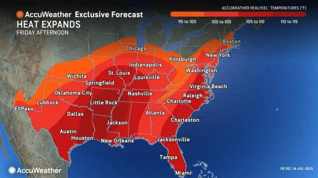
"In Hartford, Connecticut, the current record of 98 set in 2001 on Friday may be topped," AccuWeather Senior Meteorologist Chad Merrill said. "The record of 99 set in 2016 in Newark, New Jersey, may be swapped by a triple-digit reading."
The high temperature in New York City on Friday is projected to approach the record high of 97 from 1999.
Meanwhile, in Boston, the high temperature on Friday could come near the record of 96 set way back in 1882, but is forecast to fall a few degrees short with thunderstorms approaching in the late afternoon.
"Showers and heavy thunderstorms follow late in the day on Friday and bring a significant cooldown to the upper 70s on Saturday," Merrill said.
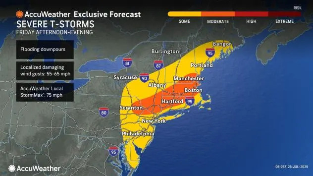
"This will be a very similar pattern to last month when Boston hit 102 degrees on June 24 and cooled to the upper 70s for highs two days later," Merrill added.
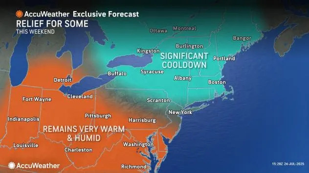
Lower humidity will accompany the cooler air in New England and the upper part of the mid-Atlantic on Saturday and may push southward a bit more on Sunday along the Atlantic coast for a time.
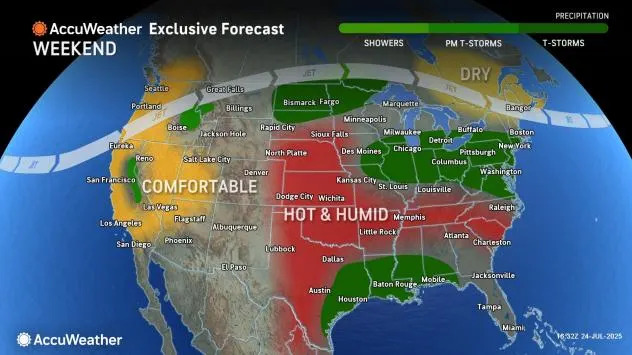
The temperature boundary will be a focusing point for at least spotty thunderstorm activity this weekend. The storms will extend from parts of the Ohio Valley and Great Lakes states to the mid-Atlantic coast.
With more cloud cover around and the likelihood of some local cooling breezes from thunderstorm activity, temperatures may inch downward just a bit over the mid-Atlantic during the weekend but far from the extent enjoyed by millions from this past Monday to Tuesday.
Highs in Washington, D.C., will trend downward from near the century mark on Friday to the mid-90s on Saturday and the low 90s on Sunday to put the mid-Atlantic region's cooling trend in perspective.
The core of the heat dome will settle southward in the Eastern states over the weekend and will take up residence in the Southeast from Saturday to Wednesday. During this weekend alone, 175 million people will experience RealFeel Temperatures of 100 degrees or higher in the East.
The cooling trend in the mid-Atlantic will likely briefly reverse early next week with highs well into the 90s from Monday to Tuesday.
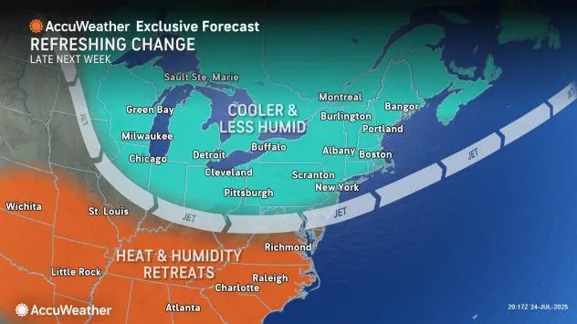
"Much more sweeping changes will come through the Northeast from Tuesday to Wednesday, depending on location, "Merrill said. "A touch of autumn is expected for a few days during the middle to latter part of next week with lower-than-historical average highs that will linger into the first few days in August."
The transition could be marked by drenching downpours and gusty thunderstorms. Those with travel plans are encouraged to keep abreast of the forecast for timing and locations of the most severe activity that could lead to disruptions.
"In the wake of the storms next week, nighttime temperatures will drop into the 30s and 40s in the Adirondacks and Green and White Mountains with comfortable 60s for much of the Interstate 95 corridor by the end of next week," Merrill said.
Want next-level safety, ad-free? Unlock advanced, hyperlocal severe weather alerts when you subscribe to Premium+ on the AccuWeather app. AccuWeather Alerts™ are prompted by our expert meteorologists who monitor and analyze dangerous weather risks 24/7 to keep you and your family safer.


Comments