The entire state of New Jersey is under a flood watch issued by the National Weather Service (NWS).
Showers and thunderstorms with sudden excessive rainfall could lead to flash flooding in most of the state, in part because excessive runoff may cause rivers and creeks to rise out of their banks, NWS advises.
Thunderstorms can increase precipitation, and isolated thunderstorms are expected south of Interstate 78.
The rain should cease later in the evening, the NWS forecasted. However, the flood watch is in effect through 6 a.m. Friday, Aug. 1.
How much is it going to rain in New Jersey?
Up to 3 inches of rain is expected for most of the state, with some areas seeing up to 7 inches of rainfall. At times, rain could be dense and fast, pouring up to 2 inches per hour, according to the NWS Mount Holly office.
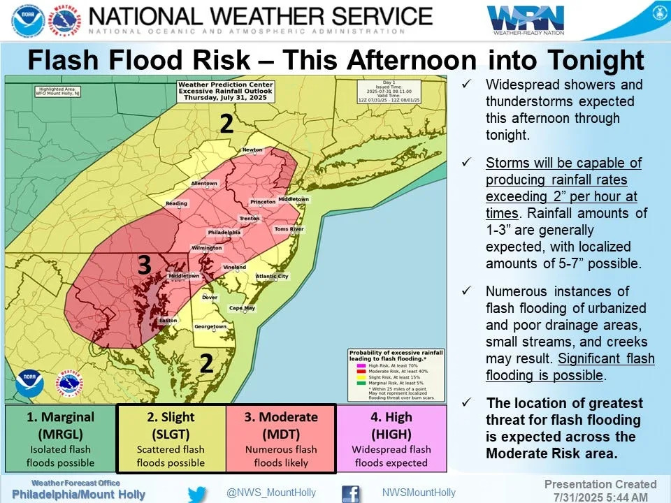
New Jersey areas at risk of flash floods:
The entire state is at risk of flash floods, but the chances are slimmer along the Jersey Shore coastline and in Sussex, Bergen, Cape May, Atlantic, and Hudson counties.
This article originally appeared on NorthJersey.com: NJ is under a flood watch. How much is it going to rain today?


Comments